Castleton Rigg is one of those places everyone knows from the car window yet almost no one bothers to walk upon. I can remember only two previous visits, one before and one after the arrival of that monstrous vanity project masquerading as public art (here and here).
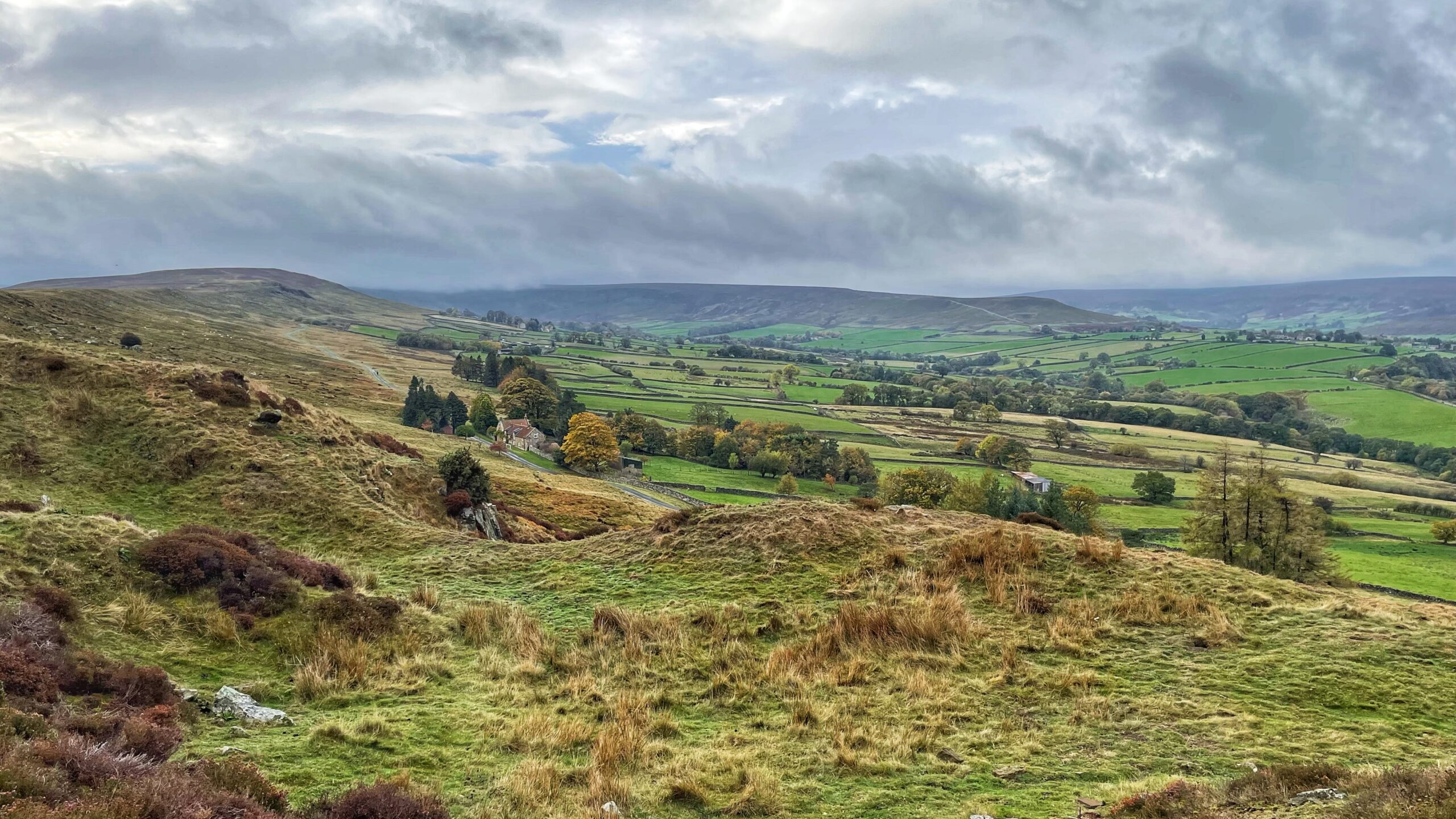
Today’s visit offered then the chance to look down upon the elongated hamlet of Westerdaleside, close enough to Westerdale to share its weather, yet distinct in its history. In the sixteenth century it bore the far more evocative name of “Barwykerowe”1Wilson, Carol M. “Westerdale: the origins and development of a medieval settlement”. 2013. Page 37.2NYMNPA HER Record No: 18795. Barwykerowe at Westerdale..
The land still tells its own story. Deep holloways, worn into the fields by centuries of passage, mark the old routes to the mill and the church. Three of these tracks meet neatly at the ford on Christy Gate Road at Tower Beck. There may once have been a field church nearby, though the “Kirk Syke” shown on the Tithe map could simply mean the way to the church at Westerdale, or land once gifted to it3Wilson, Carol M. “Westerdale: the origins and development of a medieval settlement”. 2013. Page 53..
The element “barwick” or “berwick” describes an outlying area where crops were grown or stored for the lord of the manor, while “row” implies a line of dwellings. Barwykerowe, then, was likely that string of houses stretching from Low House—the nearest in the photograph—to Brown Hill House, a tidy row that probably served as the “barley-wick” of the manor. The fields still bear the soft ridges and furrows of former arable use4Wilson, Carol M. “Westerdale: the origins and development of a medieval settlement”. 2013. Pages 48/61..
Low House itself is a curiosity. In the sixteenth century it appeared as “Tade Pytt,” later transformed into “Toad Pit House,” a name that raises more questions than it answers5Wilson, Carol M. “Westerdale: the origins and development of a medieval settlement”. 2013. Page 59.. It was once the home of John Fairfax-Blakeborough, folklorist and writer, who died there on New Year’s Day, 19766ACT/97-005. The Richard Blakeborough and John Fairfax-Blakeborough Yorkshire Folklore Collection 1750-1820; 1868-1974. Archives of Cultural Tradition. University of Sheffield. January 1999.Biographical History.. His story, however, deserves a post of its own.
- 1Wilson, Carol M. “Westerdale: the origins and development of a medieval settlement”. 2013. Page 37.
- 2NYMNPA HER Record No: 18795. Barwykerowe at Westerdale.
- 3Wilson, Carol M. “Westerdale: the origins and development of a medieval settlement”. 2013. Page 53.
- 4Wilson, Carol M. “Westerdale: the origins and development of a medieval settlement”. 2013. Pages 48/61.
- 5Wilson, Carol M. “Westerdale: the origins and development of a medieval settlement”. 2013. Page 59.
- 6ACT/97-005. The Richard Blakeborough and John Fairfax-Blakeborough Yorkshire Folklore Collection 1750-1820; 1868-1974. Archives of Cultural Tradition. University of Sheffield. January 1999.Biographical History.
Leave a Reply