Tag: prehistoric
-
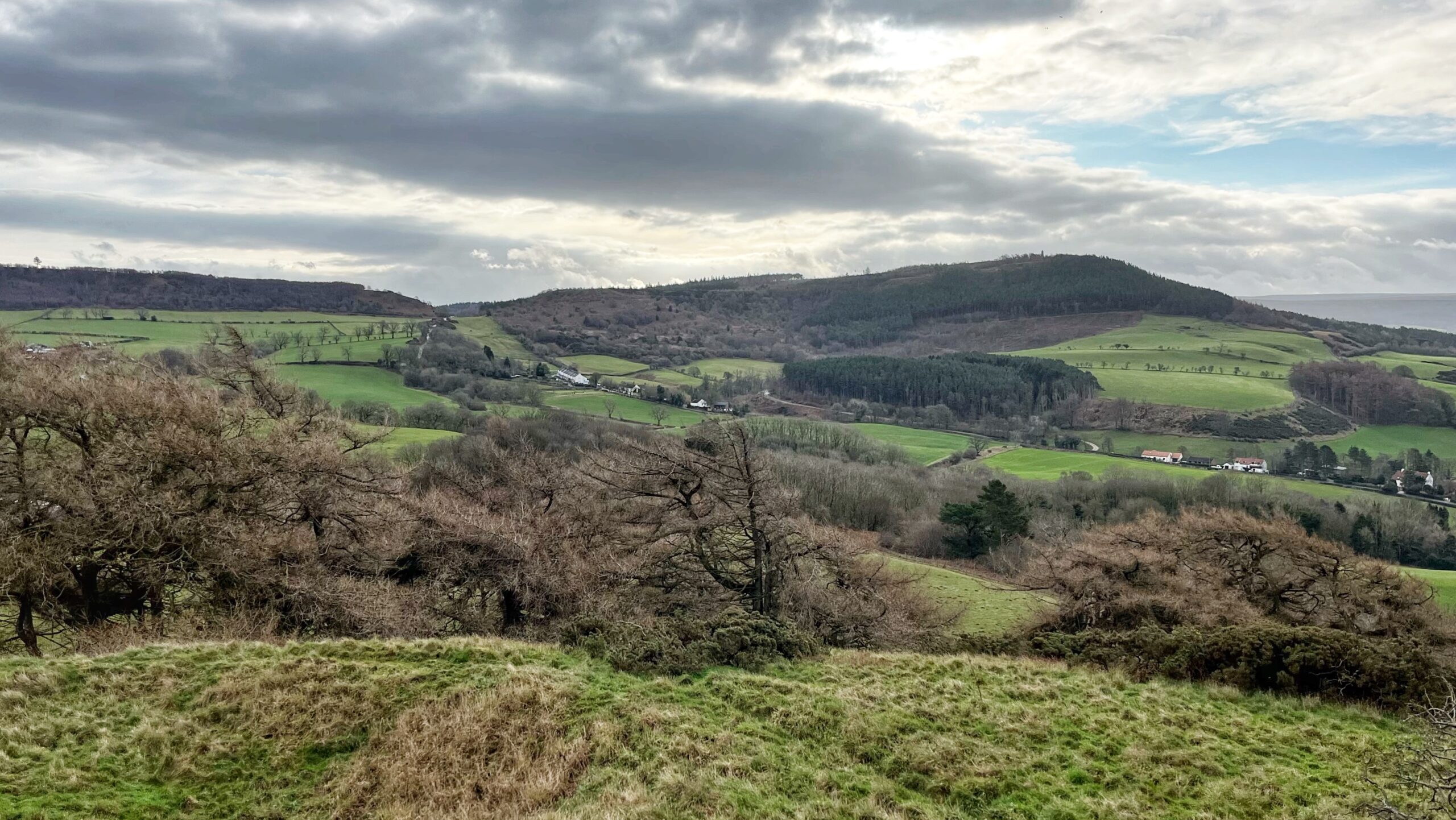
Gribdale Gate and the Edge of the Ice
A view from Cliff Rigg looking across to Gribdale Gate and Easby Moor, where the monument to Captain James Cook stands like a stubborn finger pointing at the sky. It is a landscape that seems quiet until you realise how much has happened here while humanity was busy elsewhere. Gribdale Gate is a well known…
-
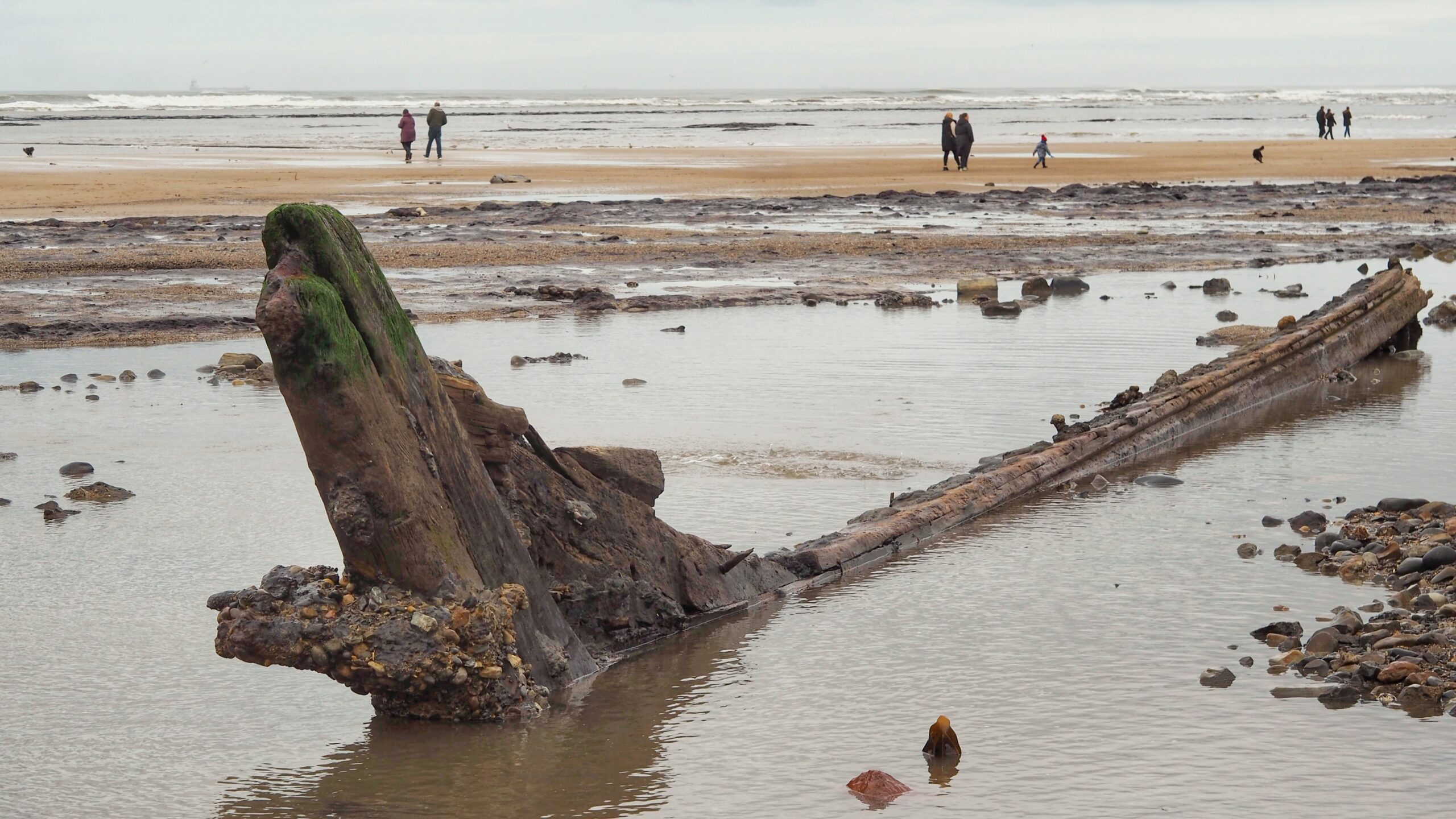
Redcar: Where Time Was Scoured Clean
When Storm Chandra recently lashed the North East coast, it behaved like a blind cosmic spade, scraping away millions of tons of sand to uncover a bleak, barnacle-furred graveyard. This was no run-of-the-mill blow. It delivered a rare, once-in-a-decade “unsanding” that laid bare the black, broken teeth of a 6,000-year-old petrified forest, alongside the skeletal…
-
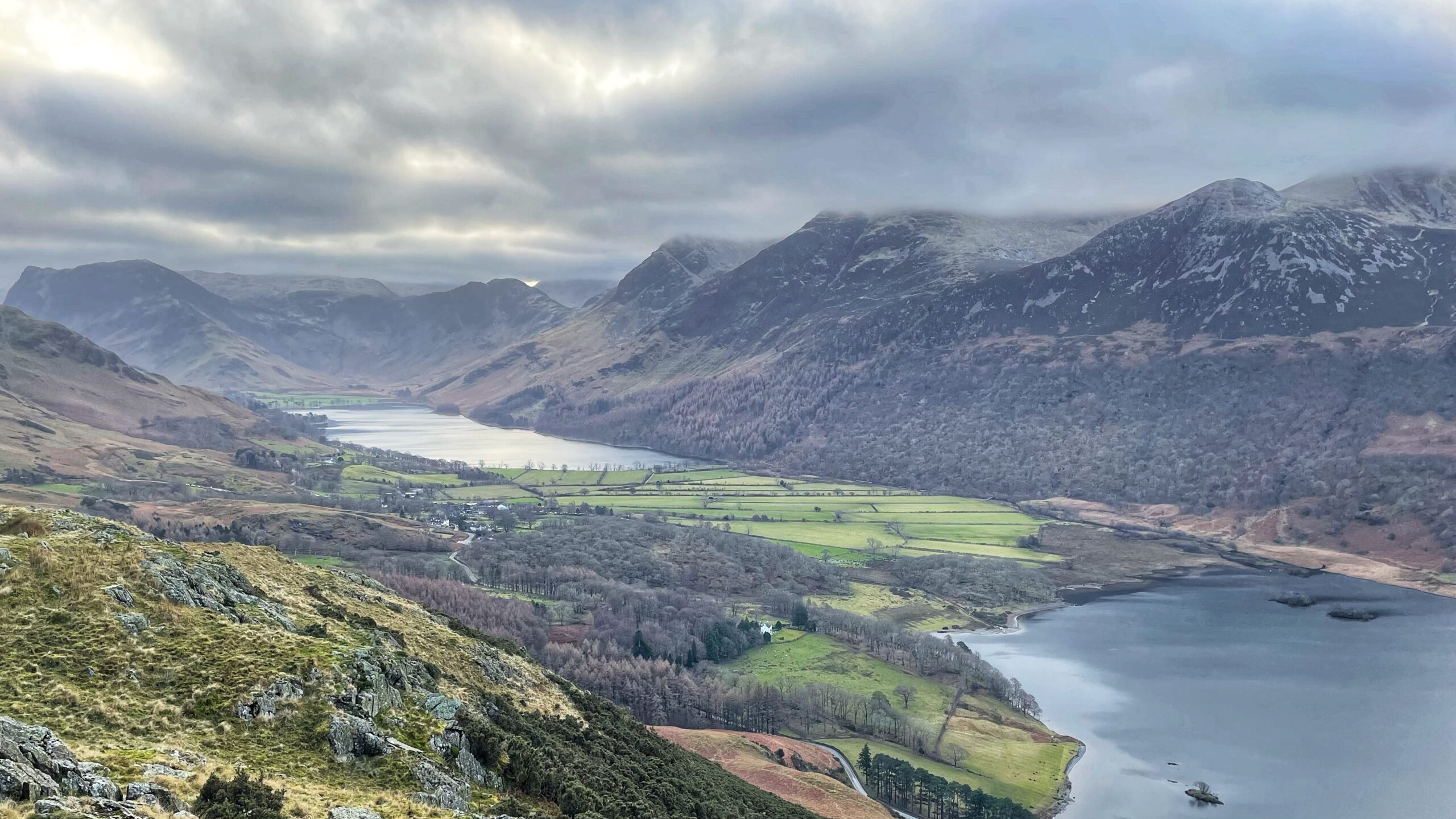
The Slow Making of Buttermere and Crummock Water
That flat sweep of rich green pasture is not there by chance. It sits on the land bridge between Buttermere and Crummock Water, quietly doing the job of keeping the two lakes apart. It was built by a geological feature known as a fan-delta, courtesy of the steady graft of Mill Beck. Long before maps…
-
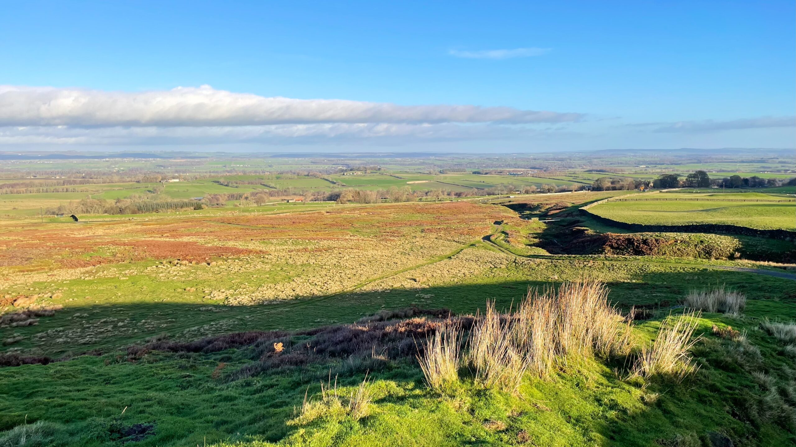
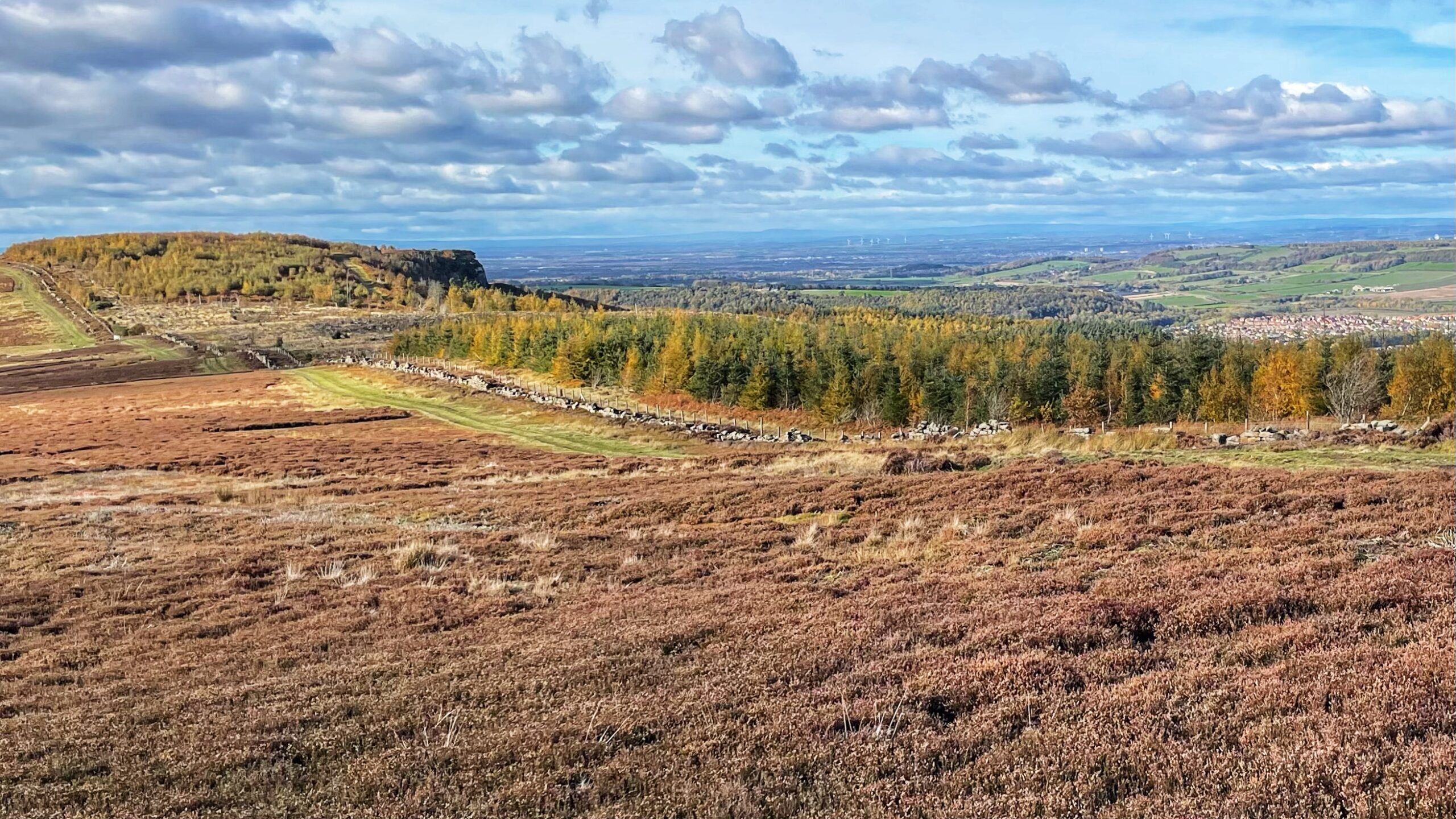
Barningham Moor
Barningham Moor lies high in the Northern Dales between the Swale and the Tees, a stretch of upland that most travellers notice only as a vague rise on the horizon while speeding along the A66. I have passed it for years without realising there was anything remarkable up there at all. From its upper slopes,…
-
The Watchers of the Plain: Highcliff Nab in the Stone Age Landscape
From Gisborough Moor, Highcliff Nab rises starkly above the Cleveland Plain, and it is easy to imagine the lives of its earliest visitors, the Mesolithic hunter-gatherers who roamed here during six millennia before 4000 BC — 900 years before Stonehenge was even thought about. Highcliff Nab is recognised as a key site of Early Mesolithic…
-
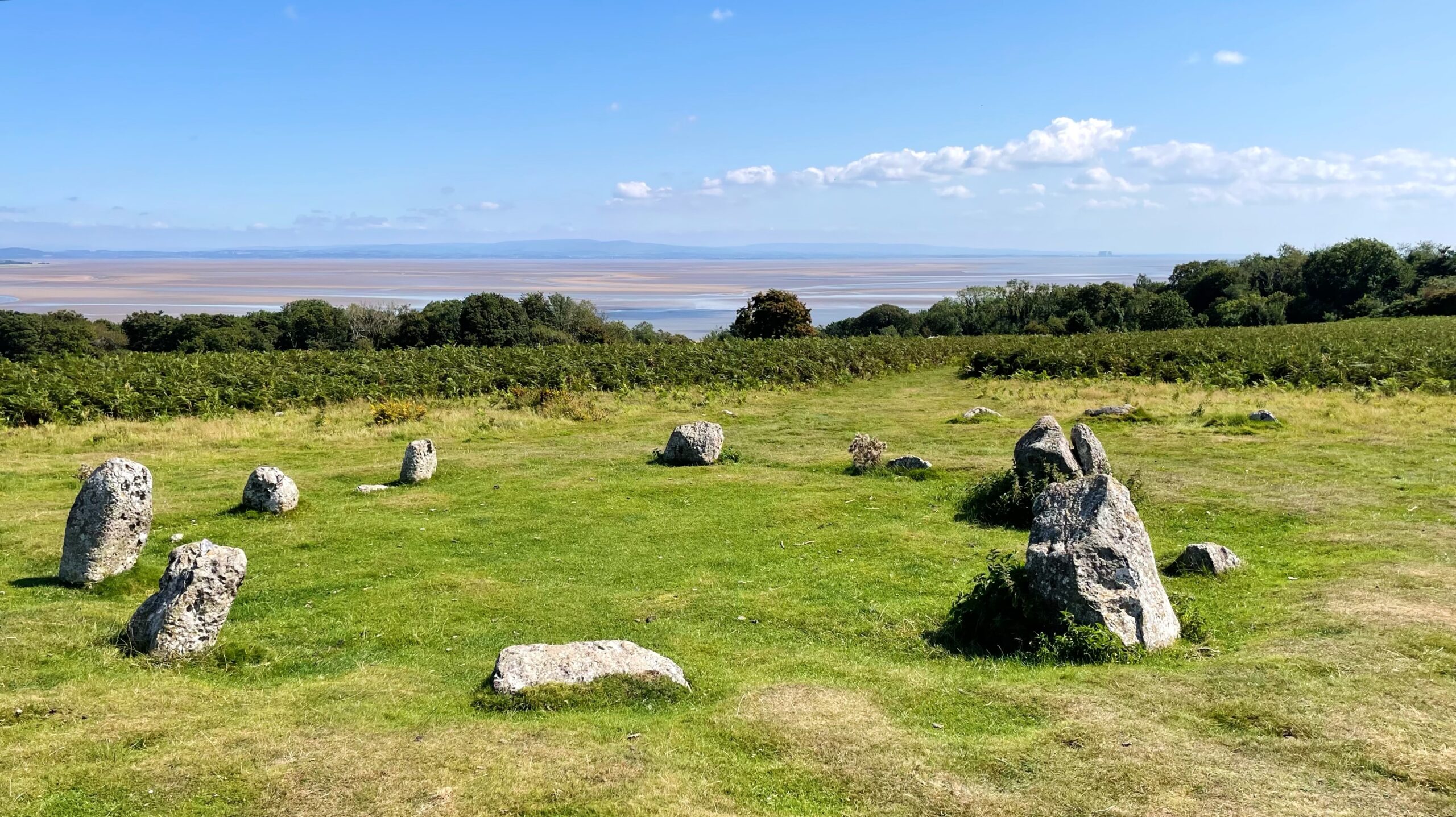
Birkrigg Common Stone Circle
Of the roughly 250 stone circles known in England, only 15 are classed as concentric, formed of both an inner and an outer ring. The most celebrated examples are, of course, Stonehenge and Avebury. Less famous, but striking in its own right, is the Birkrigg or Sunbrick stone circle, also called the Druids’ Circle. It…
-

Bridestones Moor: The Burden of an Ancient Earthwork
A return to Bridestones Moor for the annual task of clearing the Scheduled Ancient Monument — the prehistoric dyke — of bracken and self-seeded saplings. Without this, roots and undergrowth would soon begin to damage what little remains of it. The dyke, a double bank and ditch nearly a kilometre long, is thought to date…
-

Departing the Hebrides, Not Quite Yet
That is it. The Hebridean escape has come to an end. But while I drag myself back into a Yorkshire frame of mind, I can still make use of the heap of photos that never made it into the daily posts. This one shows the summit of Hacklett Uachdar, a rocky rise on the southern…
-

The Lost Graves of Àird Allathasdail
Tràigh Hamara: a sweep of pale sand where today the Atlantic was rolling in quietly, one more perfect beach among many on Barra. But our attention was not on the beach. It was drawn to the headland opposite. Not the distant one, but the nearer stretch of low dunes and machair: Àird Allathasdail. In 2005,…
-

A Walk on Ilkley Moor: Wind, Rock Art, and a Mild Sense of Betrayal
A walk “On Ilkla Moor”, though not “Baht ’at,” as I had the good sense to wear a buff. The wind was still rather sharp. Ilkley Moor, an eastern limb of the Pennines, sits between the Wharfe and Aire valleys. This expanse of rough moorland is littered with relics of prehistoric activity. Chief among them…