Tag: history
-
Scarth Nick and the Making of a Landscape
Scarth Nick, a dry trench bordered by steep banks of bracken and heather, stands as a striking reminder of the fierce sculpting of the great Ice Age. Around fifteen to twenty thousand years ago, a glacier from the north spread across the vale of Cleveland and pushed an icy tongue deep into Scugdale. As it…
-
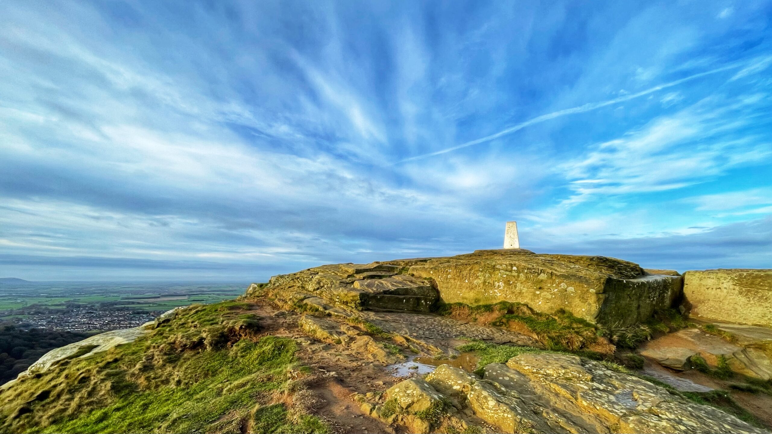
Before Satellites Spoilt the Fun: The Rise of Triangulation
Trig points cling to hilltops like relics from a time when humans trusted metal and masonry rather than shining toys orbiting the earth. This one on Roseberry’s summit keeps being repainted in traditional white, only to be graffited again by passing aritists who imagine posterity cares about their scribblings. With GPS now doing the clever…
-
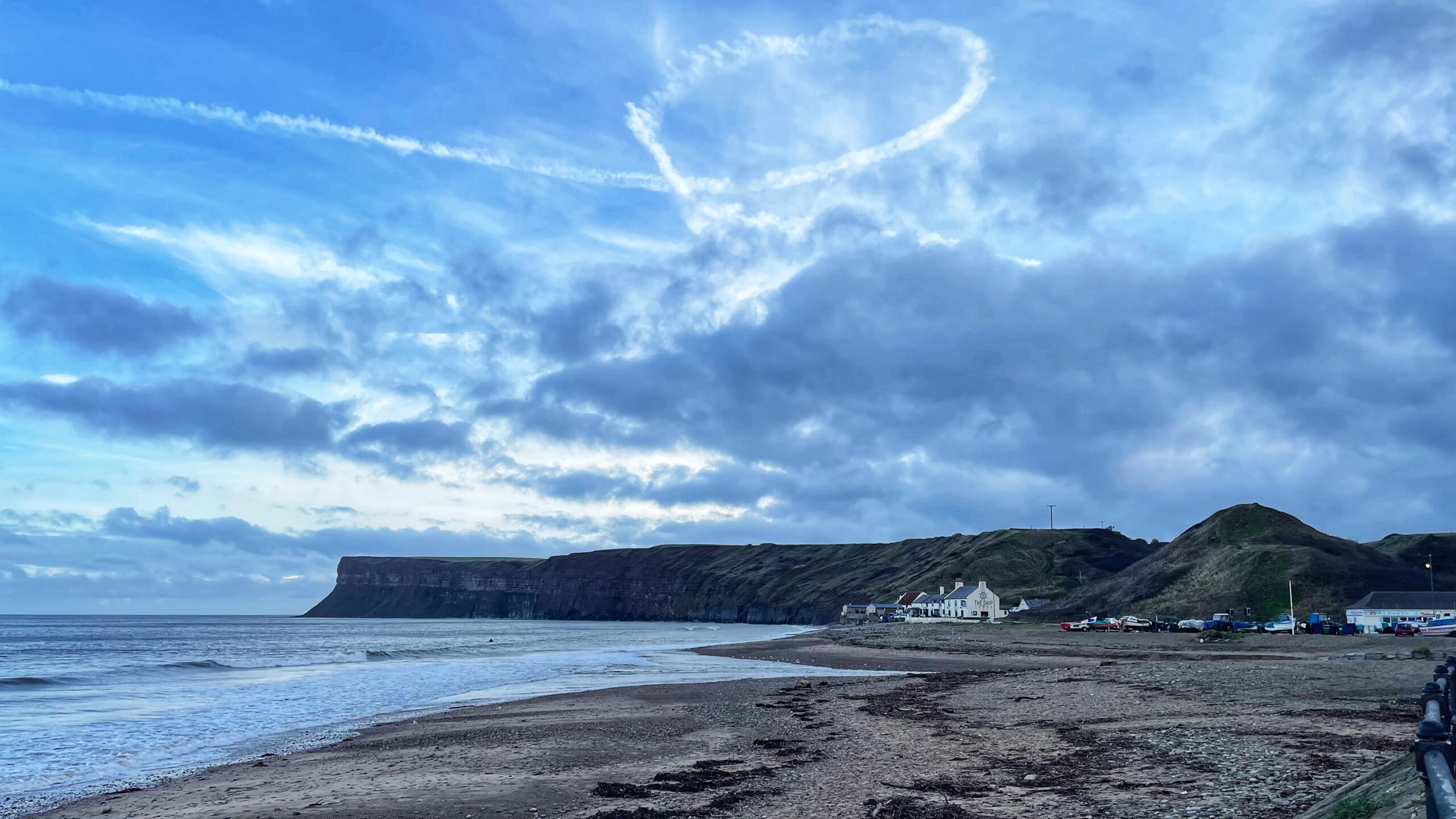
A Heart over The Ship Inn
Is that a heart floating above The Ship Inn at Old Saltburn. Charming. The pilot must have been struck by a fit of sentiment, or perhaps simply bored stiff. Back in the eighteenth century this tiny fishing village beneath Huntcliff and the ever-so-subtle Cat Nab managed to support four inns, plus enough gin shops to…
-
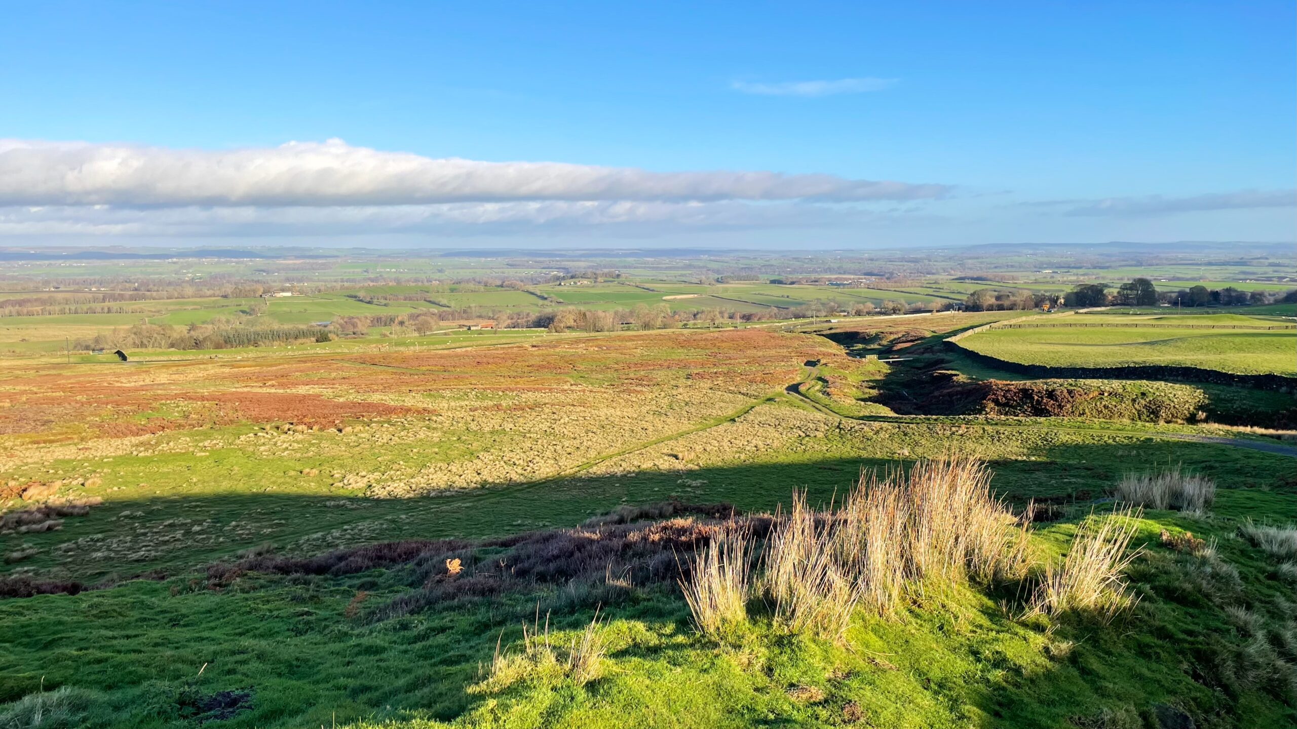
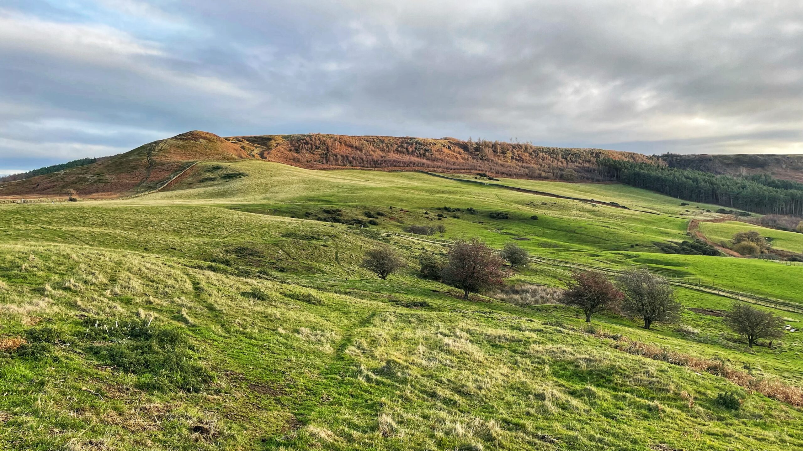
Barningham Moor
Barningham Moor lies high in the Northern Dales between the Swale and the Tees, a stretch of upland that most travellers notice only as a vague rise on the horizon while speeding along the A66. I have passed it for years without realising there was anything remarkable up there at all. From its upper slopes,…
-
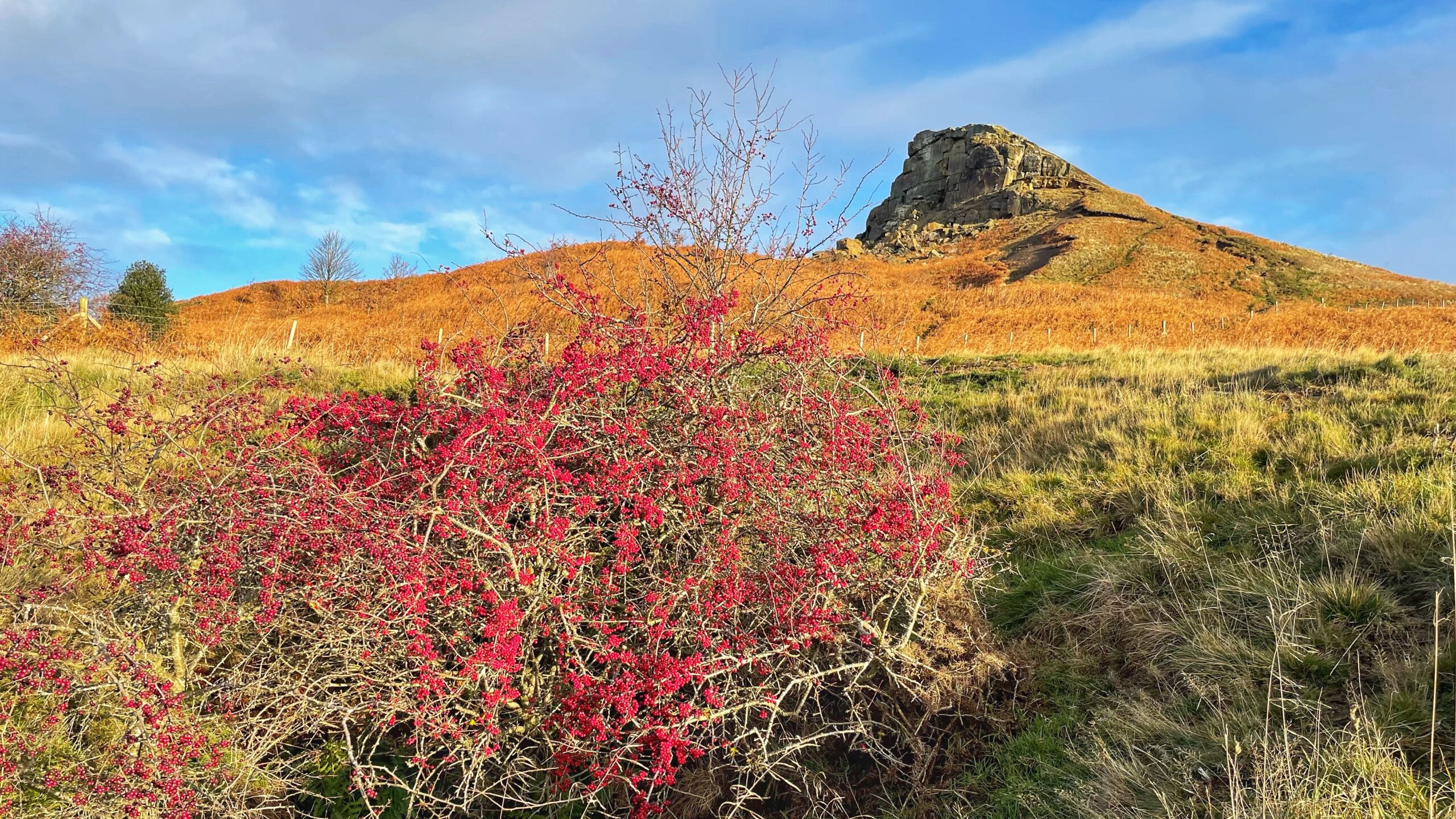
December Arrives and Haws for the Birds
And so we stumble into December, once the proud tenth month of a Roman calendar designed by people who thought it wise to leave sixty days of winter adrift like sheep in a snow drift. Eventually they realised this was a fool’s errand, tacked on January and February, and shuffled December to twelfth place. One…
-
A Quarter Century of the Right to Roam, More or Less
Today brings a double milestone for those in England and Wales who find the open air rather more enticing than the sofa. It is twenty-five years since the Countryside and Rights of Way Act 2000 marched through Parliament and twenty years since its promised freedoms finally reached the boots of the public. Since then, the…
-

Paths on the Map but not on the Ground
This boundary stone on Great Ayton Moor stands on its highest point as though it has nothing better to do than provide a focus to anyone passing by. A glance at the O.S. map shows this top lies on a junction of a Public Bridleway between Gribdale and Hutton, plus two Public Footpaths approaching from…
-
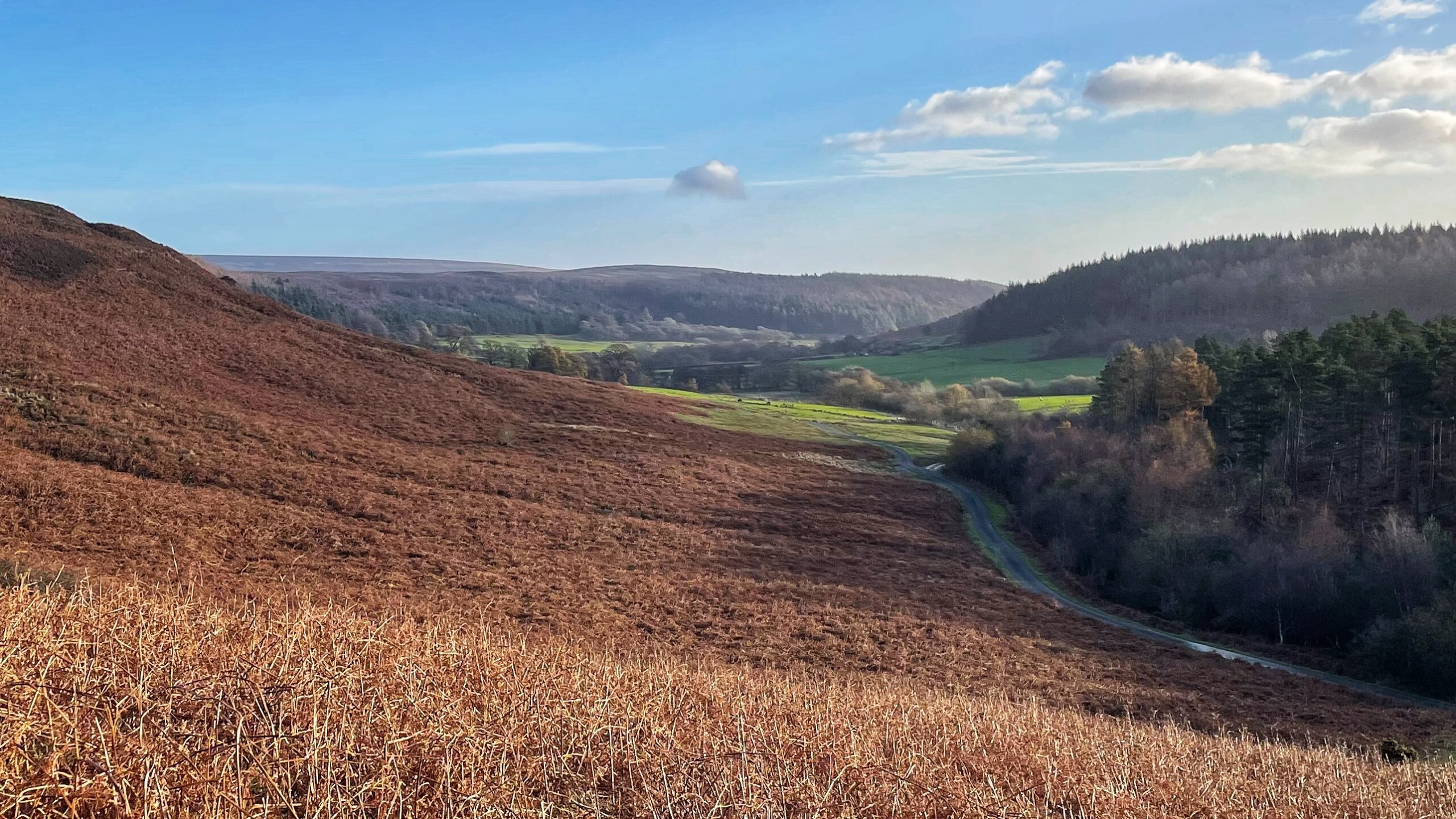
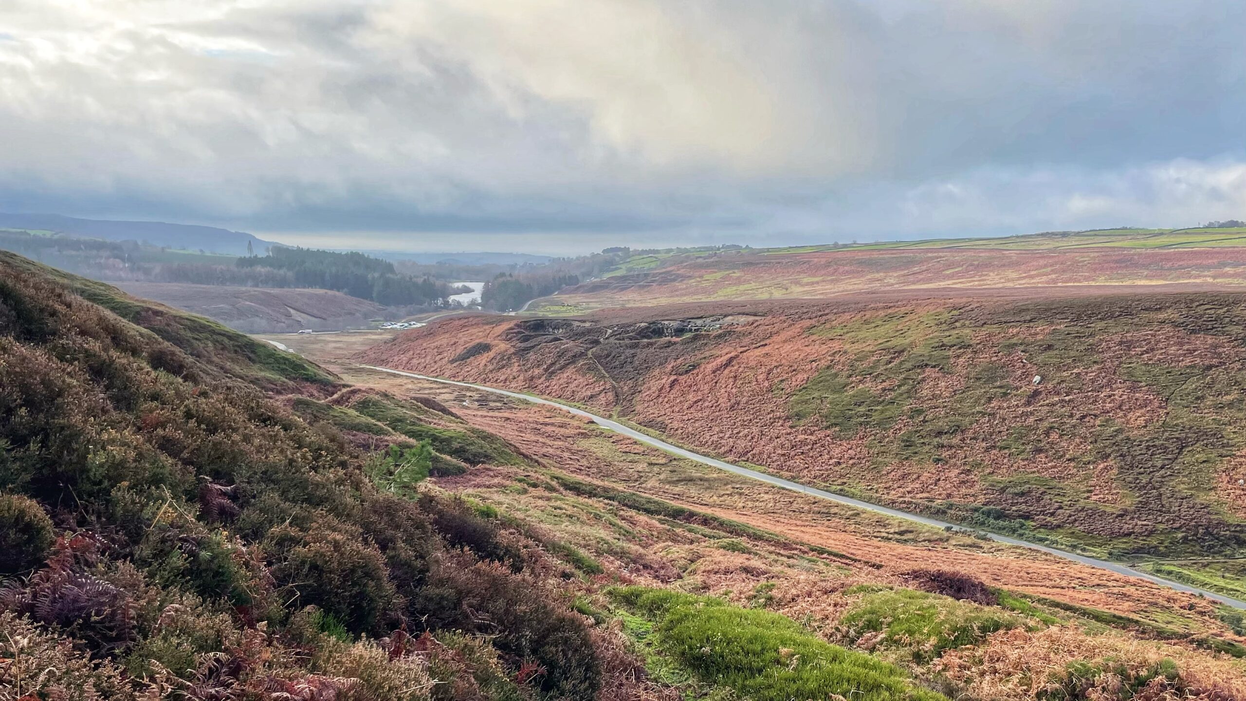
Winter Colour beyond Gribdale Gate
A photograph dominated by bracken in its dry, reddish-brown winter state. From Gribdale Gate, the narrow road winds down beside the beck which marks the parish boundary between Great Ayton and Kildale. In the shadowed south side of the dale, the conifers of Coate Moor plantation rule. This abundance of bracken across the northern slope…
-

The Tofts and the Wandels: Echoes of the Deserted Medieval Village of Danby
One of the most striking features of Danby Dale is its parish church, standing rather alone about three kilometres from the present village. Castleton and Ainthorpe sit a little closer, yet the church remains a solitary figure in the landscape. In the photograph, it can be seen just to the right of centre, north of…
-
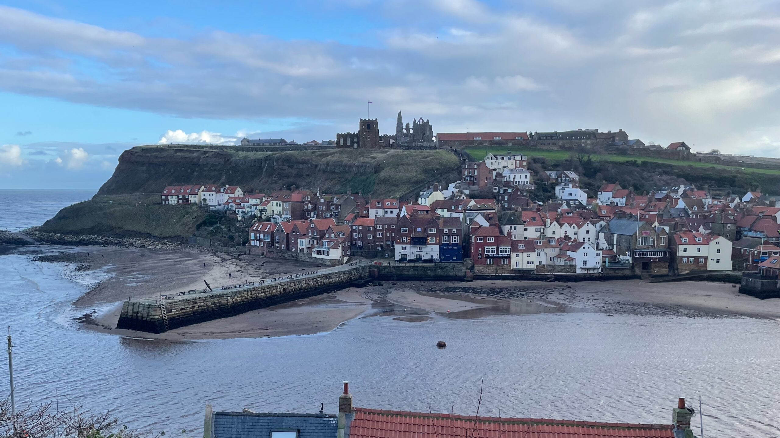
Whitby’s East Cliff
A rare chance to wander through the nooks and crannies of Whitby, where every turn seems to ooze history. This view from the curiously named Kyber Pass looks across the Esk towards the jumble of red-roofed houses that appear to cling for dear life to the crumbling East Cliff. High above them, standing guard against…