A random selection …
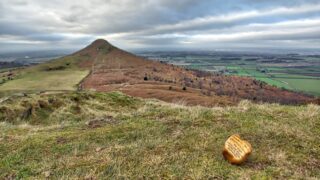
Painted Rock
My heart sank when I came across this while descending Little Roseberry. Now call me a killjoy but is this really necessary in a National Park, “our most breath-taking and treasured landscapes”. It’s only a painted pebble left in a prominent place and asking finders to post photos to a Facebook page. A craze from […]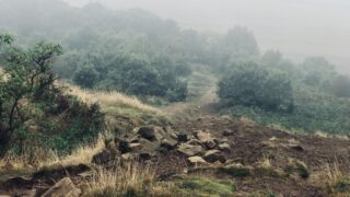
The Forgotten Rebellion: Winter Hill’s Mass Trespass of 1896
Another delightfully dreich day on the North York Moors. In the murk, we stumbled upon two workers labouring away on the new footpath up Roseberry. The path, prepared to its subsoil, resembles some sort of glutinous purgatory, offering a walking experience only slightly less pleasurable than a swim in wet cement. The workers mentioned the […]
Codhill Heights — Celtic origins in Yorkshire’s landscape
I read once that place-names split neatly into two groups: habitative names, describing the kind of settlement in question, and topographic names, painting a picture of the lay of the land — rivers, rocks, marshes, and hills. Among the ancient Celtic place-names that have trickled down to us, habitative names are not easy to find; […]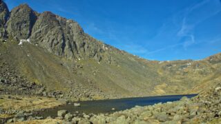
Dow Crag and Goats Water
The great buttresses of Dow Crag in the Coniston Fells down which the vindictive Geoffrey Westcott fell to his death after attempting to shoot Rowf who had been making his way along the foot of the crags. Perhaps not the best panegyric for a fellwalker but Mr. Westcott is a fictional character and Rowf is […]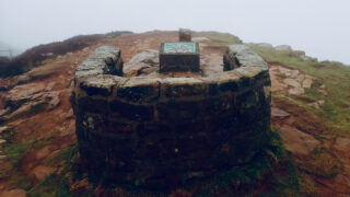
Once more into the clag
Not much to see today above the 300m contour. This is the Alec Falconer memorial seat on Cringle Moor. Alec Falconer was a founder member in 1912 of the “Middlesbrough and District Countrywide Holidays Association and Holiday Fellowship Rambling Club” which went on to become known as the Middlesbrough Rambling Club. He was also an […]