-
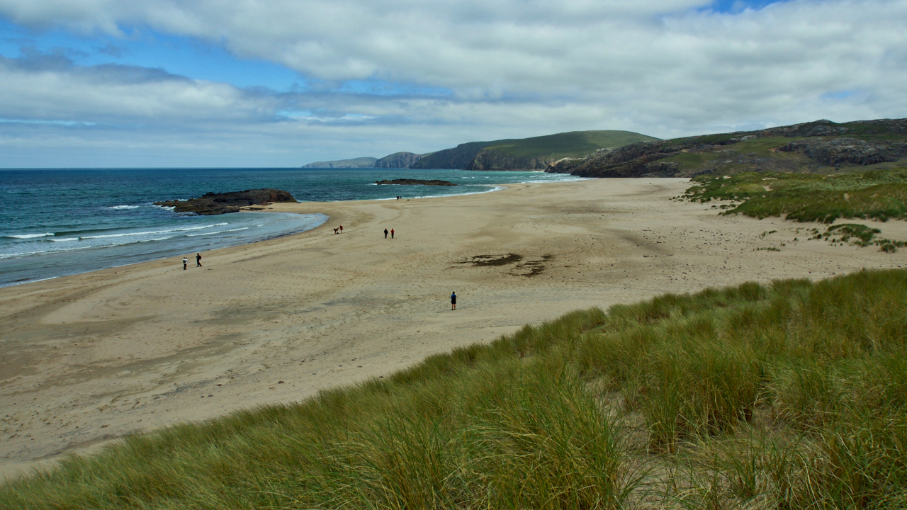
Seannabhat
I was last here 20 years ago but I can’t for the life of me remember the 6½ km walk in. But I have the photo to prove it so must have. Sandwood Bay is far more popular today but I wonder if the wild campers that were there know of the ghostly stories associated…
-
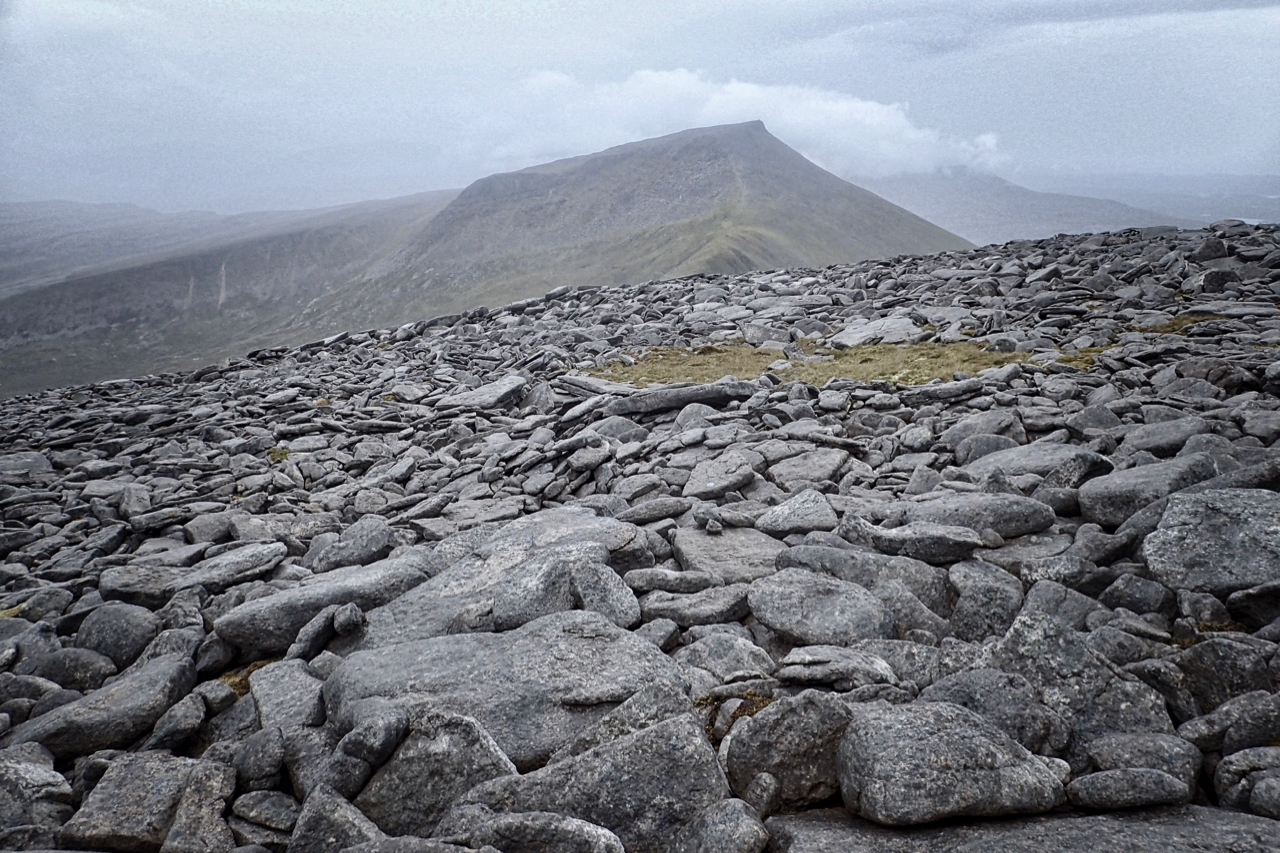
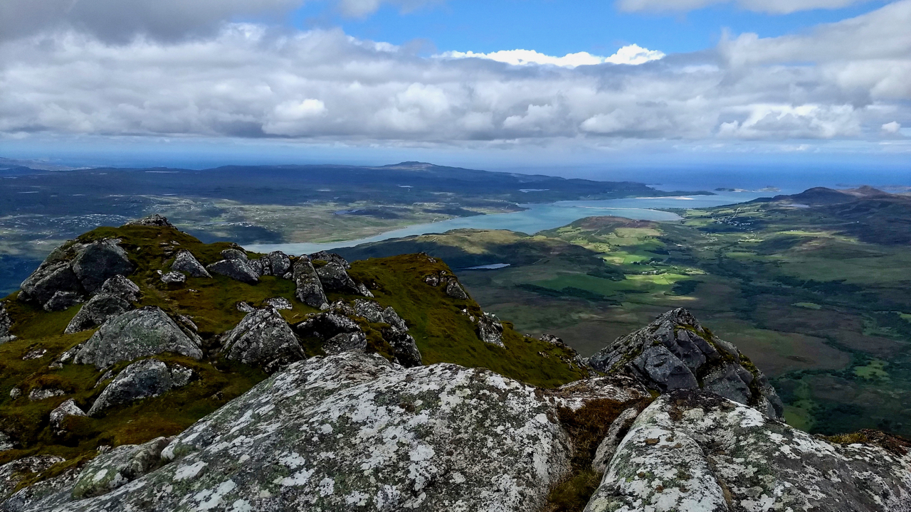
Cranstackie from Beinn Spionnaidh
The two most northerly Corbetts. 45 minutes earlier I was on top of Cranstackie in the distance in 70 mph winds, rain with no visibility. I had decided to call it a day and abort an attempt on Beinn Spionnaidh, but by the time I made the col the mist had cleared and the rain…
-
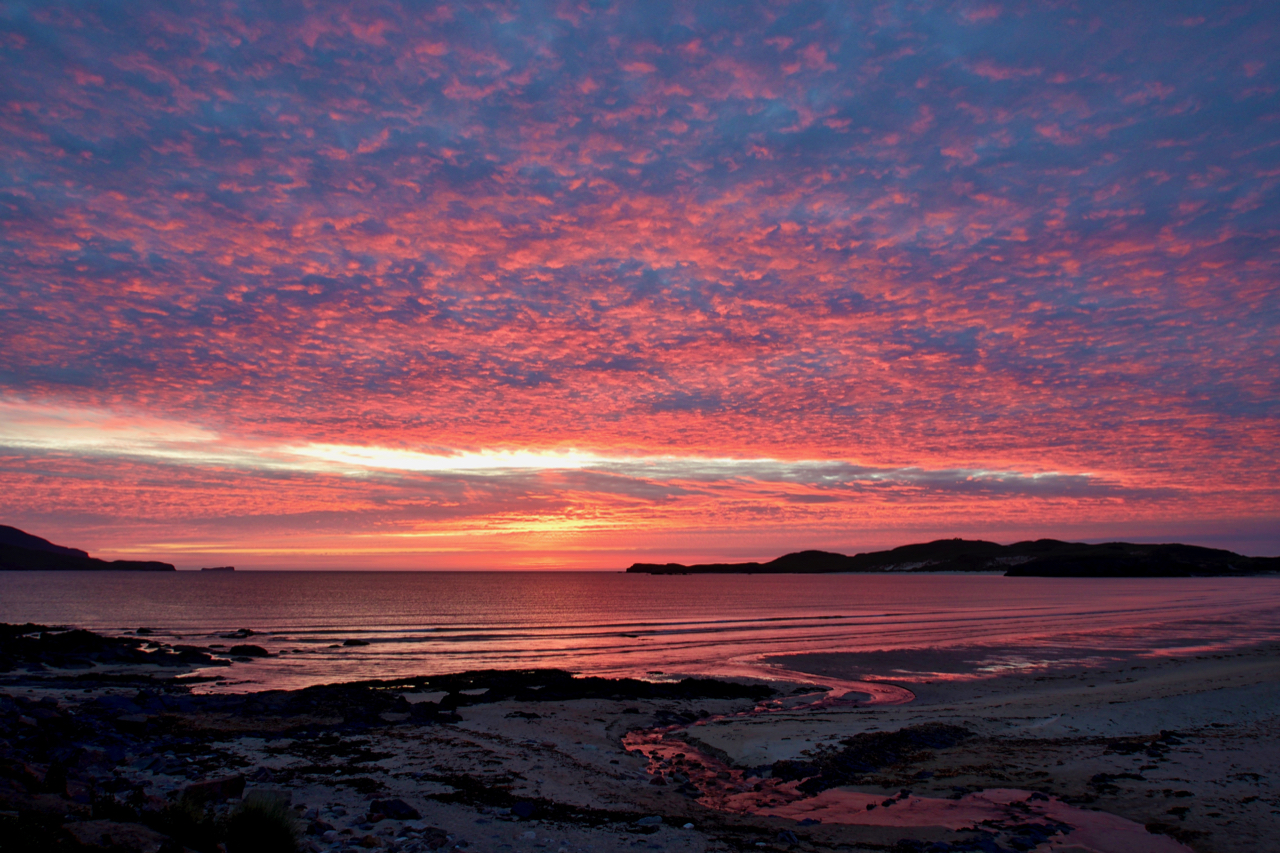
Cracking sunset last night
Actually, the sun had already set. Half past ten! Parked up at Balnakeil Bay near Durness. Open Space Web-Map builder Code
-
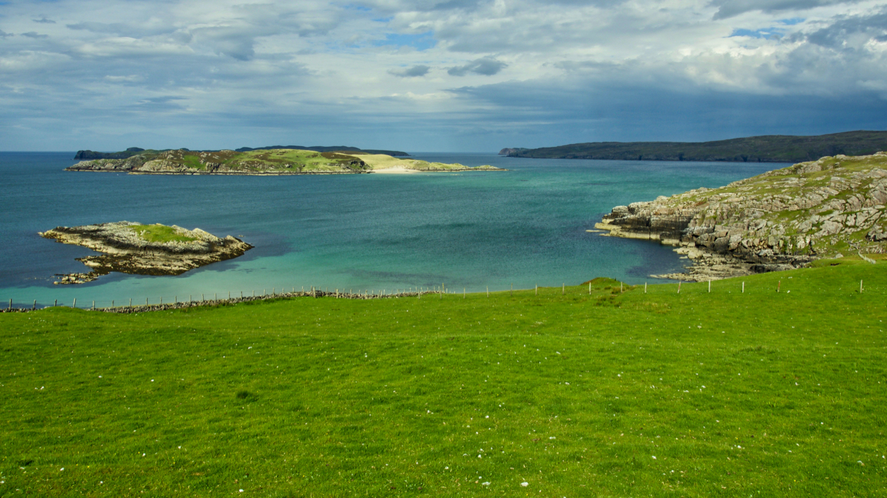
Rabbit islands
The little island nearest is Talmine Island but the ones in the distance are called Rabbit Islands. There are three maybe five of them depending if count one as being split by a cleft and another by a sandbank both of which are dry at low water. In fact the map shows a tidal sandbar…
-
Kyle of Tongue from Ben Loyal
Or Beinn Laghail to give it its proper Gaelic name, Ben Loyal being just an Anglicised spelling. Laghail is thought to come from the Norse “laga fiall” meaning law mountain. Although others have suggested a mountain of trees as an alternative derivation , law mountain is the more likely as there is a strong Norse…
-
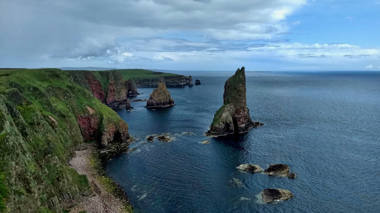
Stacks of Duncansby
A pair of dramatic sea stacks just off the north-easterly tip of the British mainland. But we almost lost them. Apparently in 1953, in what seems like a bizarre Monty Python sketch scientists from the Aldermaston Atomic Weapons Establishment had proposed to test a nuclear bomb on top of one of the stacks. The Stacks…
-
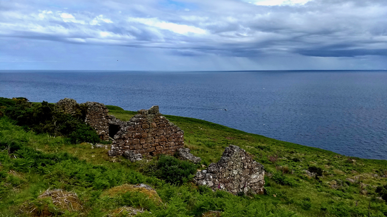
Badbea
I’ve seen before the deserted black houses of communities in fertile straths that were cleared by absentee landlords to make way for vast sheep farms. I had thought the villagers were often provided with a small croft on the east coast in towns such as Wick and left to make a living from the sea.…
-
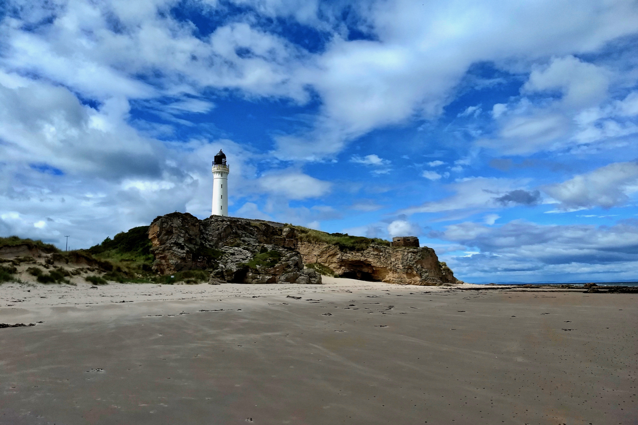
Covesea Skerries Lighthouse
Built in 1846, following a terrific storm 20 years earlier in which 16 vessels were lost in the Moray Firth, several on the notorious Covesea and Halliman Skerries. The delay was due to Trinity House, the board responsible for lighthouses, believing that a lighthouse was in fact unnecessary. Eventually, the board was swayed by public…
-
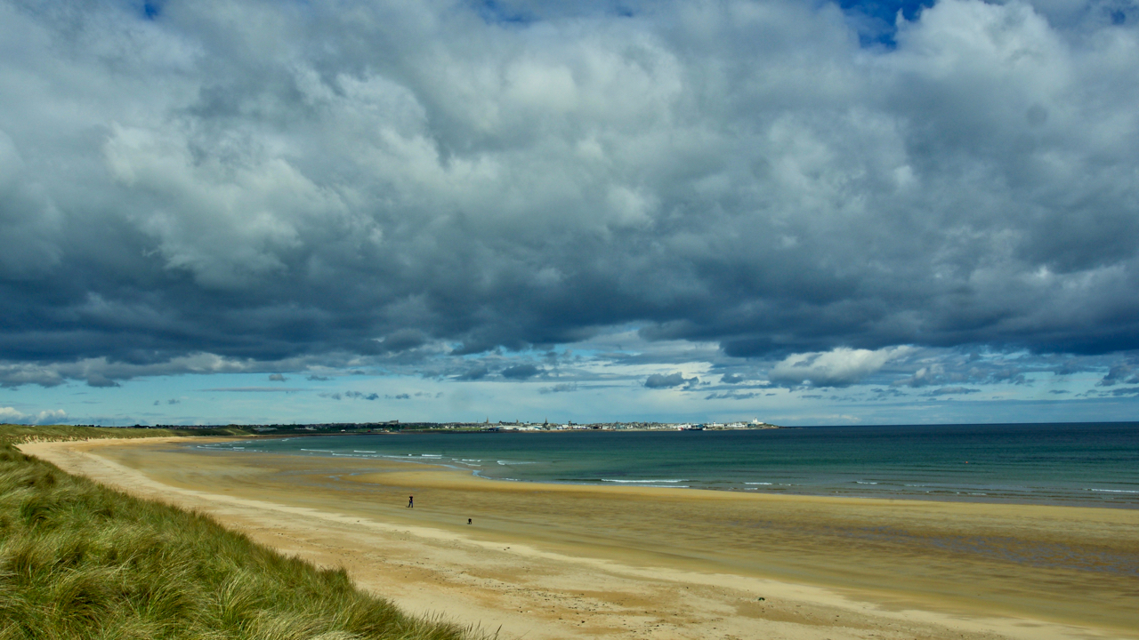
Fraserburgh Bay
The north-east coastline of Aberdeenshire has many miles of clean golden sands, deserted but for the occasional dog walker. This is Fraserburgh Bay between Kinnard Point and Cairnbulg Point. In the distance is Fraserburgh, a town dating from the 16th-century and named after Clan Fraser. Beyond Fraserburgh, the Moray Firth begins. Open Space Web-Map builder…
-
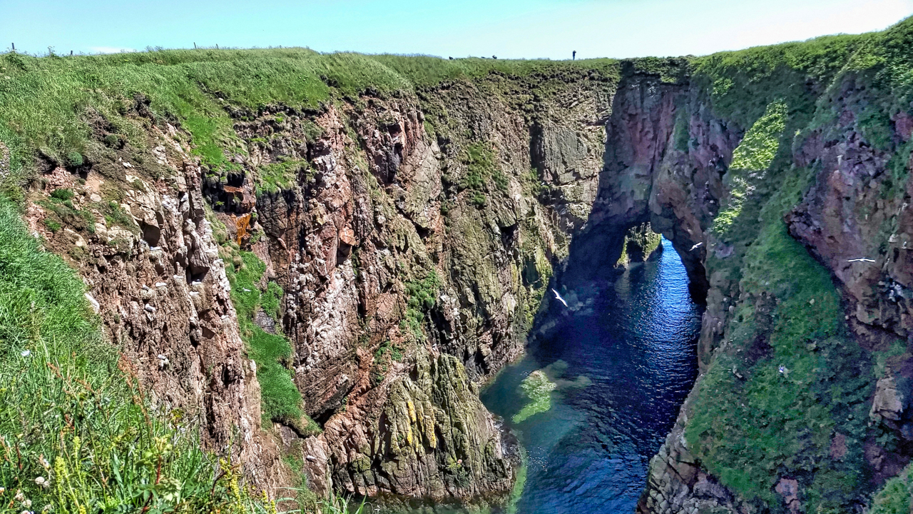
Bullers of Buchan
“The Pot”, once a massive sea cave with a collapsed roof. A buller is a whirlpool or in this case, it refers to the bellowing noise coming from The Pot as the sea roars through the arch. There is a local legend of a fisherman, in his boat one evening seeing a mermaid at the…
Care to comment?