-
The Forgotten Lichenologist of Great Ayton: William Mudd
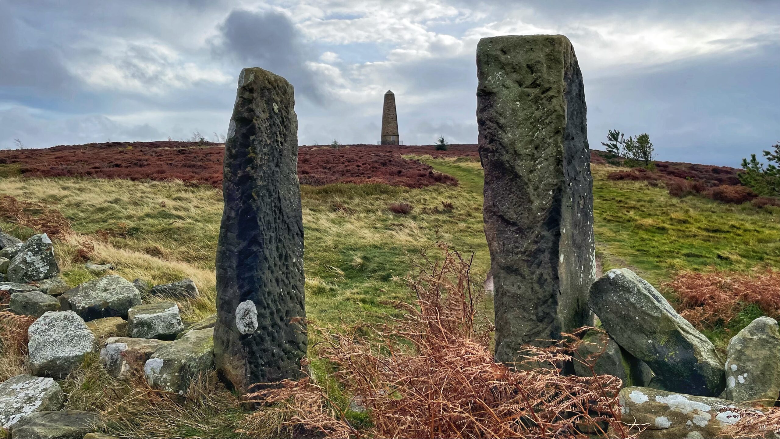
Watching over this popular approach to Easby Moor stand a pair of weathered gateposts, their stone faces mottled with centuries of lichen. They guard the path with the weary dignity of old sentinels, and one cannot help but wonder: did they stand here before Captain Cook’s Monument was raised on the hill beyond? The answer,…
-
Shale, Sandstone and a Coffee Cup
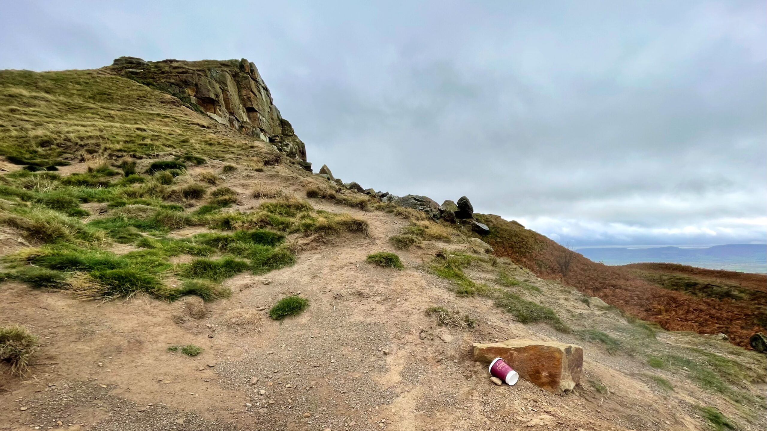
I set out this morning hoping to capture a clear view of the mound on Roseberry’s western slope, formed by the landslip of May 1912. The result was underwhelming; the photograph failed to do justice to the defining shape of the old slump. During the second week of that May, a great section of Roseberry’s…
-
Urra: What’s in a Name?
Urra. A name that sounds as if the wind itself whispered it across the moor. Once, according to Richard Blakeborough, this lonely hamlet in upper Bilsdale had a blacksmith and an inn – the twin hearts of any small community. Now it is little more than a name on a map, clinging to the edge…
-
Cramond Brig: Where the King had a Narrow Escape
The River Almond begins its quiet journey in North Lanarkshire, winding eastwards until it slips, almost unnoticed, into the Firth of Forth at Cramond. But just before it meets the tide, the Almond performs one last act of theatre. Its course cuts through a steep, wooded gorge where oak, beech and sycamore crowd the banks,…
-
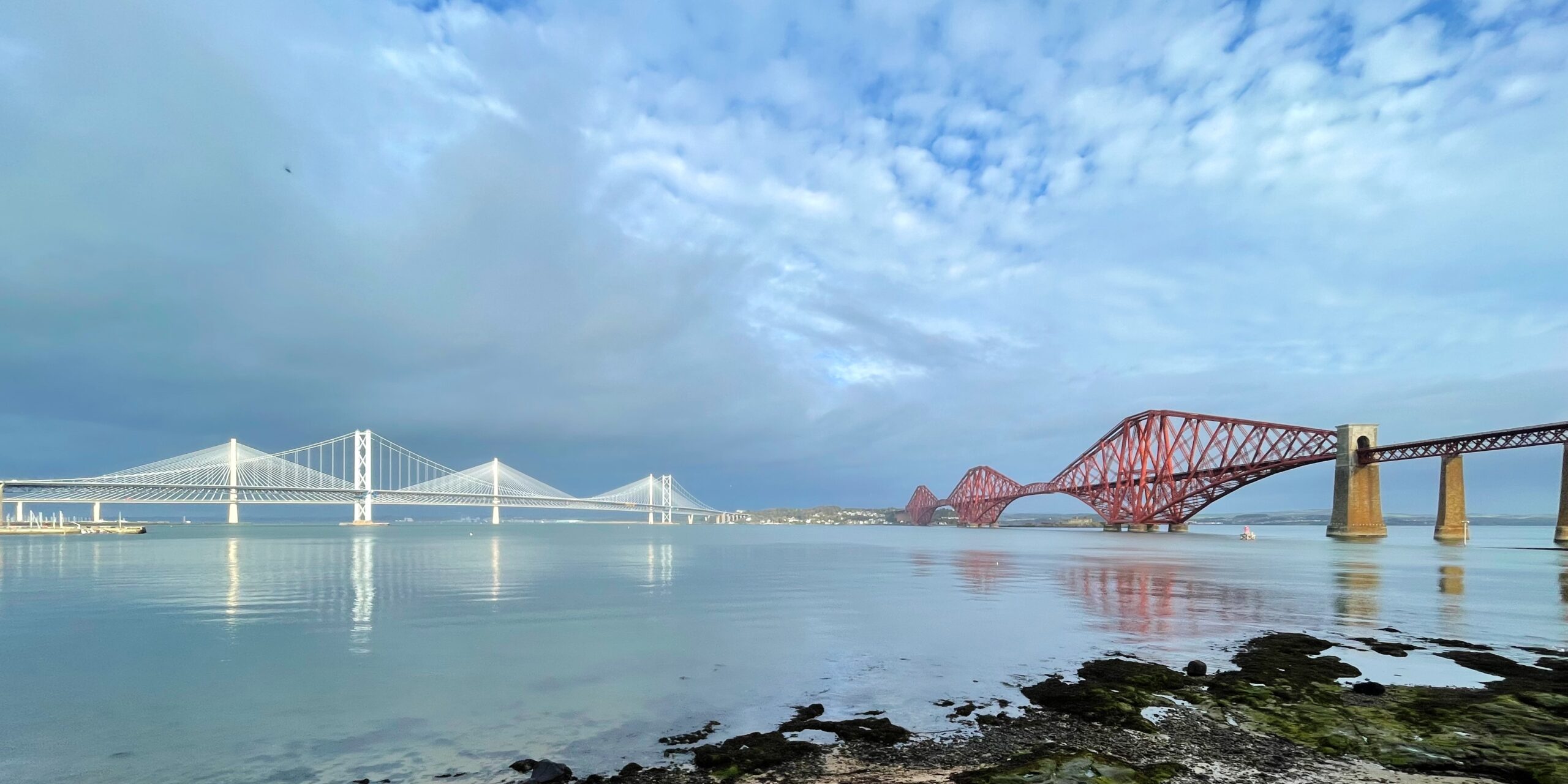
The Ferry That Time Forgot: Queen Margaret’s Gift to Travellers
A sweeping view of Scotland’s most iconic bridges, taken from the charming town of South Queensferry—a place where steel, stone, and centuries meet across the Firth of Forth. It is tempting to drift into the story of how these mighty spans were built, but today the real fascination lies not in iron and rivets, but…
-
Waterloo Monument, Peniel Heugh
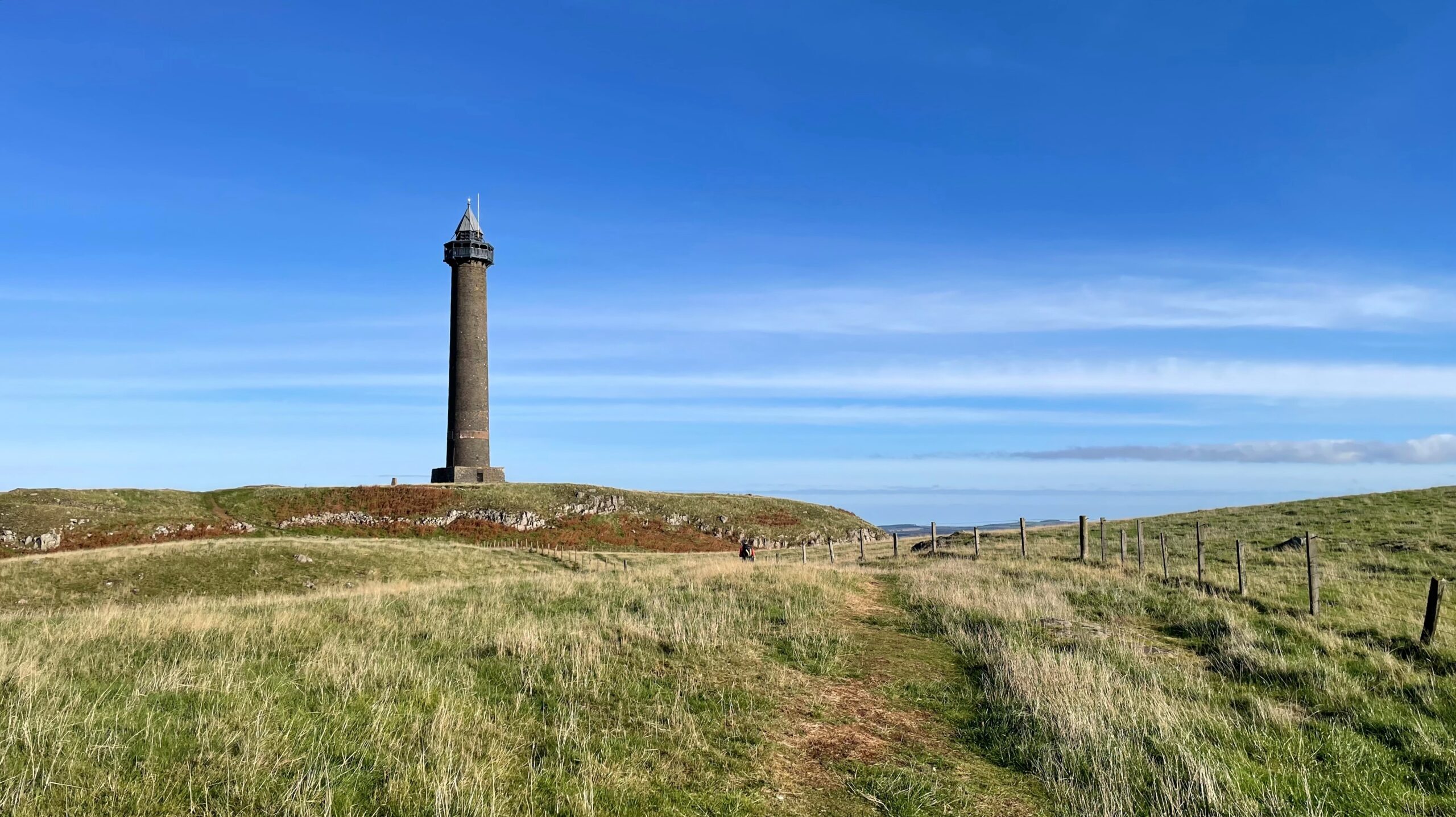
Into the Scottish Borders, and to Peniel Heugh—a modest hill of 237 metres, though it carries itself as if it were Everest. It is, I am told, a volcanic plug of olivine microgabbro, which sounds far grander than the dark lump it appears to be above the village of Ancrum. At its summit stands the…
-
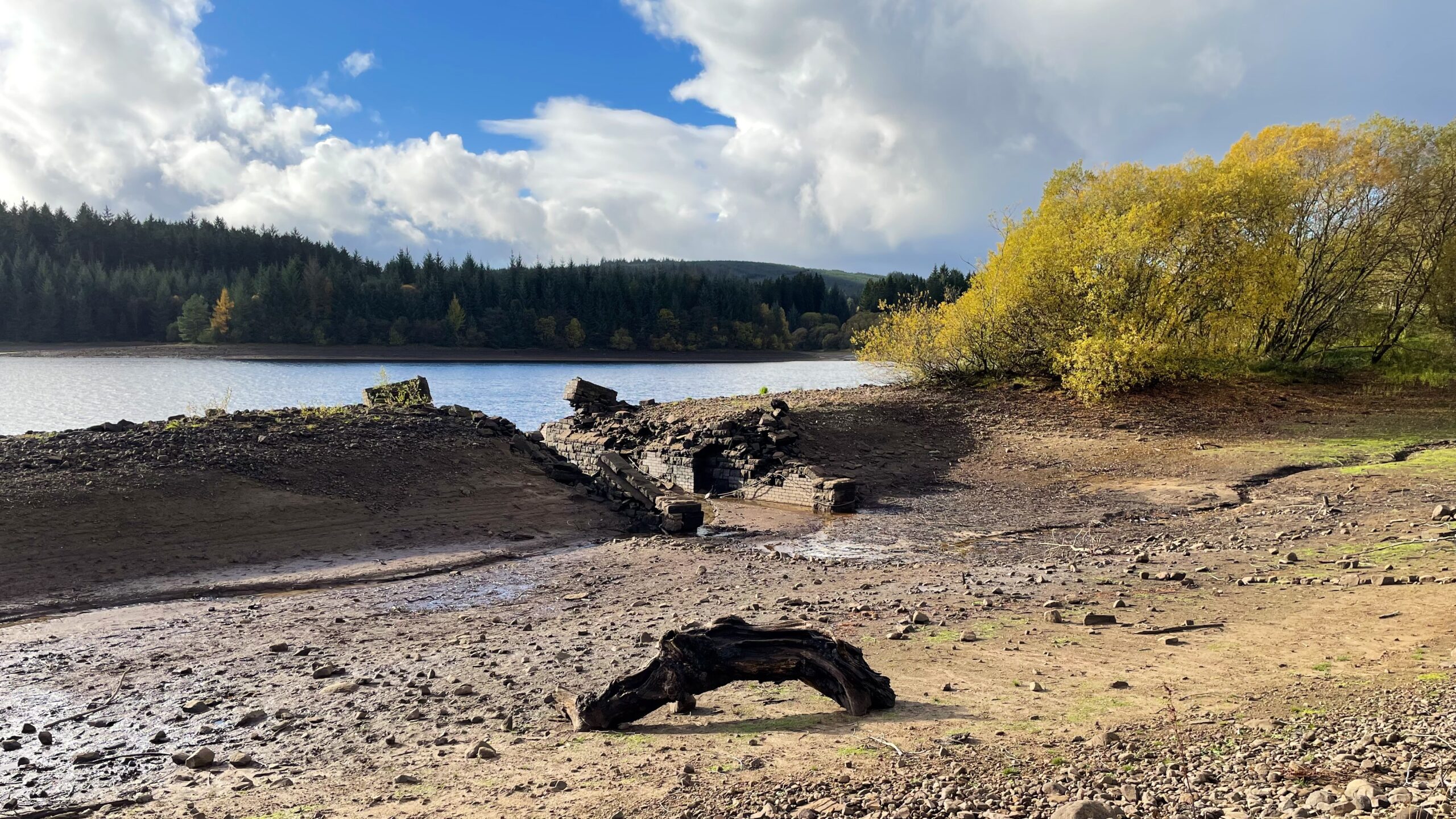
Drowned Tracks: The Railway That Kielder Swallowed
I had always imagined Kielder reservoir as an endless supply of water, vast and untouchable. So when I saw it shrunken, its shoreline drawn back to reveal the bones beneath, it was a bit of a shock. There, exposed after decades under the surface, lay the embankment of a forgotten railway that once wound its…
-
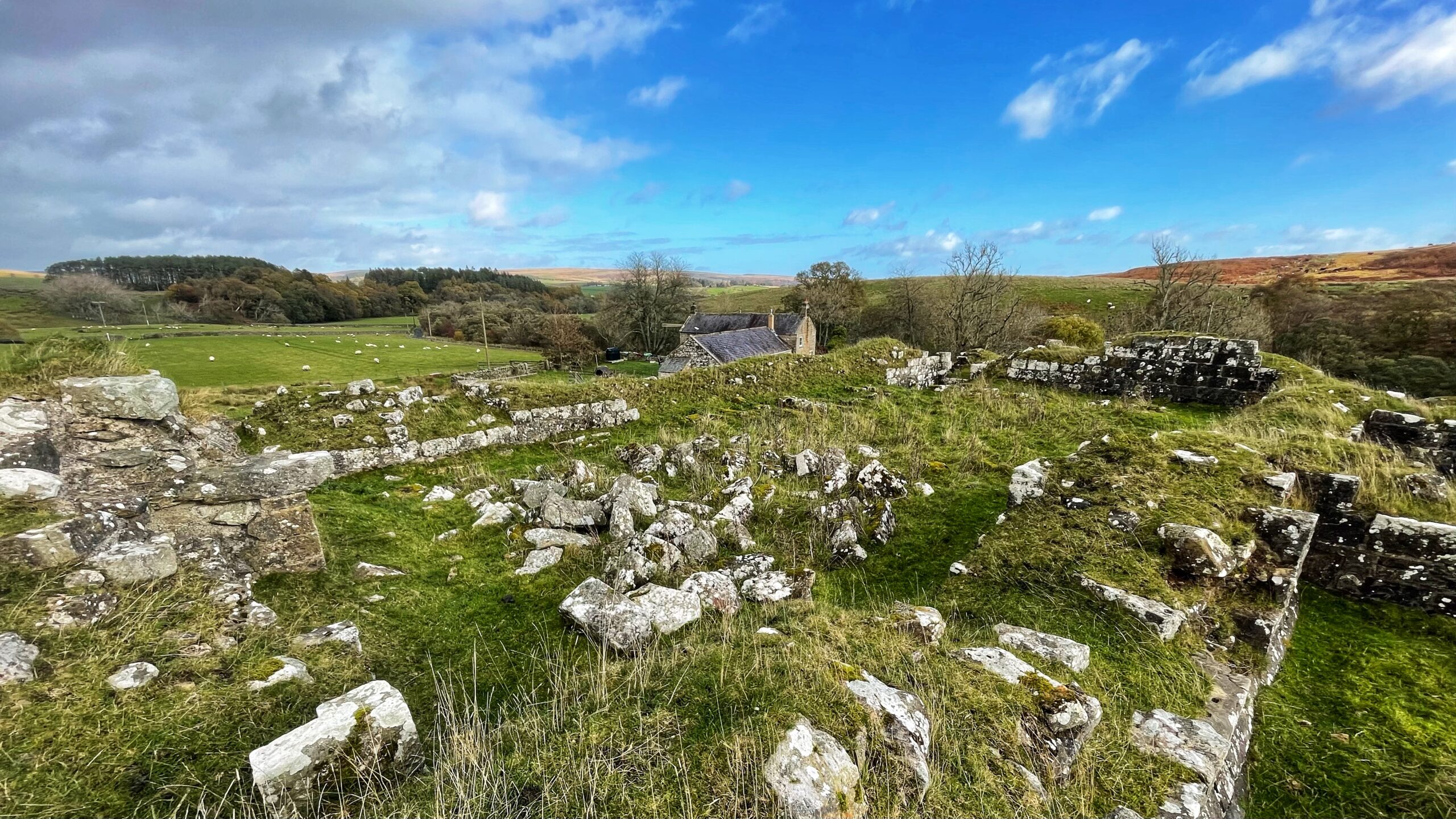
Dally Castle: Where Legend Outlasted Stone
The ruined Dally Castle in Northumberland sits on its grassy knoll like the ghost of a forgotten age. Only low walls and scattered stones remain, but they hint at a place that once surveyed the countryside with authority. The information board, in its pedantic way, insists that Dally was never a true castle at all.…
-
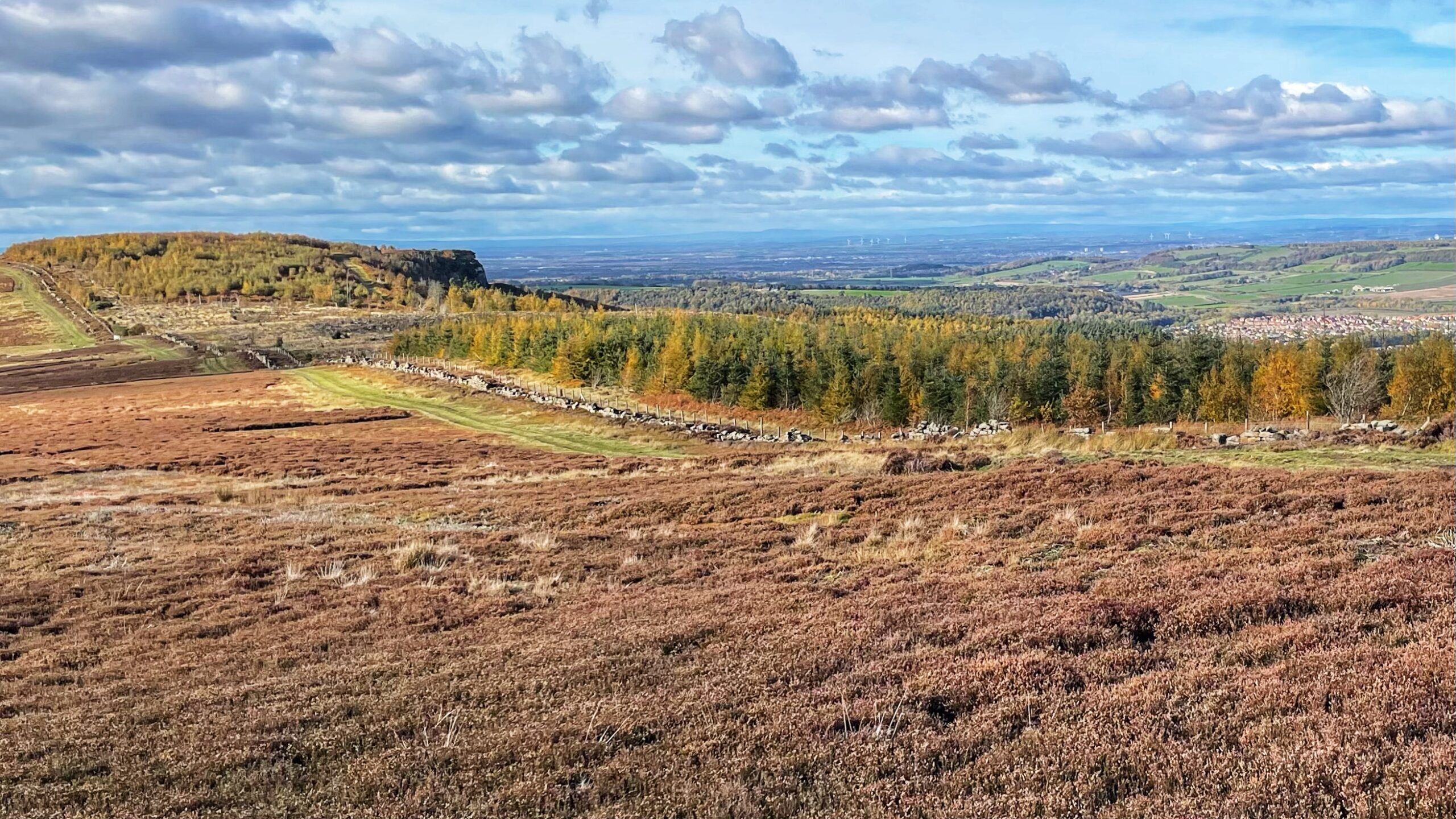
The Watchers of the Plain: Highcliff Nab in the Stone Age Landscape
From Gisborough Moor, Highcliff Nab rises starkly above the Cleveland Plain, and it is easy to imagine the lives of its earliest visitors, the Mesolithic hunter-gatherers who roamed here during six millennia before 4000 BC — 900 years before Stonehenge was even thought about. Highcliff Nab is recognised as a key site of Early Mesolithic…
-
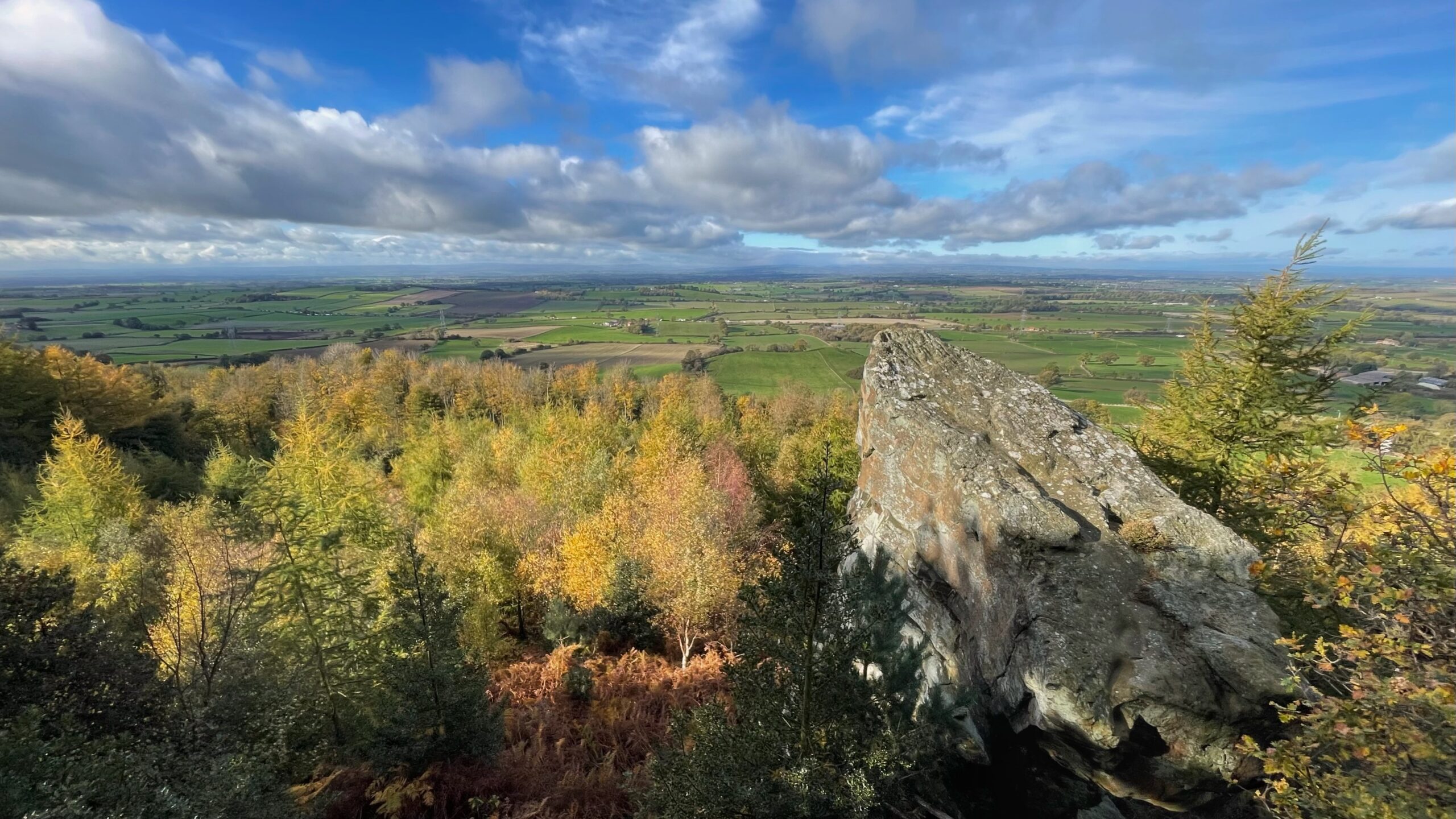
The View from the Hanging Stone
About a mile north of Over Silton, on the steep flank of Thimbleby Banks, stands a curious mass of stone known as the Hanging Stone. It is a great angular block of coarse grit, so boldly poised that it seems to hover in mid-air. Were it not hidden by the thick wood below, one might…
Care to comment?