Category: North York Moors
-
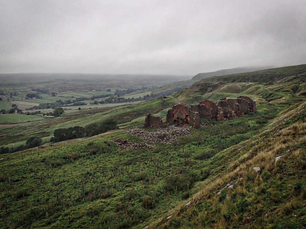
High Baring Cottages
Why is it, I thought as I was driving over Rosedale Head, that every time I head into Rosedale it’s damp and it’s foggy. A truly miserable morning. The plan had been to park high on the east side, cross the dale and have a look at the kilns on the west side. Dropping out of…
-
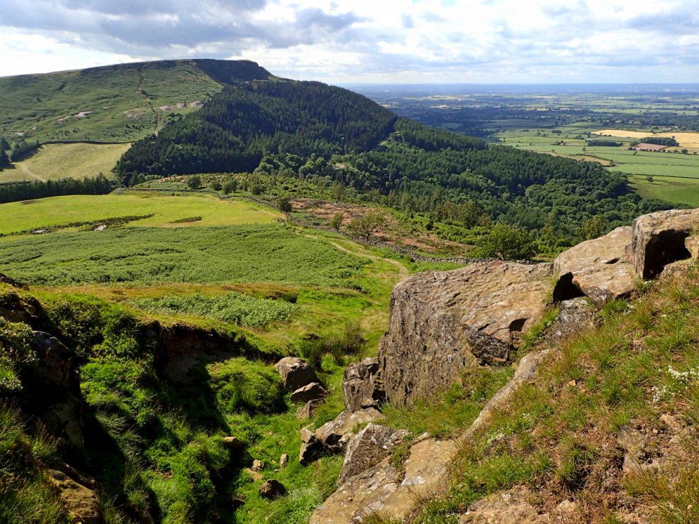
Hasty Bank
A view west from Carr Ridge towards Hasty Bank. Whether the gulley is natural or man made, a holloway created by the centuries of use, is uncertain. The track is certainly of antinquity, an old way called Haggesgate which linked the market town of Stokesley to the Thurkilsti road heading south along Bransdale Rigg to Welburn. In parts of Yorkshire,…
-
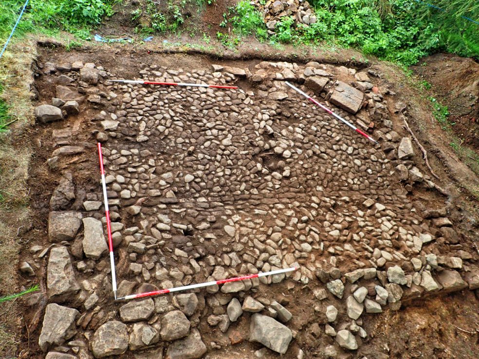
Capt. Cooks’ Cottage Archaelogical Dig
That’s it. That’s as far as we go. The archaeological excavation at Aireyholme Farm, near Great Ayton, is done. Today has been spent tidying and cleaning for photographing and recording. Going on the evidence of oral tradition of the farmer at Aireyholme that the boyhood home of Capt. James Cook was within a stand of…
-
Black Hambleton
The Tabular Hills make up most of the southern half of the North York Moors. Hills with a hard limestone cap. At 1,308 feet Black Hambleton is the highest point making it, for hill bagging enthusiasts, both a Hump and a Tump. A Hump stands for HUndred Metre Prominence and is defined as a hill with a drop…
-
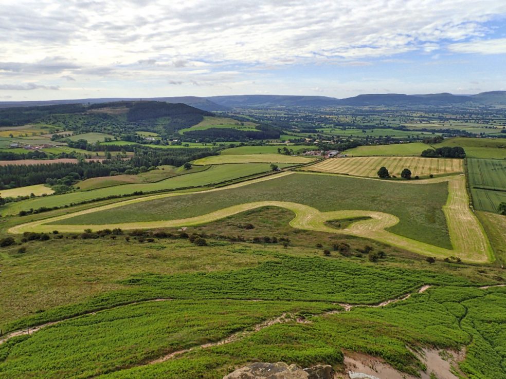
Aireyholme
This made me smile. From the top of Roseberry. It could almost be described as art but I doubt that is what the farmer at Aireyholme intended. A question for the intellectuals amongst you: does there have to be intent to create a work of art? The teardrop island and the squat peninsular closest are where the ground is broken.…
-
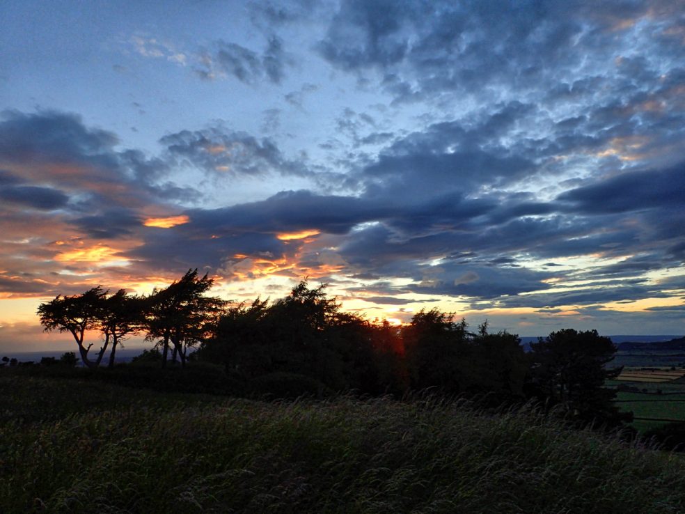
Cliff Rigg
Dashed up to Cliff Rigg above Great Ayton to catch the sunset. Not spectacular but good after a dull overcast morning.
-
Castleton Rigg
I heard yesterday that a new sculpture is being planned to be erected on Castleton Rigg over looking Westerdale. I just had to have a look at the place so I made that my mission for the day. Castleton Rigg is a long finger of prime grouse moorland separating Westerdale with Danby Dale. It is not walked…
-
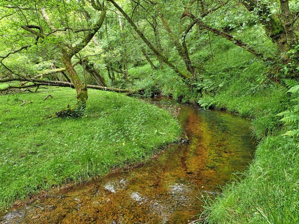
Staindale Beck
A quiet dale just outside the eastern edge of Dalby Forest Park with a wooded beck of crystal clear waters with small trout on one of the National Trust’s working farms. The name Stain Dale comes from the Norse and means a ‘stony valley’ probably because of the rock formations higher up the valley at the Bridestones.
-
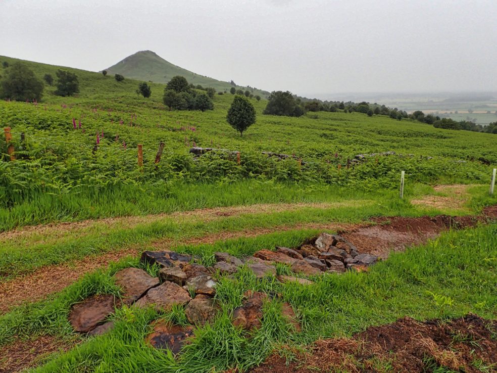
Roseberry Common
I have posted a photo of this new downhill mountain bike track on Ryston Bank before. It’s quite a feat of engineering. I don’t begrudge the building of the track but I am concerned about the source of the sandstone rocks used to make the berms and ramps. Roseberry Common, beyond the fence and ruined dry stone…
-
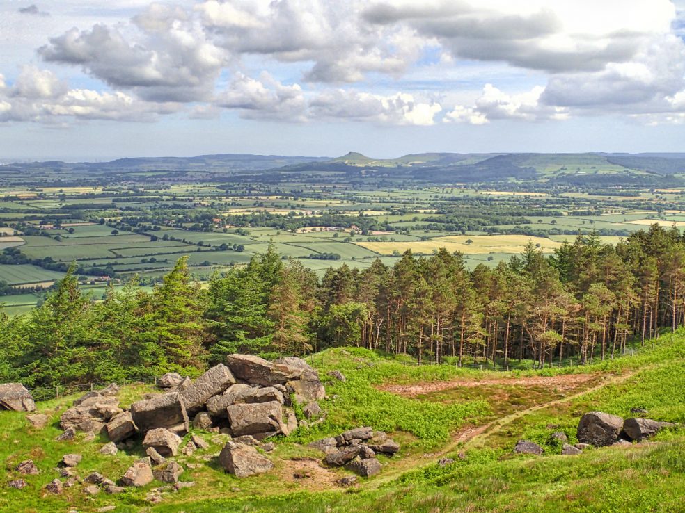
Roseberry in the distance
A nice view of Roseberry Topping across the vale of Cleveland. But it is the jumbled collection of rocks below the Wain Stones that has long intrigued me. Dumped there by the last glacier that passed by on its way southwards it must have provided ideal temporary shelter with good views for mesolithic man as he began the…