Category: Cleveland Way
-
Well, there’s good news and there’s bad news
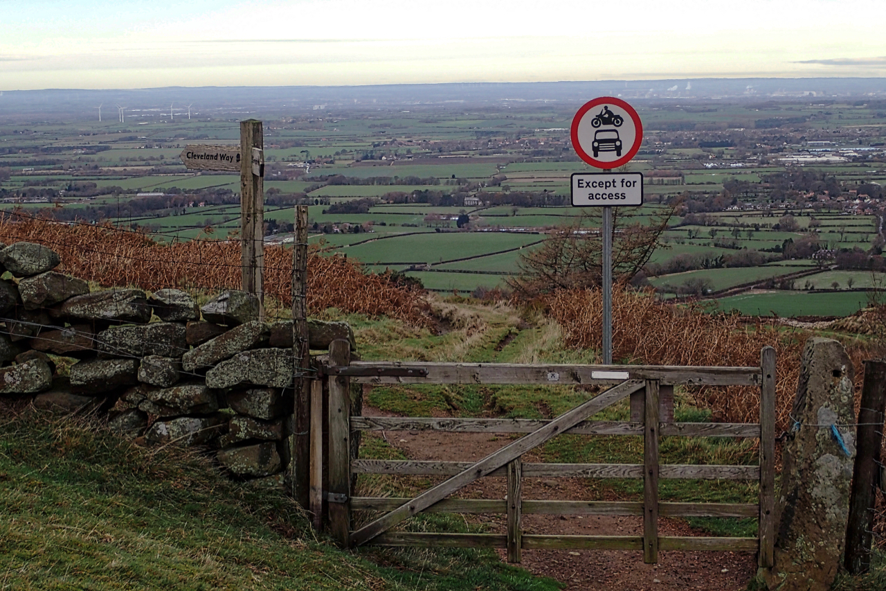
The good news is that it looks like the Traffic Regulation Order restricting off road motorbikes and vehicles from using the medieval trod that climbs Kirby Bank has finally been issued and is in force. The trod was part of a pannierway connecting Rievaulx Abbey in Bilsdale with the River Tees. Off road motorcycles have…
-
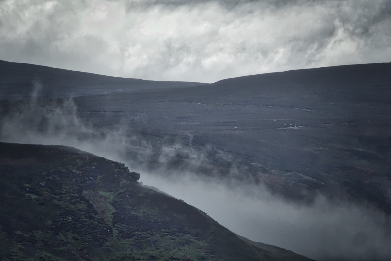
Park Nab from Percy Rigg
Park Nab, like a sleeping dragon with its breath creeping up the hillside. A dismal forecast. A day for keeping local. Open Space Web-Map builder Code
-
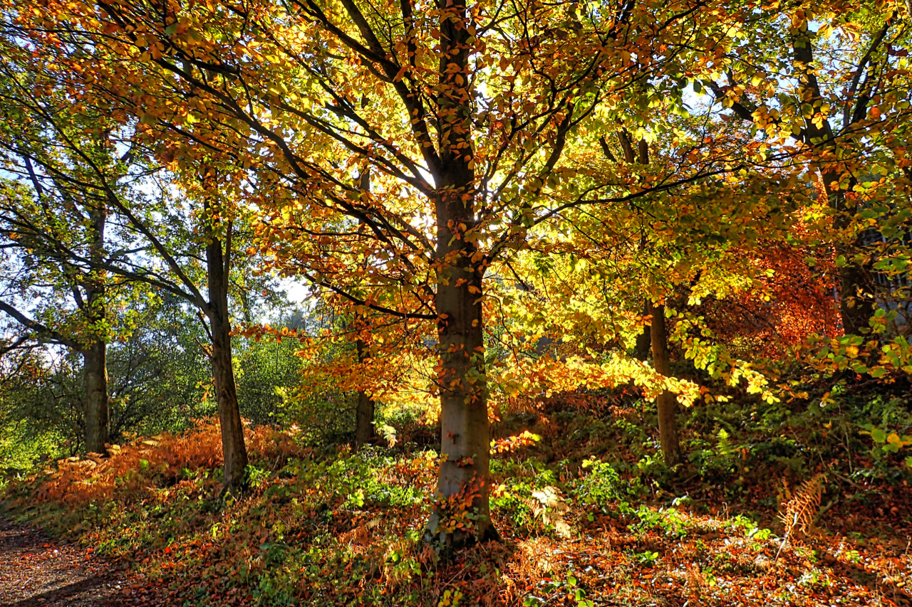
Clain Wood
You don’t see that many hangers of beech in North Yorkshire, its soils are too clayey. They don’t like getting their feet wet preferring dry alkaline soils like the chalk hills of Southern England. In the north, beech is considered a non-native species. The Cleveland Way and Coast to Coast footpaths go through this little…
-
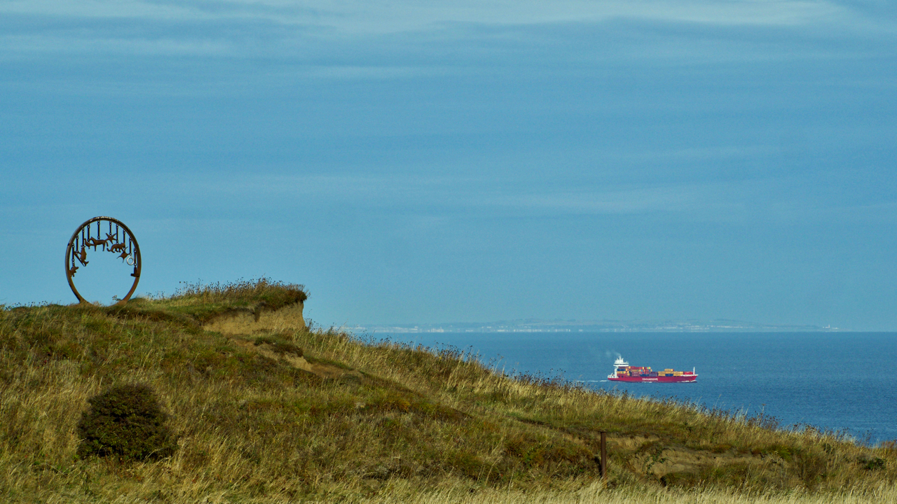
The Charm Bracelet
I must admit I wasn’t too impressed when this appeared on the Cleveland Way between Saltburn and Skinningrove in the early 1990s but it has grown on me. Some youths in ’96 didn’t like it and they promptly hoyed it over the cliff. Or maybe they just did it for a laugh. I wonder what…
-
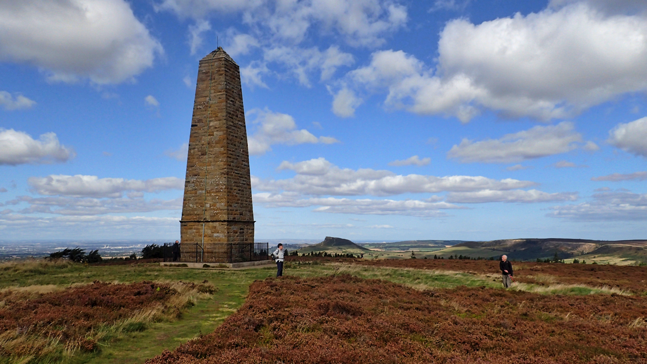
Capt. Cook’s Monument
250 years ago Lieutenant James Cook was two and a half weeks into his first voyage on board the HMS Endeavour. He was bound for the Pacific Ocean where he was to record the transit of Venus across the Sun in order to devise a method of determining longitude. On September 12th he anchored at…
-
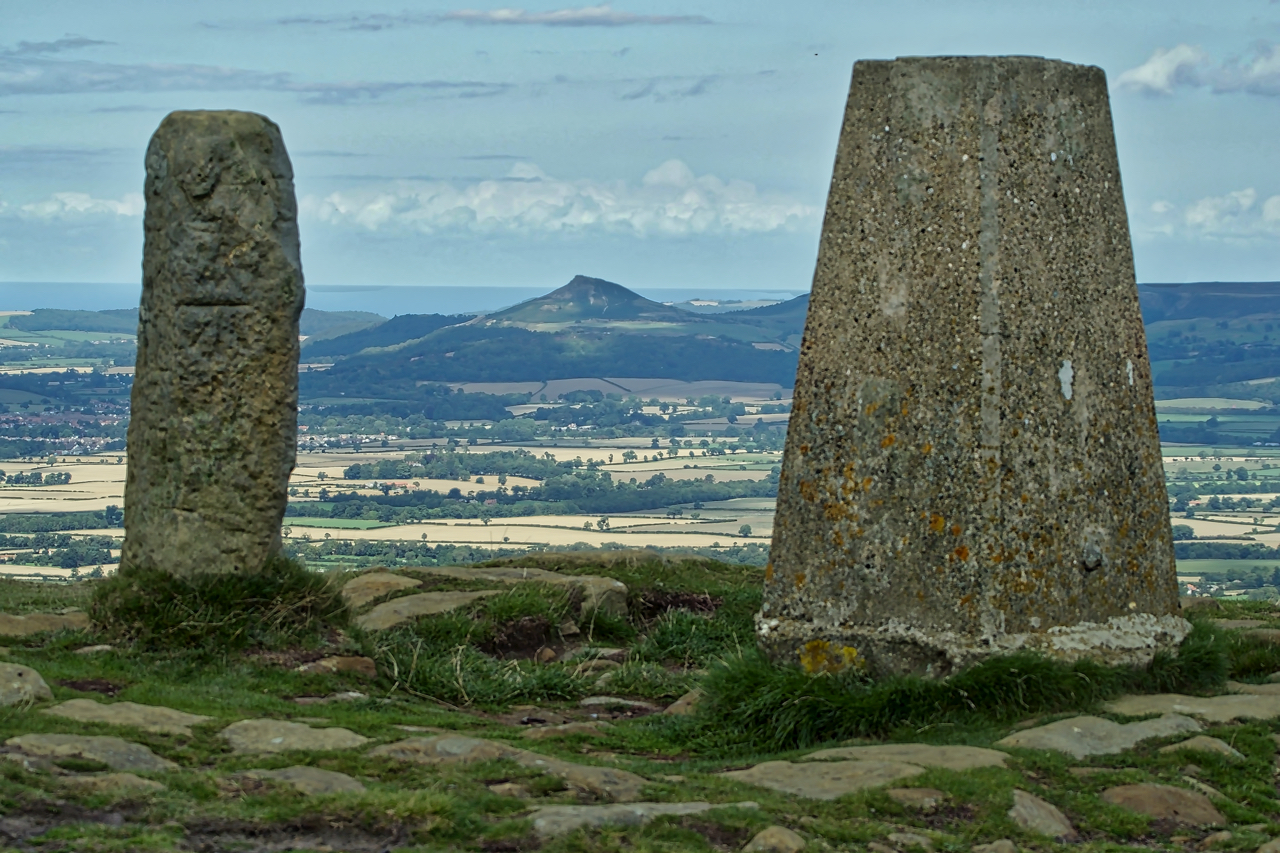
Carlton Bank Trig Point
A view of Odin’s hill, Roseberry Topping, sandwiched between the trig point and old parish boundary stone on the highest point of Carlton Bank. The summit, at 408m above sea level is the third highest point on the North York Moors. Today it is generally known as Carlton Moor but has also been mapped at…
-
First day of the grouse shooting season
The first day of the grouse shooting season so I took in a circuit via Urra and Greenhow Moors in the hope I might come across a shoot. It is not the “Glorious 12th”, of course, that was yesterday but being a Sunday the start is postponed for a day unless you are in Scotland…
-
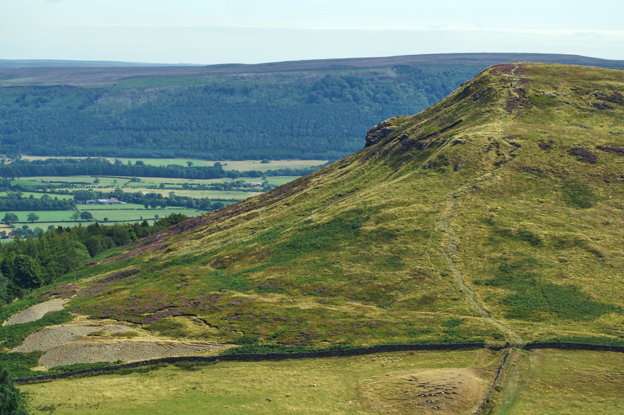
Cold Moor
A view from Cringle Moor across to Cold Moor, one of the four bumps so obvious from the Cleveland plain. The footpath followed by the Cleveland Way and Coast to Coast long distance paths can be seen climbing to the 401m summit. The spoil heaps bottom left are 19th-century jet workings, the miners seeking the…
-
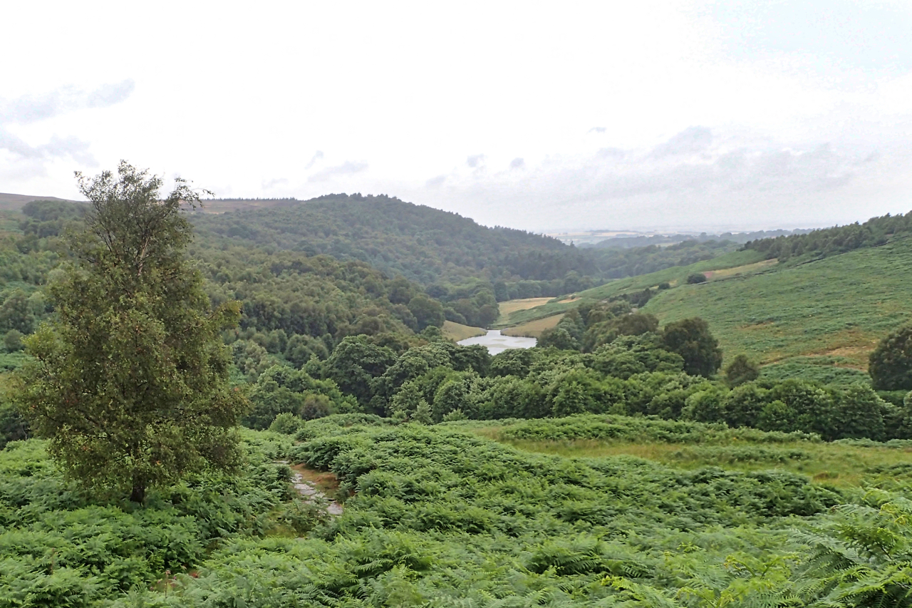
Oakdale
A weathered sign: “Oakdale Reservoir a source of Yorkshire Water” but now decommissioned and transformed into a wildlife lake, passed by The Cleveland Way. And a memory evoking view. Open Space Web-Map builder Code
-
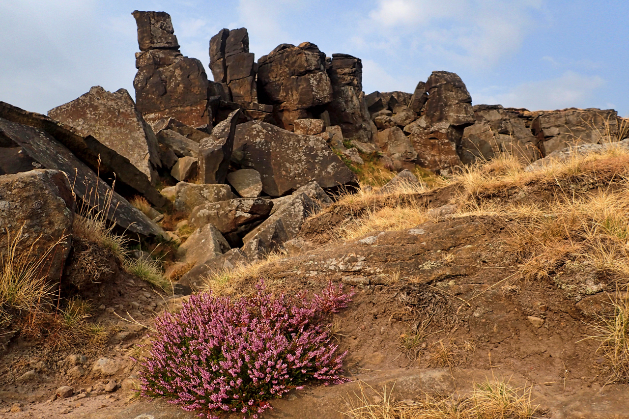
The Wainstones
Making the most of a break in the lightning and storms, a quick trip up to the Wainstones. Still very humid though. Nice to see the ling beginning to bloom. Open Space Web-Map builder Code