Author: Fhithich
-
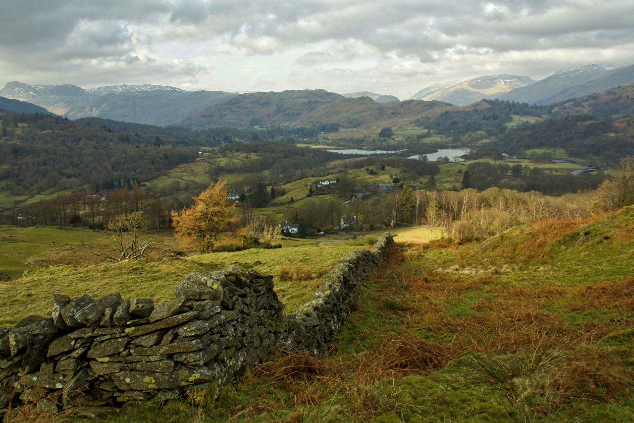
Elterwater from Black Fell
Above Skelwith Bridge. Black Fell is a little frequented National Trust property. Looking north west towards the lower Langdale valley. The twin lakes are in fact one – Elterwater. Open Space Web-Map builder Code
-
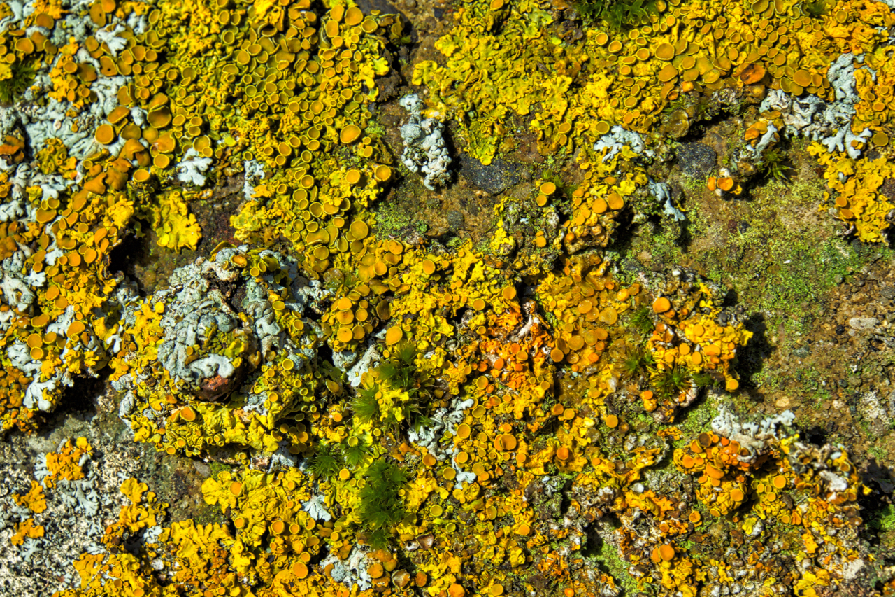
Xanthoria aureola
A splash of colour by the side of the Cleveland Way in the winter sunshine. Easily overlooked but deserving a closer inspection. Lichens fascinate me but I admit I am lost when it comes to naming and hesitate to put a name to this. Xanthoria aureola is a likely candidate, there are other contenders, same…
-
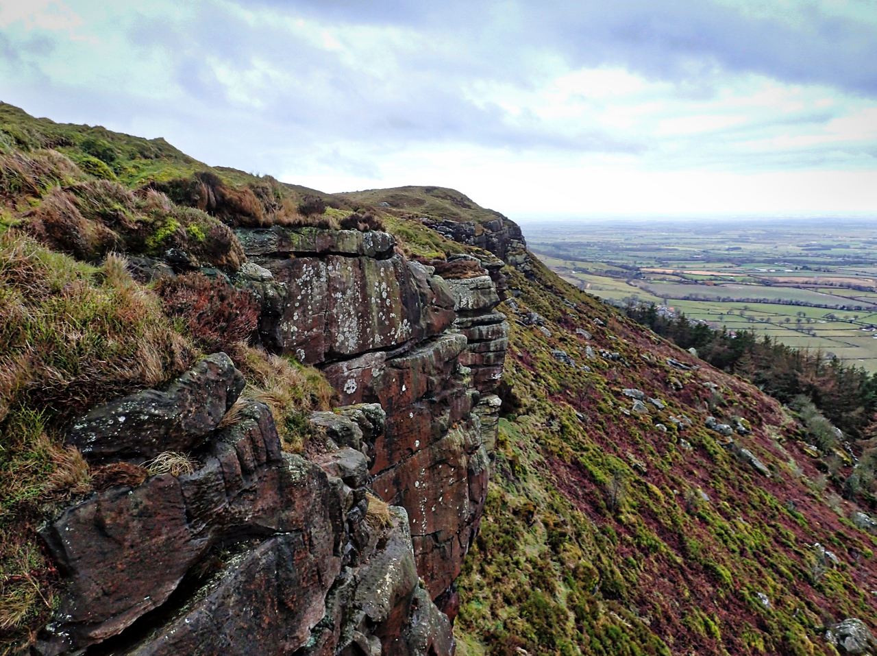
Raven’s Scar
A north facing sandstone crag overlooking Great Broughton on Hasty Bank. On the 1857 map named as Baven’s Scar which I think must have been an error. Open Space Web-Map builder Code
-
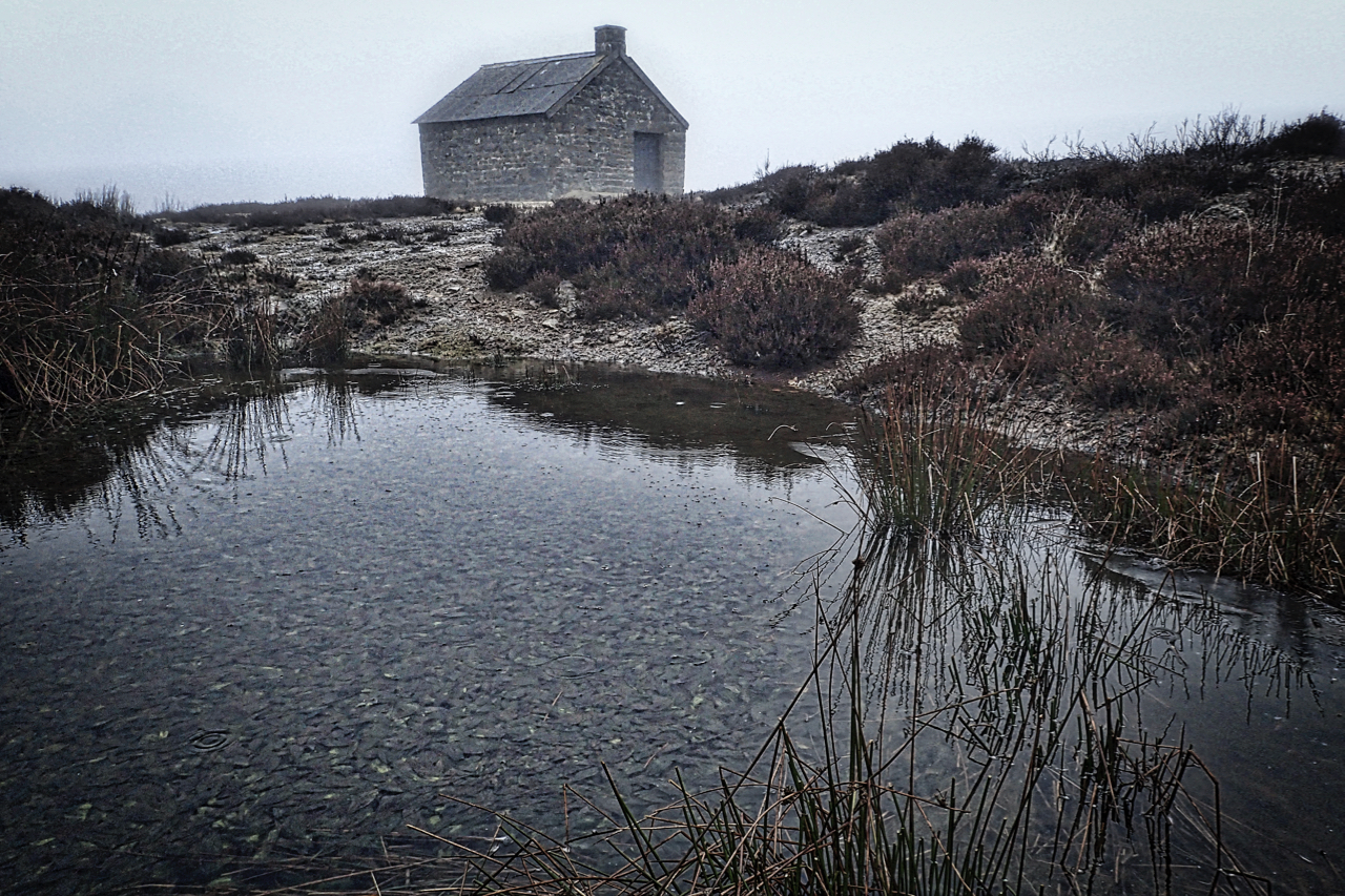
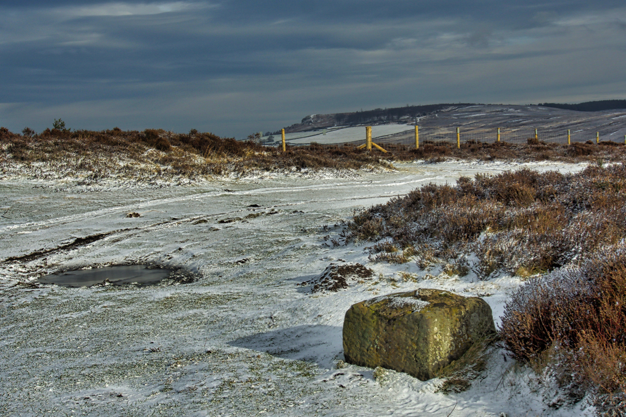
Swainby Shooting House
Just over a year to the day (well three days actually) and I find myself again at this remote spot on the vast expanse of heather moorland to the east of Osmotherley. But what a difference in the weather. Clag down and a heavy drizzle. The shooting house stands at a height of 319m above…
-
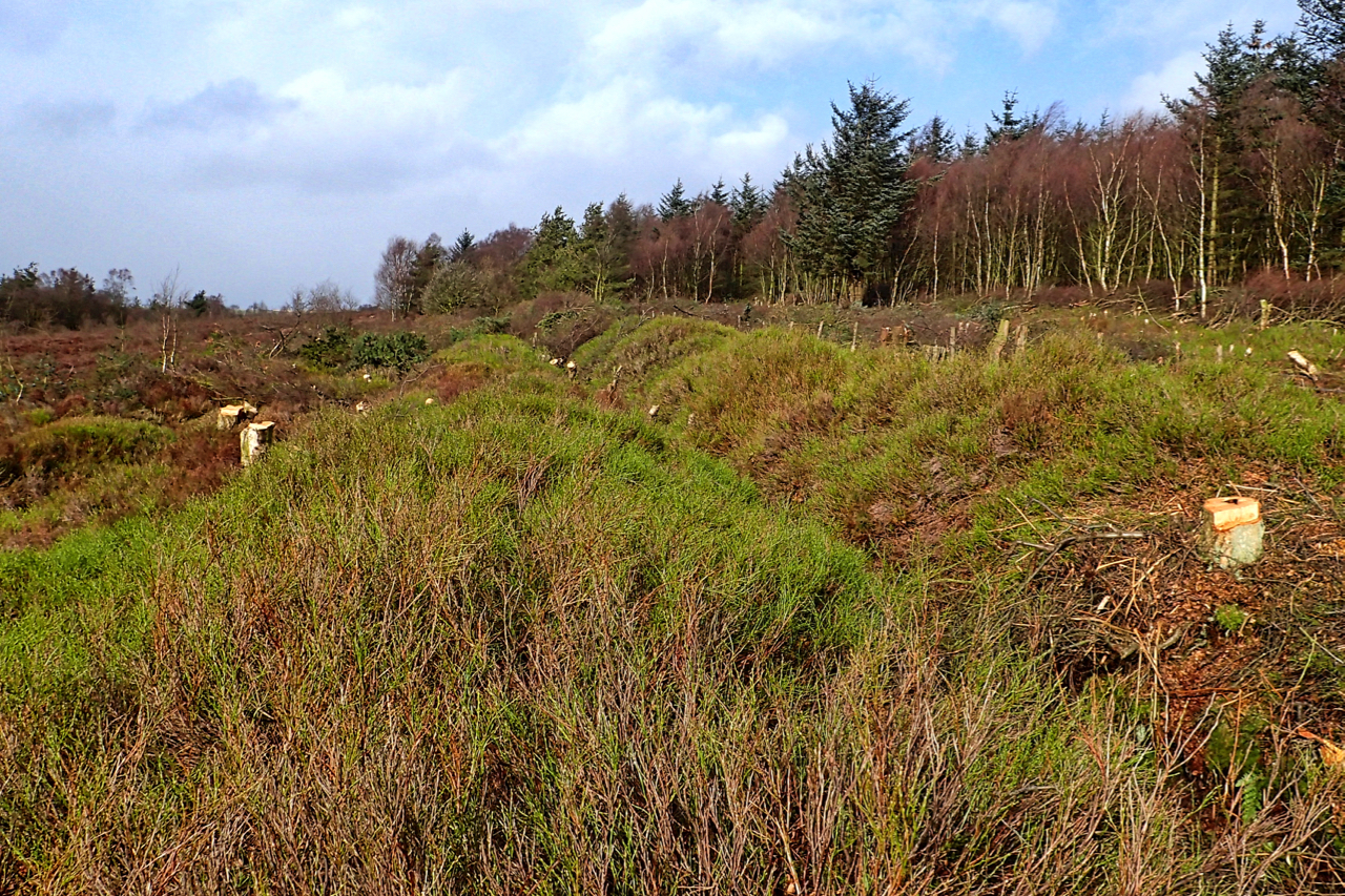
Siberia
Greenhow Botton, often known as Midnight Corner. Felling has opened up new views. Not such a gloomy place. And somewhere in the cleared forest stood the temporary construction camp for the Ingleby Manor ironstone mine. It was named as Siberia and later reused for construction workers of the railway incline to Rosedale. Open Space Web-Map…
-
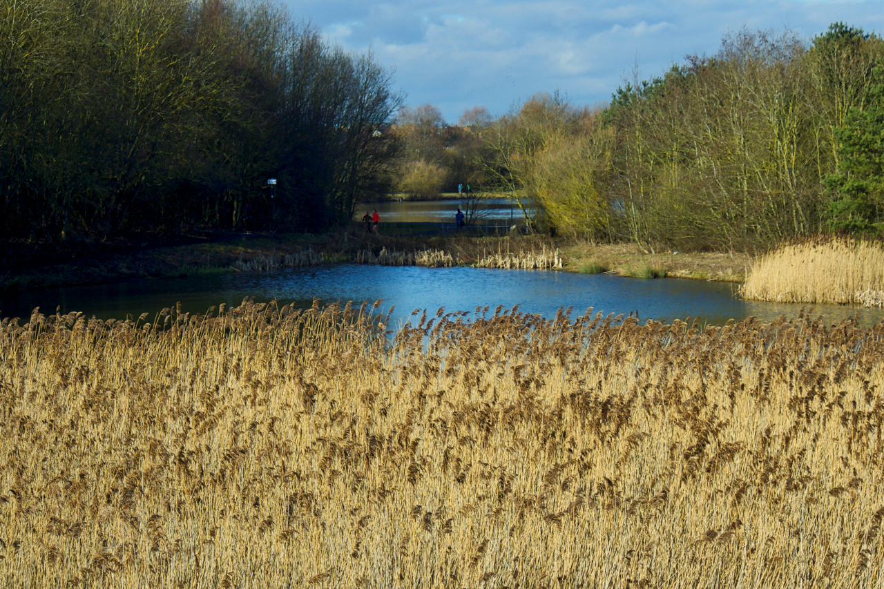
Blossom Pond, Hetton Lyons Country Park
Trying to navigate my way around Hetton Lyons Country Park using the 1922 6″ to the mile Ordnance Survey map. A lot has changed. The old surface workings of the Hetton Colliery. The heart of the colliery was to the south of the Durham, Elvet & Murton Branch railway, now a walkway/cycle path. An industrial…
-
Public Bridleway through Coalmire Wood
This annoys me. Intimidating signs erected across a Public Right of Way, clearly shown as such on the O.S. maps and on the North York Moors National Park’s own mapping portal. I took the photo above at point A, and the one below, of a padlocked gate, at point B. Both maps indicate a Public Bridleway…
-
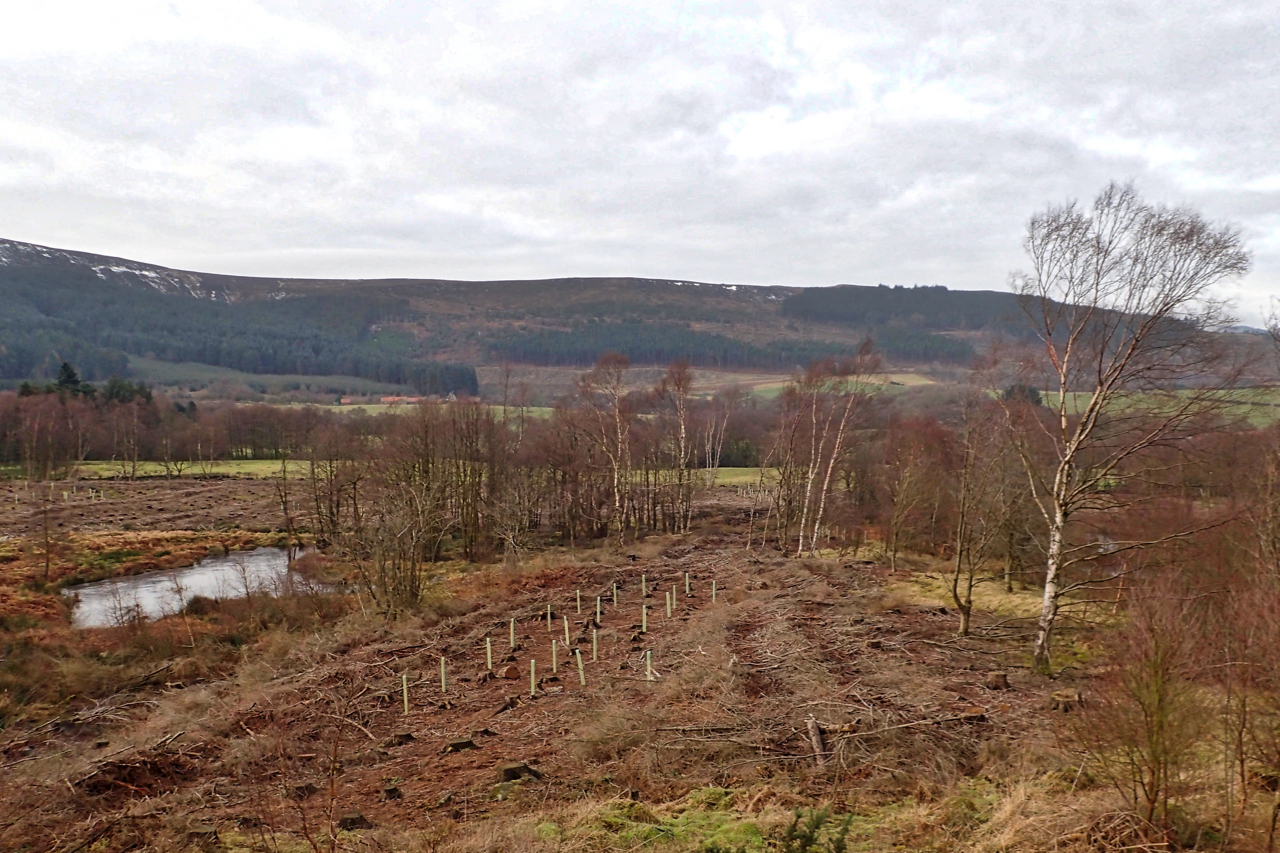
Prehistoric linear boundary at the Bridestones
The National Trust’s second winter season of tree and scrub clearance of the prehistoric linear boundary at Bridestones is almost over. Tree felling stops in the spring and summer to avoid disturbance of nesting birds. Just remaining for this winter is to stack the brashings and logs to create wildlife refuges. The Bronze Age earthwork…
-
Percy Cross
I’ve had my eye on this medieval wayside cross for some time but its position at the edge of a road verge is not very photogenic. Last night’s snowfall, however, has had the double effect of transforming the scene and highlighting the base of the cross known as Percy Cross. Although the shaft is missing…
-
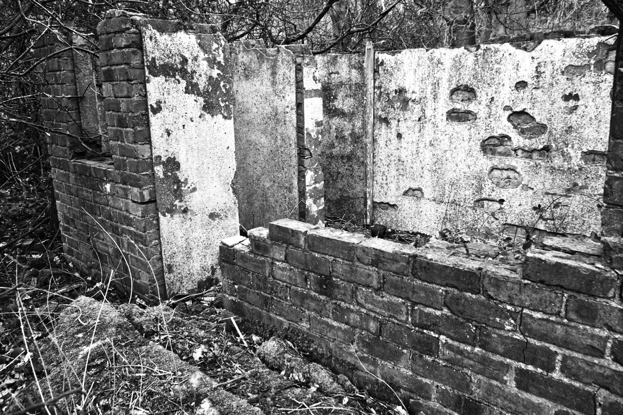
Ruin in Cliff Ridge Wood
Hidden in the dense undergrowth of Cliff Ridge Woods, this small ruin, with a footprint no bigger than a domestic garage, is inaccessible at the height of the summer. It has two internal “cupboards” and what could be a netty outside. Now it is tempting to assume the ruin is a relic of the whinstone…