Category: Lake District
-
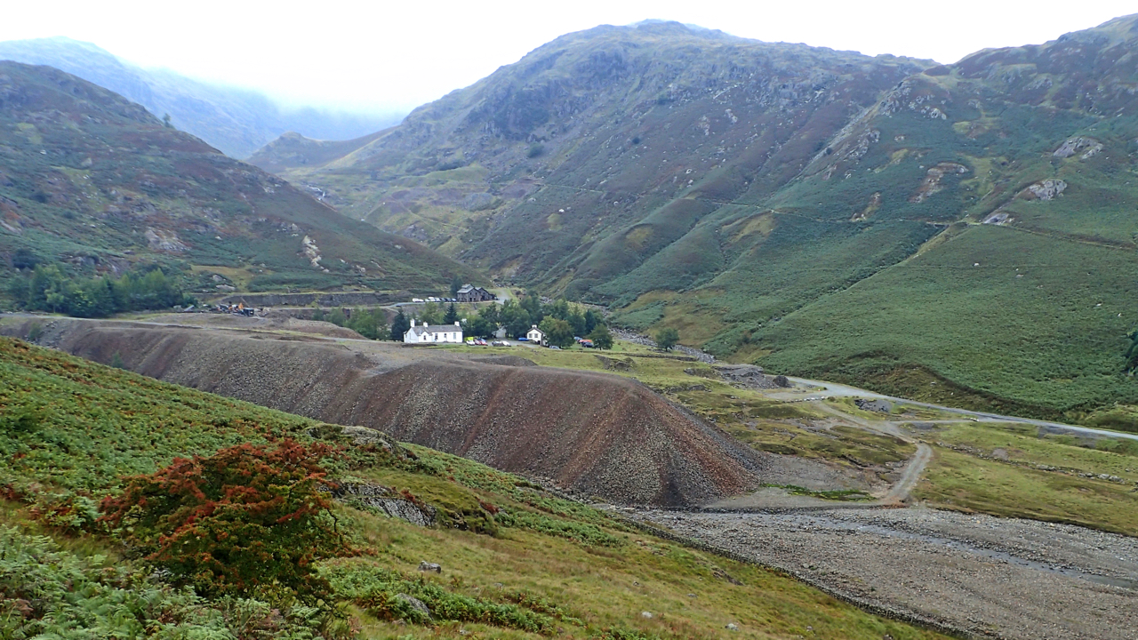
Coppermines Valley
A small reminder of what man has done to the planet. Elizabeth I was Queen of England when mining for copper began in this valley above Coniston. Heavy mechanical hammers driven by huge water wheels crushed and broke the ore. A cacophony of bangs, rumbles and growls. Women and children picked over the rock separating…
-
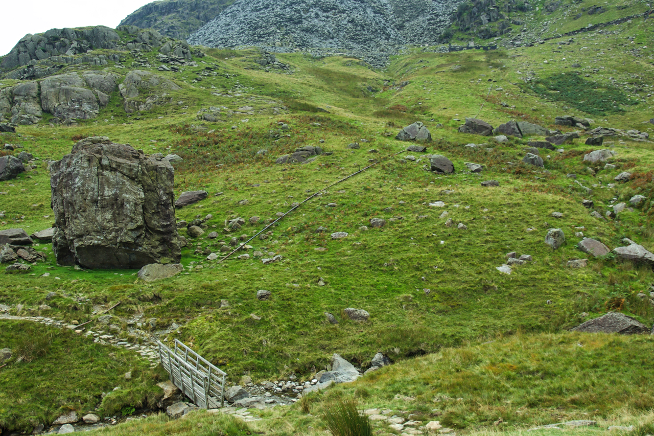
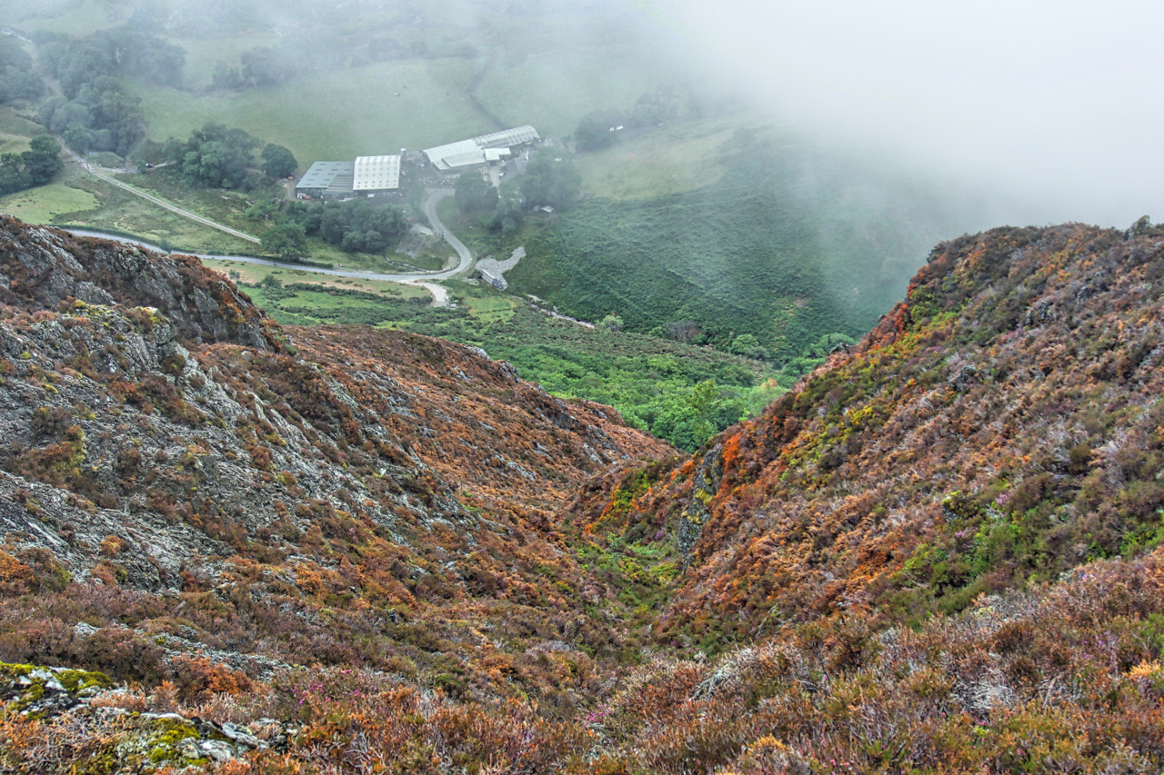
The Pudding Stone
And so summer ends. Above the heavily scarred landscape of the Coppermines valley in Coniston is a small dry valley called the Boulder Valley on account of its numerous boulders, the largest of which is the Pudding Stone. A huge boulder that tumbled down millennia ago from the heights of Brim Fell. Some idea of…
-
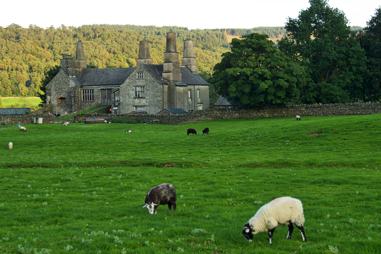
Coniston Hall
It’s eighteen years since I was last at Coniston Hall. A National Trust tenanted farm run as a campsite on the side of Coniston Water. Very little changed, still as popular. The vernacular architecture of the Lakeland chimneys still intrigues me. Open Space Web-Map builder Code
-
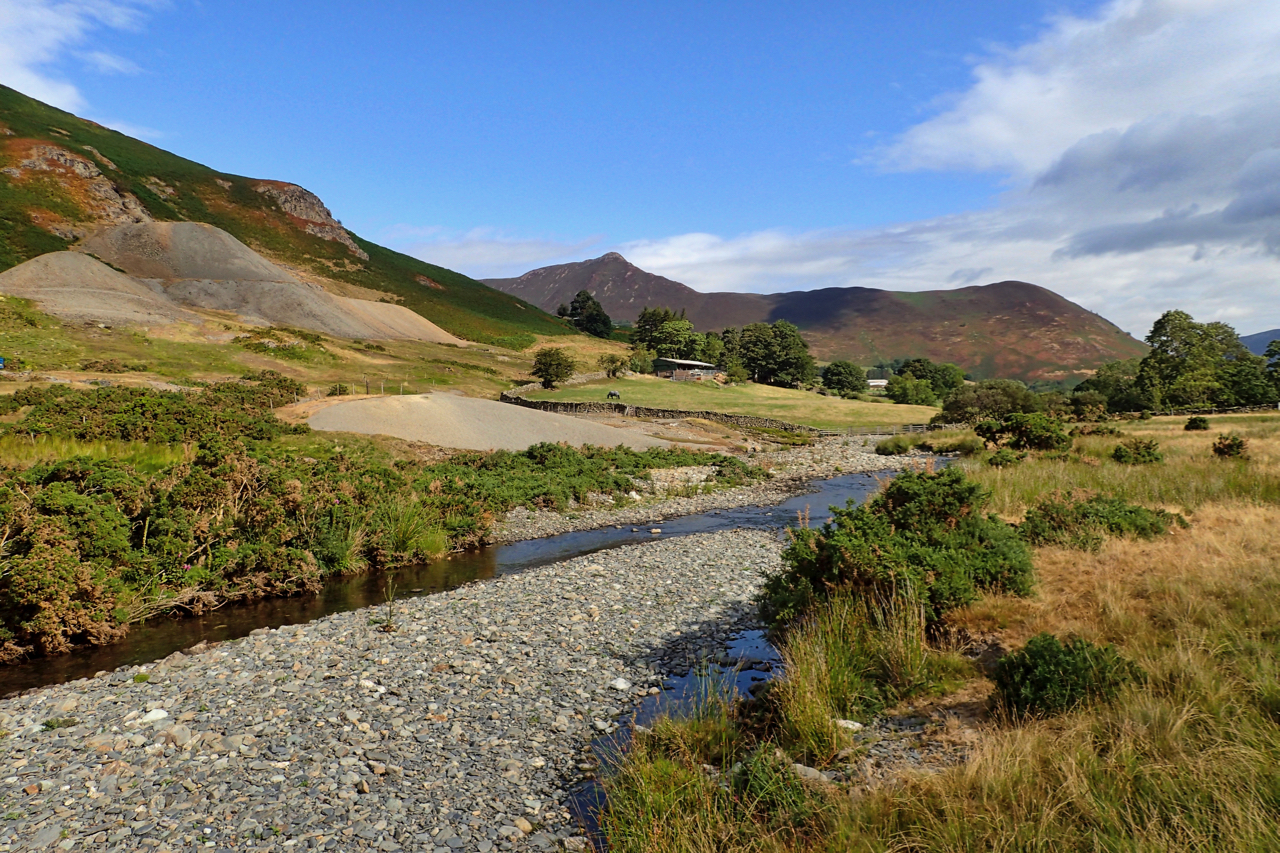
Newlands Valley
Newlands Beck meandering down the dale from its head below the appropriately named 753m high summit Dale Head. In the distance the prominent Causey Pike, a tortuous climb from this direction. The spoil heaps far left are from Goldscope Mine, one of the earliest mines in the area documented back to 1564, the year Shakespeare…
-
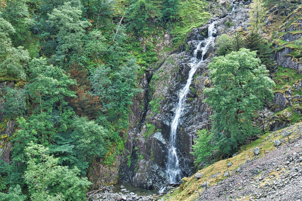
Ard Gill
Cloud base about 500m. I no longer find interest in bagging summits shrouded in mist so I opted for a circuit just dipping in and out of the cloud. On Ard Crags a break revealed the spectacular Ard Gill falling down to Keskadale Farm. Magic. Open Space Web-Map builder Code
-
Taylorforce Gill
In Borrowdale, the “wettest place in England”. Allegedly. Yesterday’s drizzle has fizzled out. But there’s still water coming out of Styhead Tarn. Styhead Gill tumbles down Taylor Force Gill, a 140-foot drop, one of the highest in the Lake District. Open Space Web-Map builder Code
-
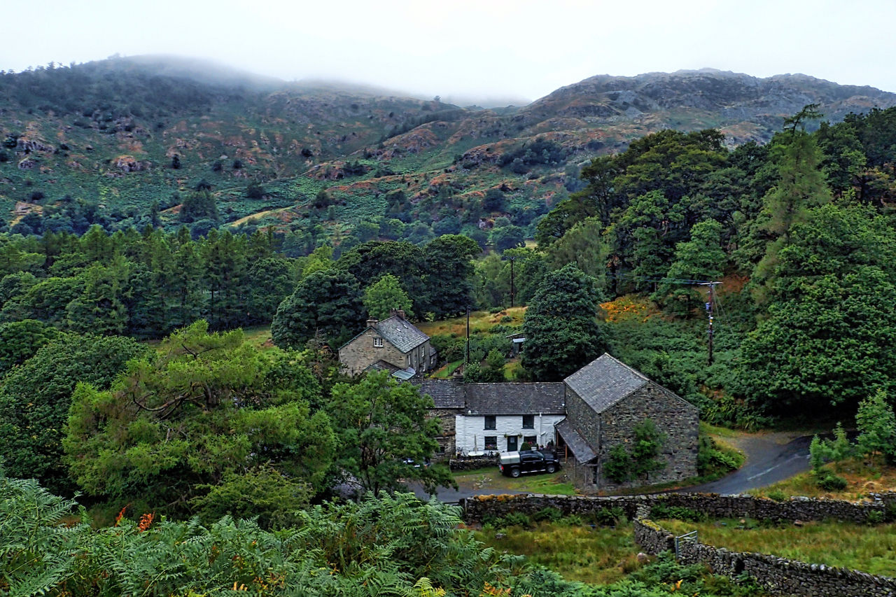
Holme Ground, Low Tilberthwaite
Drizzle and low cloud covering the tops, a welcome refreshing change. Tilberthwaite is a lovely little valley with mature woods hiding abandoned slate quarry workings and spoil tips. Open Space Web-Map builder Code
-
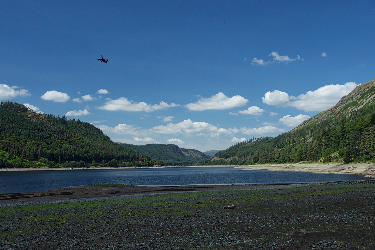
A very low Thirlmere
Buzzed over by an RAF jet not quite copying the X-Wing fighter in Star Wars: The Force Awakens, it seemed weird seeing Thirlmere so low, the reservoir that supplies water to Manchester which will soon have a hosepipe ban. Normal demand on the reservoir is 40 million gallons per day, a figure which to me…
-
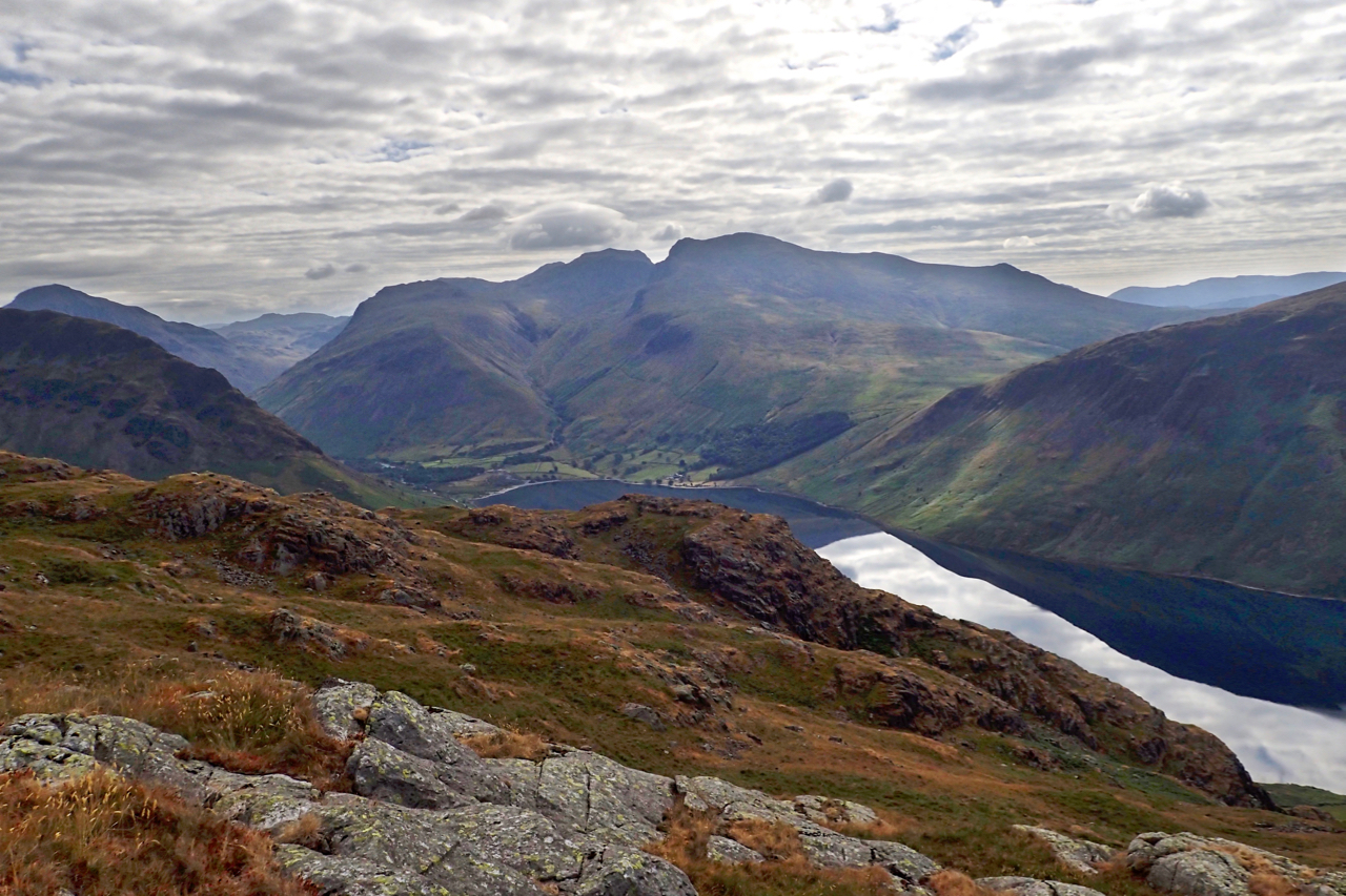
Wasdale Head and the Scafells
At 582m high Middle Fell is an unassuming hill overlooked by mighty neighbours. A craggy knoll just down from the summit offers unobstructed views of Wast Water and to the North East Scafell Pike, the highest mountain in England, and Sca Fell separated by the high col of Mickledore. Open Space Web-Map builder Code
-
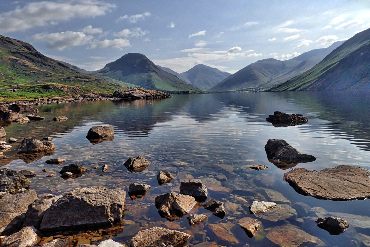
Wast Water
Wasdale Head, the classic view. We were woken up at 5 o’clock this morning by the hurrying sound of crunching feet on the gravel. It was photographers, racing to get the prime location to capture the sunrise. I wasn’t impressed but avoided muscling my way into the line of tripod set up like crows on…