Category: Lake District
-
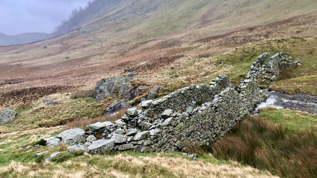
A Sheep Wash or Something More?
Last Thursday proved quite a trial. We found ourselves trudging along the Miners’ Balcony Path, tracing the contours, with Scot Crag looming above us and Glencoyne below. The wind, oh, it was a fierce adversary, pushing against us with all its might. To make a long tale short, we decided to beat a retreat and…
-
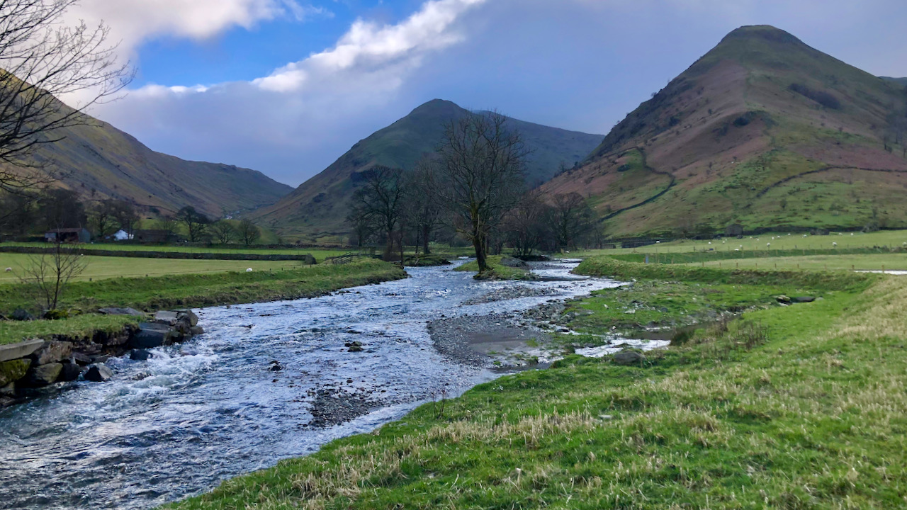
Kirkstone Beck
It has been two years since I was last this far up Patterdale, and I see there’s been quite a bit of change to Kirkstone Beck, thanks to work carried out by the National Trust. As in many dales of the Lake District, Kirkstone Beck used to flow in a canalised channel, modified over the…
-
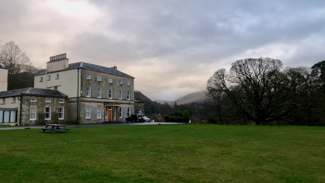
Brathay Hall — “Mr. Law’s White palace – a bitch!”
Brathay Trust is based in an elegant 18th Century Georgian country house. It was built by George Law, the son of an Attorney who was involved in Backbarrow ironworks. On his death, in the West Indies in 1802, the house passed to his son Henry, who rented it to John Harden, a gentleman with connections…
-
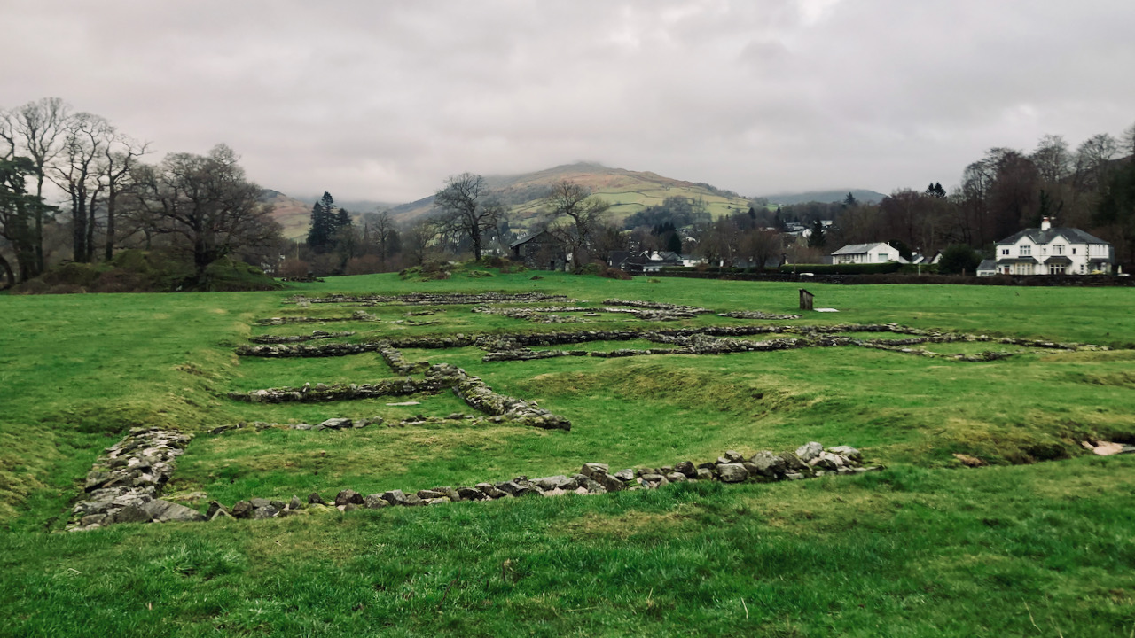
Galava
Borrans Field, at the northern end of Lake Windermere near Ambleside, is the site of the Roman fort of Galava. Today, the field was flooded, despite the lake being a good two metres below its 2009 watermark. One can only hope the Romans knew what they were doing, building on a floodplain. This fort, in…
-
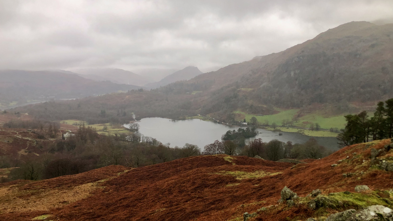
Rydal’s Rainy Reflections
Not a day fit for photography, thanks to the never-ending rain. I managed to grab this photo while perched on Lanty Scar, the northeastern ridge of Loughrigg Fell. Across Rydal Water, cars on the A591 sport their headlights. Rydal is supposed to be a contraction of Rothay-dale, and is actually placed in a narrow gorge,…
-
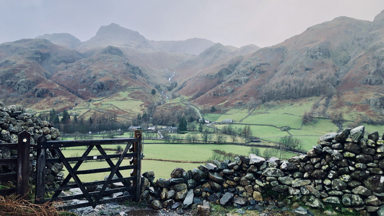
Wordsworth woz ere
An outlook spanning Great Langdale to Stickle Ghyll, featuring Harrison Stickle and, adjacent on the right, Pavey Ark, its formidable crag wall softened by the mist. Wordsworth once found himself taken aback by the bleat of a lamb, resounding from Pavey Ark, while standing by Stickle Tarn. A recollection of that very sound inspired a…
-
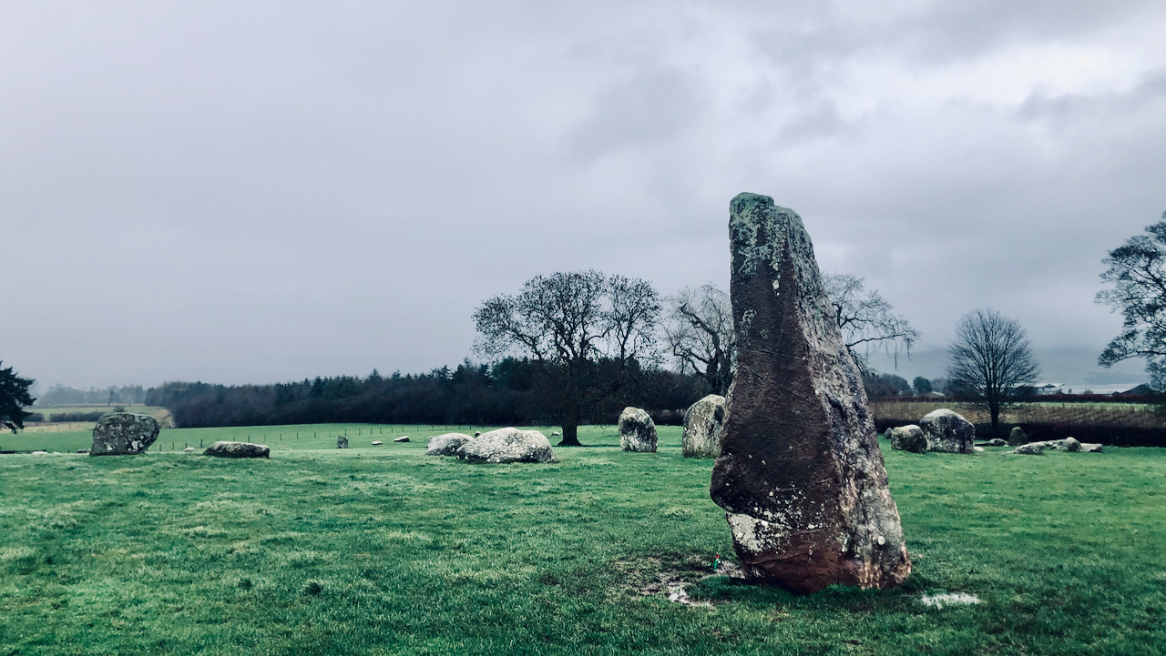
Long Meg and Her Daughters
On a sodden expedition to one of the remarkable and enigmatic ancient marvels in the north of England—Long Meg and Her Daughters. Long Meg, a towering 4-metre monolith of red sandstone, stands apart from her ‘daughters,’ which form a large circle. Reportedly, there are approximately 68 daughter stones, erratics likely displaced from the Lake District…
-
Ulpha and the Traveller’s Rest Inn
I’m still recounting my adventures in the Lake District last weekend. Monday turned out to be a real gloomy one, with clouds hanging low and some drizzle here and there. I reckon I caught a glimpse of the sun once, but those rugged hilltop views remained elusive. As I descended from the murky heavens, the…
-
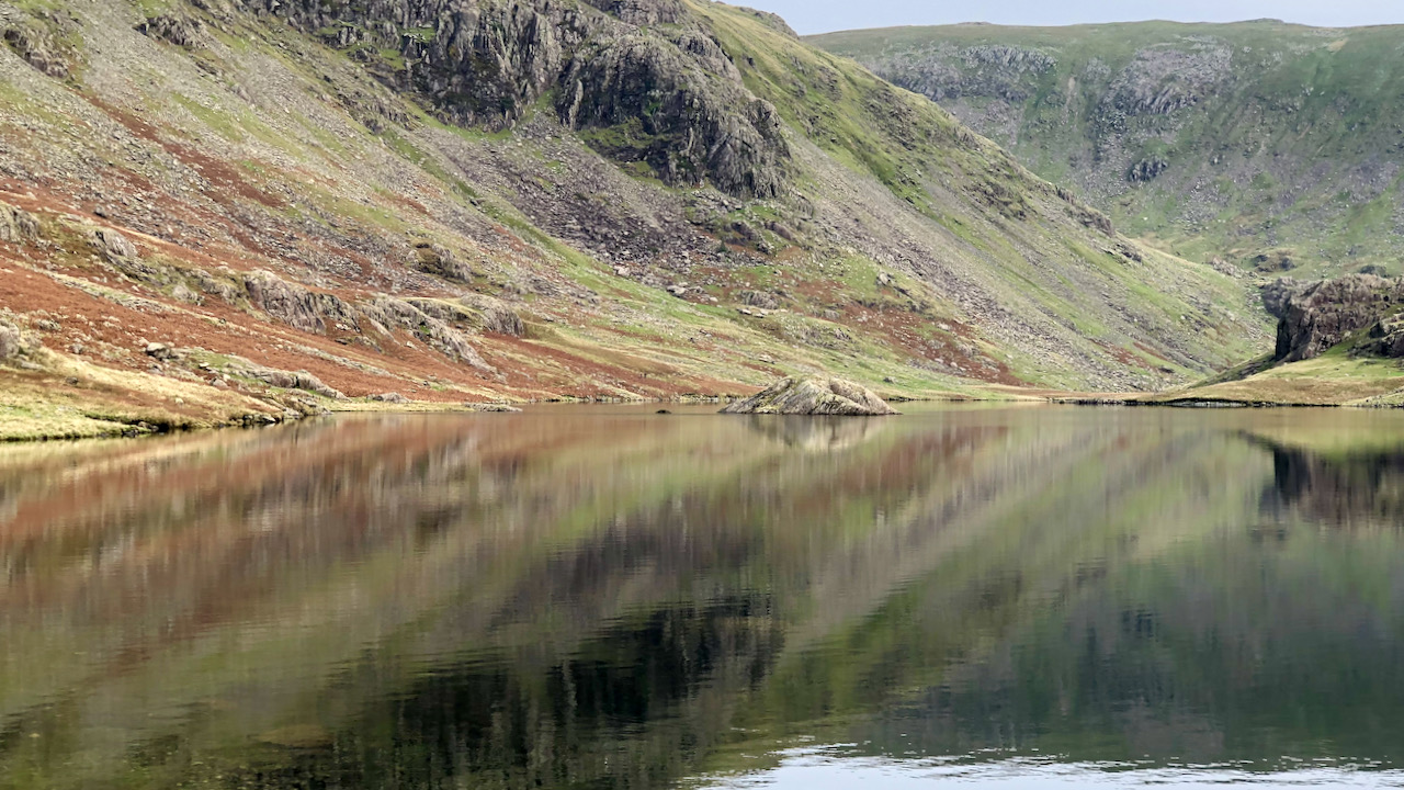
Seathwaite Tarn
Nestling in the cupped embrace of the Coniston Fells lies Seathwaite Tarn, all glittery and serene. It’s wrapped up by a wild autumn tapestry of dull olive, blazing copper, and pale maroon, sprinkled with a hint of grey cliffs and little patches of piney green. The fickle sky’s in a sullen mood, draping the shadowy…
-
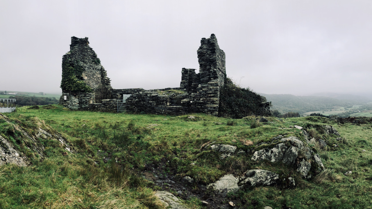
The ghost of Frith Hall
A handful of days nestled within the charming embrace of the Duddon Valley in the Lakes, a forced separation from the digital world. I’ve passed through Ulpha on numerous occasions in the past, en route to Eskdale and the lofty central fells. Yet, a few days in this tranquil dale have unveiled a treasure…