Category: Bilsdale
-

Boundaries in Stone
Dry stone walls stand as testament to the enduring craftsmanship of generations past. They are a quintessential feature of the North York Moors and other rocky regions of the British Isles. From Cornwall and the Cotswolds, to Scotland and Ireland, these walls served as swift and sturdy field boundaries, surpassing the time it would take…
-
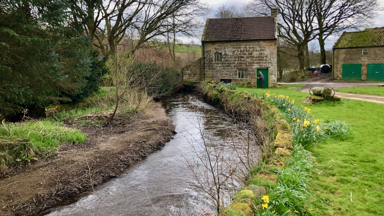
Low Mill, Bilsdale
Low Mill, a small corn mill presently under private ownership, stands beside the swift waters of the River Seph amidst the charming valley of Bilsdale. Historical records date its inception to the 16th century, though subtle signs suggest its presence may extend as early as the 12th century, coinciding with the establishment of Rievaulx Abbey.…
-
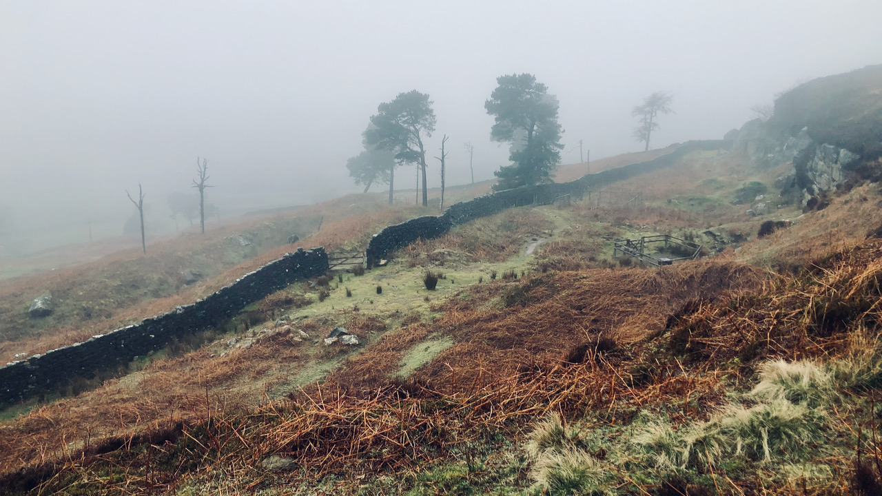
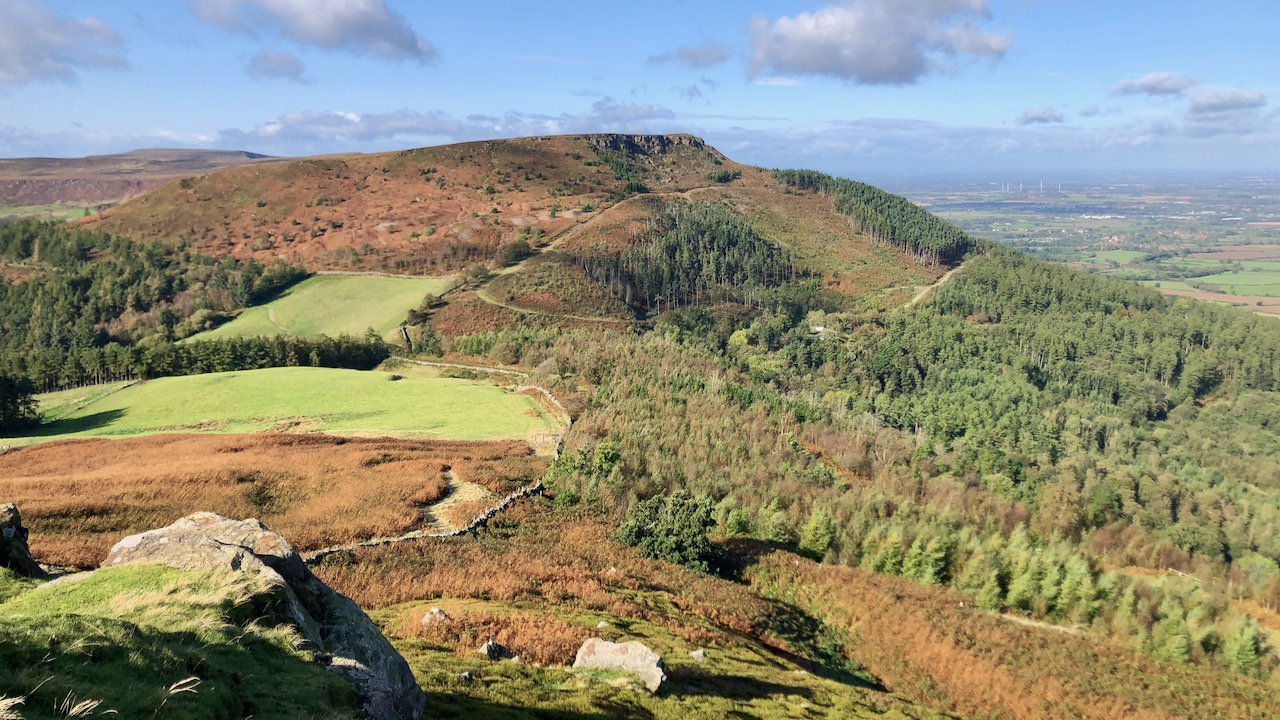
Weighill’s Plantation
What a dreich morning to inaugurate the month of April. ‘Pinch punch, first of the month,’ as the old adage goes, though it hardly seems an occasion for mirth. The ragged pines emerge as solitary figures amidst the enveloping mist, remnants of Weighill’s Plantation, which would, if not for the mist, command a view over…
-
Seave Green, a hamlet in Bilsdale
One might reckon Seave Green a hamlet nowadays, though through the ages, it’s been nothing but a scattering of farms, stretching southward to Chop Gate. Further up on Bilsdale’s far eastern slope, a chapel and manor once stood, though ‘Town Green’ hints there might’ve been a medieval village. The buildings of Seave Green, mostly built…
-
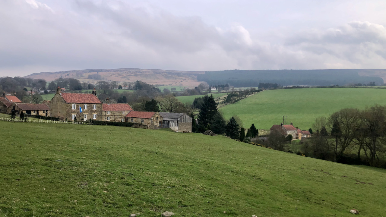
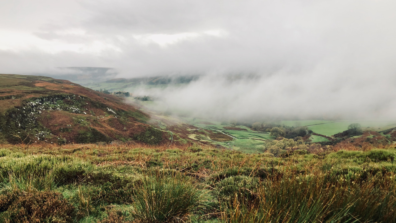
A View from Wath Hill and Echoes of Life at Clough House
A view of Wath Hill from above the remains of the old farmstead of Clough. Just a handful of moss-covered stones indicate where Clough House farm used to stand. It’s simple to overlook its past as a bustling farm, a family home. A solitary out-building still stands, its roof clad in corrugated sheeting. The rest…
-
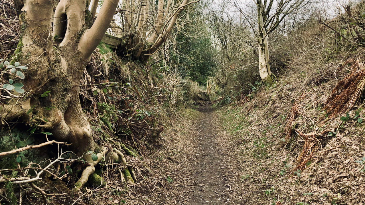
Cold Moor Lane — Hollow Way and Medieval Trod
Taking a respite from the biting easterly breeze while in the shelter of Cold Moor Lane, a sunken bridleway climbing out of Chop Gate, a debate unfolded about its origins. Well, if we concede that its sunken characteristic stems from centuries of human and animal movement along this route, then I suppose one could argue…
-
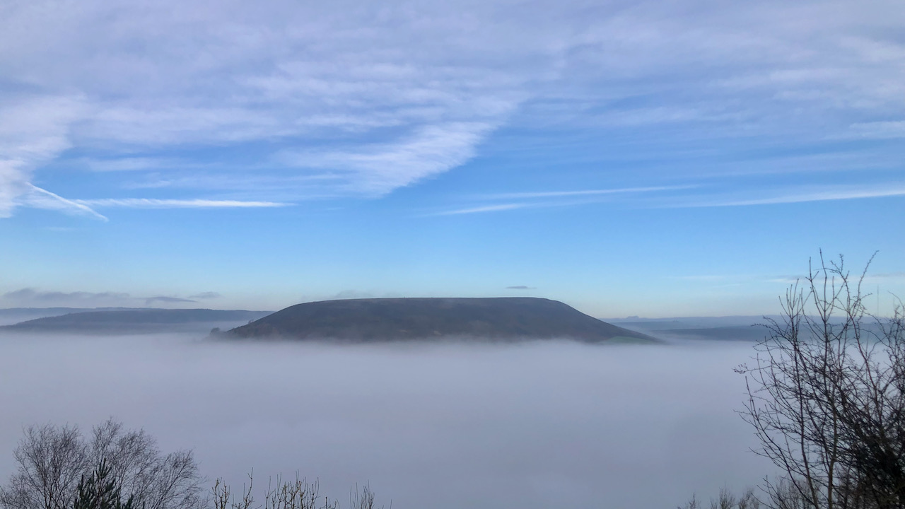
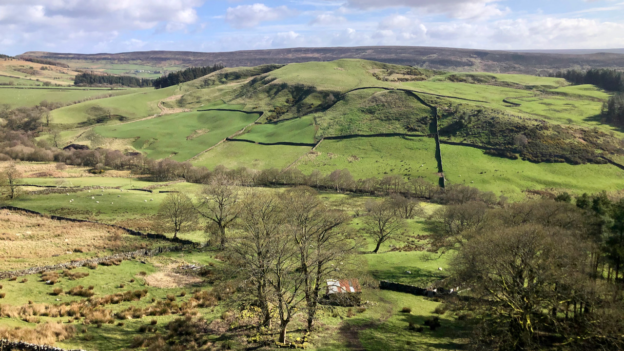
Easterside Hill, the sleeping behemoth
It was a magical moment, ascending from the sombre depths of Bilsdale up Newgate Bank, when we emerged into a realm of brilliance and lucidity, with a cloudless azure sky adorning the western horizon. And the formidable hogback of Easterside Hill loomed above the cloud like a sleeping behemoth. While the mist persisted in the…
-
From Spider Bites to Scorpion Stings: DEFRA’s Leadership Labyrinth
On a rather dreich stroll across Urra Moor, the swirling clouds over Bilsdale managed to inject a bit of interest into an otherwise lacklustre affair. Now, I had it in my notes to have a whinge about Thérèse Coffey’s decimation of the 2010 consensus concerning the future of our public paths. Today seems an opportune…
-
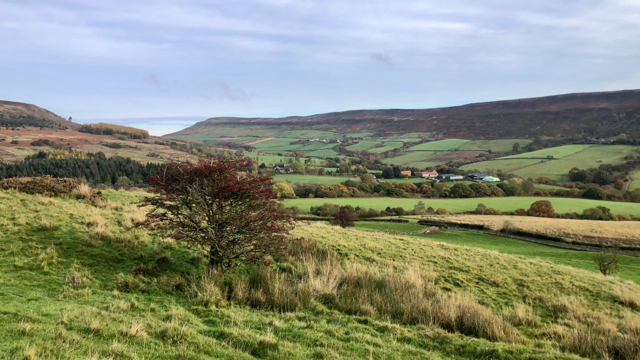
Little Raisdale — A modest dale with a forgotten settlement and chapel
In the upper reaches of Raisdale, an eastern prong stretches out to the edge of the Cleveland Hills between Cold Moor and Cringle Moor. Right of centre in the photo stands Hall Garth Farm, a name which suggests a once grand manor-house, standing proudly on the land. To its left, there used to be a…
-
Local Governance Quagmires: Who Pays for Road Repairs?
One might think that our modern roads just magically appeared, but let’s cast our gaze upon the B1257, the stretch that runs between Stokesley and Helmsley, for a tale of twists and turns. First, let’s scale Cushat Hill to Clay Bank, which, back in the day, used to be known as Hagg’s Gate. Then, it…