Category: North York Moors
-
Side-tracked by the Trans-Atlantic Slave Trade
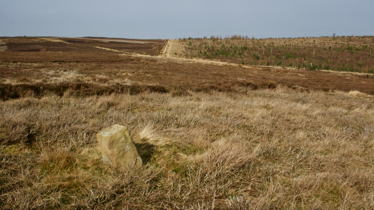
I am slowly getting around every boundary stone on these northern moors. This one is inscribed “RY 1752”, identical to the stone 600m or so to the south west. Ralph Yoward must have had a bulk buy. 1752 — George II was on the throne; the 11 days between 3rd and 13th September inclusive were…
-
It can be done …
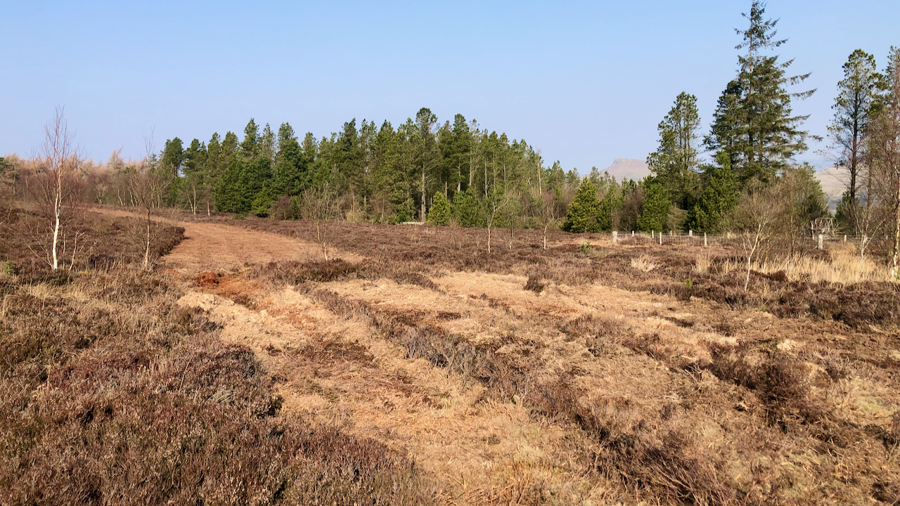
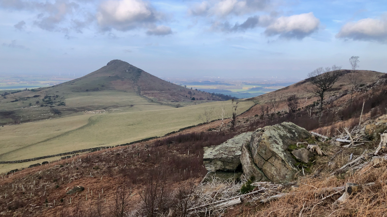
The relatively small patch of heather moorland around Captain Cook’s Monument has recently been strip mowed. This photo is technically of a strip on Little Ayton Moor, north of the parish boundary wall, but the area surrounding the monument, Easby Moor, also has at least two parallel strips. The moors are technically dry upland heath,…
-
Joan Hutton-Wilson Memorial
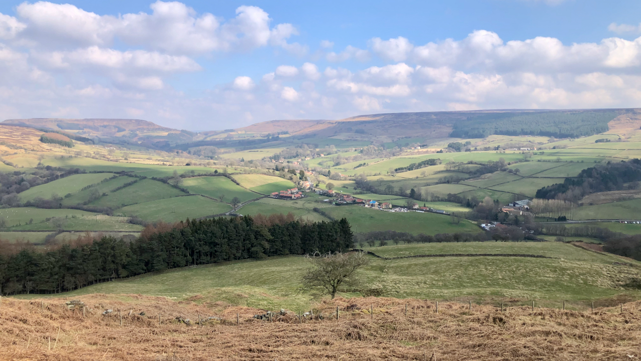
I’ve come across this memorial before, in a bracken infested copse just off the steep Trenet Bank out of Bilsdale. I was almost surprised to find it: 1968 Joan Hutton-Wilson who loved Bilsdale Not that I thought it would have disappeared. The main photo is the view from the memorial. Chop Gate is centre, the…
-
The House of Lords is “useless and dangerous to the people of England”
The House of Commons so declared on this day, 19th March, in 1649, when the House of Lords was abolished. In January of that year, Charles I had been executed and Oliver Cromwell, ‘Lord Protector‘ dominated the Government. The House of Lords was reduced to a largely redundant body having no powers and was abolished…
-

Low Staindale
A delightful former farm-house situated in Staindale in the parish of Lockton. The farmstead is shown on the Thomas Jefferies map of 1775 and it is believed the farmhouse certainly dates from that time with later alterations and extensions. The house itself is Grade II listed but two of the outbuildings are also of historical…
-
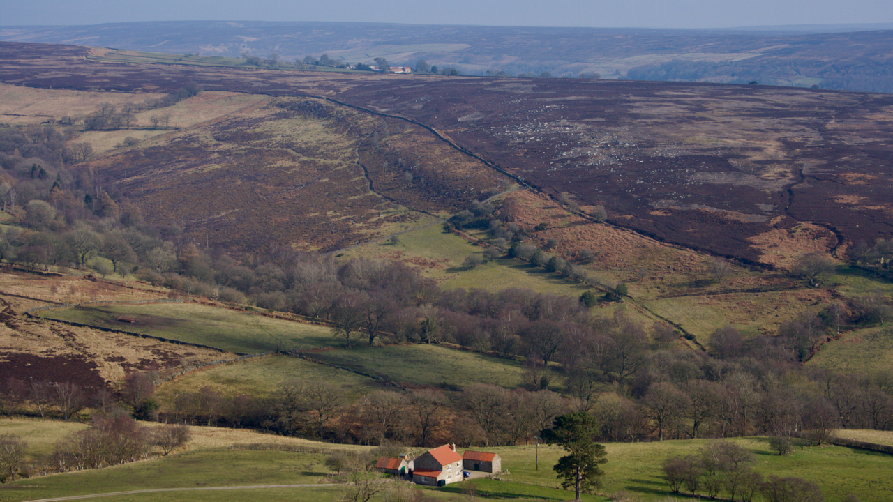
Kirby Bank
Once a scene of industry, with an ‘alum house’ believed to be on the grassy tract on the right near the patch of gorse. The workings were higher up the bank, out of shot to the left, where the bridle way contours around the hillside. A wooden channel is thought to have carried the liquor…
-
Nova Scotia Farm and Ladhill Gill
A view north-east from Hawnby Hill. A view with several interesting features. Bumper Hagg, on the far side of Ladhill Gill, contains an abundance of pre-historic features. Cairns, and linear earthworks. In the distance, seemingly on the highest point of Bumper Moor, is Wethercote Farm. This was one of the main sheep-rearing farms of Rievaulx…
-
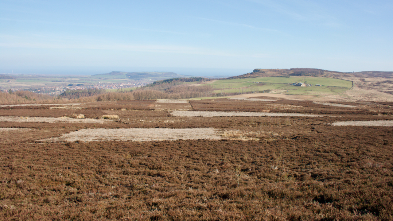
Black Bank
The eastern edge of Newton Moor, still showing signs of the devastation left after felling some twenty years or so ago. I wonder how long will the old tree stumps take to decay. This sandstone outcrop is shown as a quarry on the 1856 O.S. map. But no access track is shown, nor is there…
-
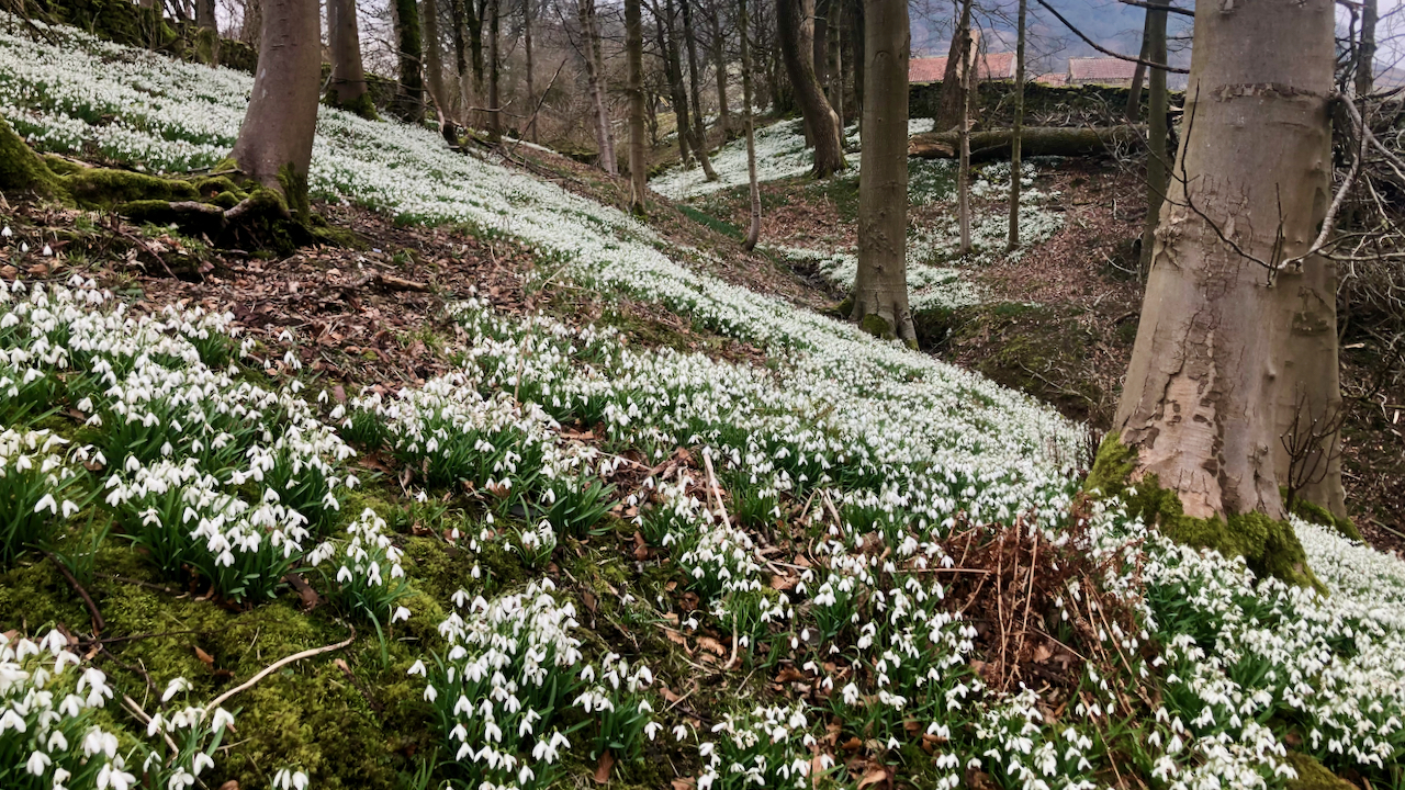
A Snowdrift
I can’t claim these are the first snowdrops I’ve seen this year but they are certainly the most impressive. This drift is behind the little church at the head of Bransdale, along a beck with no name. In a month’s time, the bank will be dominated by daffodils, only to be overtaken by bluebells a…
-
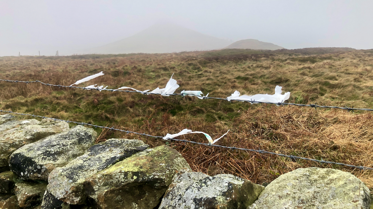
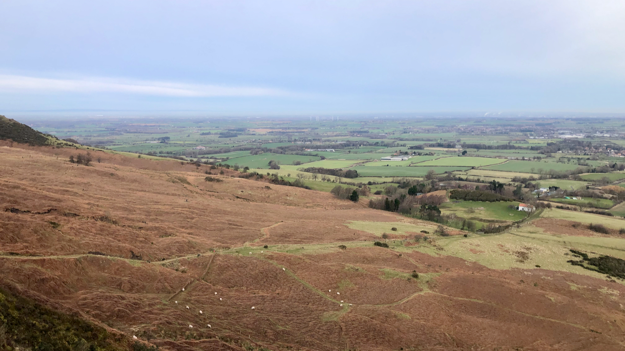
Witches’ Knickers
A dreich day, witness my photo of Roseberry not quite smothered by mist. ‘Witches’ Knickers’ is an Irish epithet for the poly bags that attach themselves to shrubs and trees, and barbed wire as here on Newton Moor, slowing shredding in the wind. I keep meaning to clean it up but put that fiddly job…