Month: September 2022
-
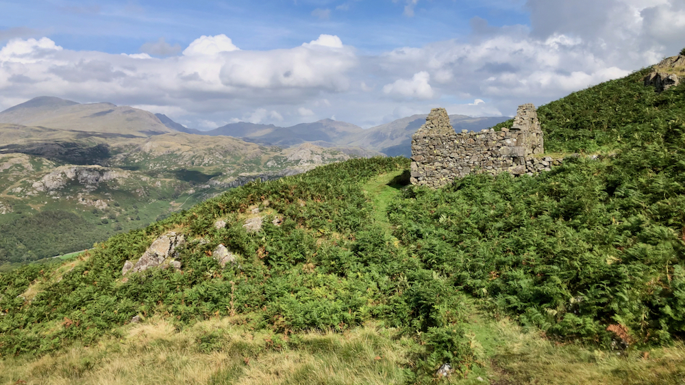
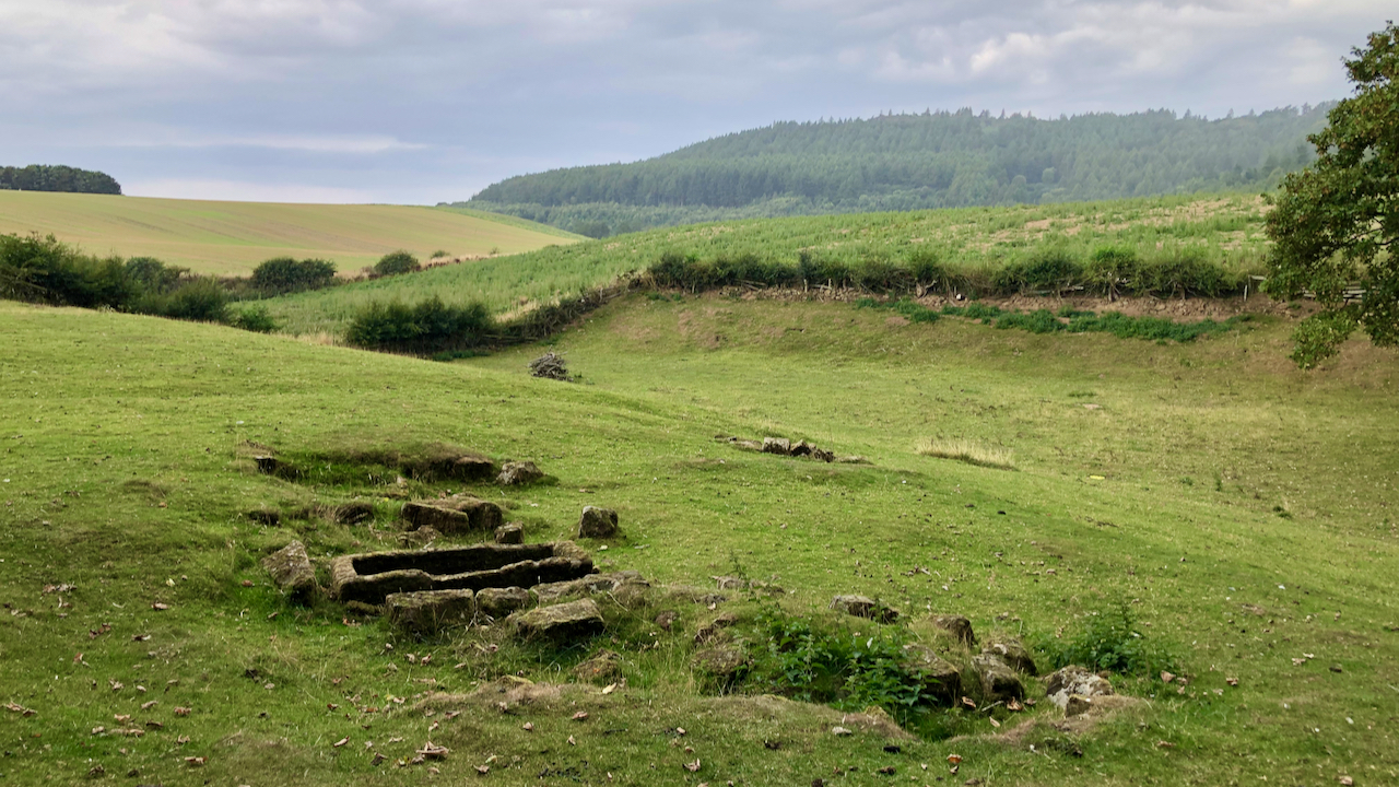
Peat storage hut, Birker Fell
I came across this ruin on the descent of Harter Fell. The Scafell range of fells provide a stunning backdrop. It is one of 35 huts that have been identified in the Eskdale area that were used for the storage of peat turves. Its date of construction is unclear, certainly post-medieval but it was still…
-
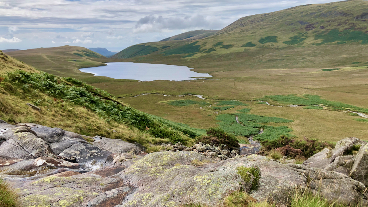
Burnmoor Tarn
Described by Coleridge as “flounder-shaped” with “it’s Tail towards Sca’ Fell, at its head a gap forming an inverted arch with Black Comb & a peep of the Sea seen thro’ it“. He was on his ascent of Scafell in 1802, and took the direct route from Burnmoor Tarn, so he could well have passed…
-
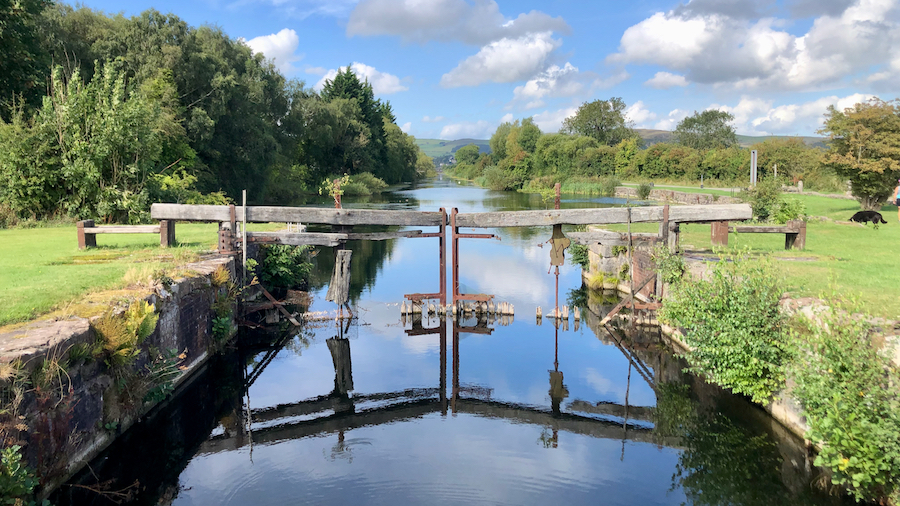
Ulverston Canal
I had it in mind to try to find the ‘Devil’s Chair’, a rock carved stone chair, on Hord Hill near Ulverston, and was intrigued to notice a canal from the town to the sea. A canal! In the Lakes! Perfectly straight, 1¼ miles long. It turned out to be a little gem, brimming with…
-
Devensian musings
I have mentioned many times of the great Devensian ice sheet which flowed over the Pennines at the Stainmore Gap, spilling out into what would become the Vale of Cleveland. And it is also common knowledge that the glacier did not flow over North York Moors, which became an island in a sea of ice,…
-
Was this the site of the stronghold of the de Percys?
On the Ordnance Survey map this raised mound is annotated as a ‘motte‘, a flat-topped mound normally associated with a motte-and-bailey castle. John Walker Ord cites the Elizabethan antiquarian William Camden as being the only mention of a ‘castle’ at Kildale. it is now thought the mound is a naturally occuring knoll and the site…
-
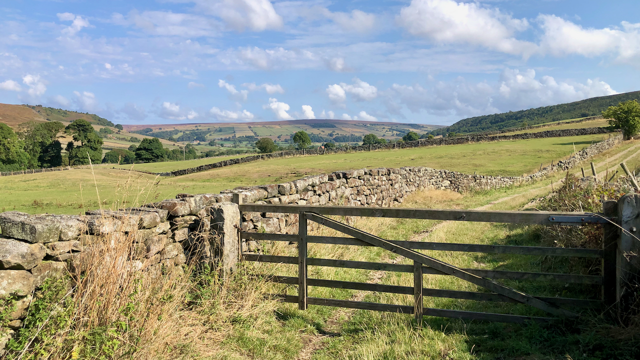
High Lane, Little Fryup Dale
The fields of the eastern side of Little Fryup Dale are accessed by the enclosed High Lane, which has only been designated as a Public Bridleway for about half its length. Looking down the valley towards the 299 metre high Danby Beacon.
-
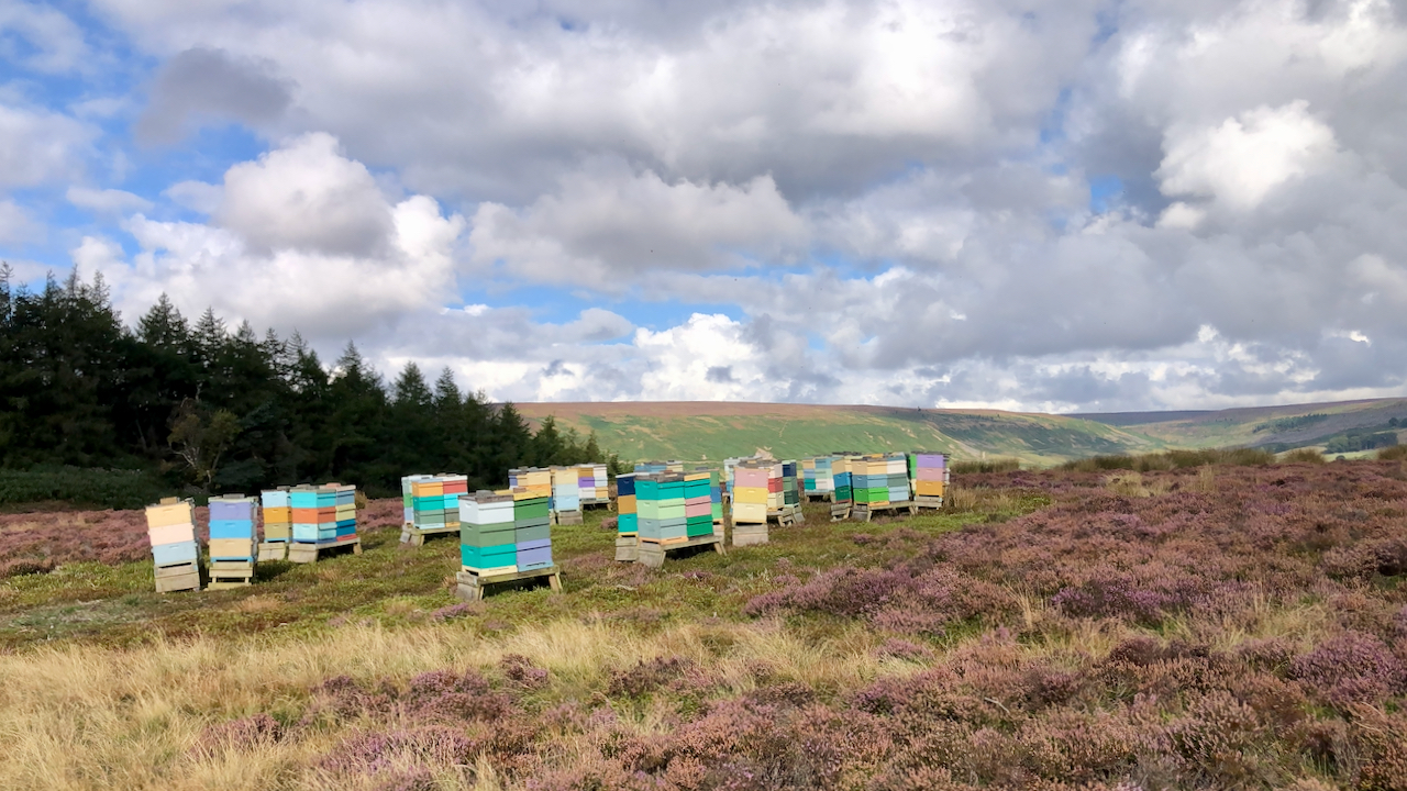
‘THIS may be called a Bee country’
THIS may be called a Bee country;— especially the Morelands, and the northern margin of the Vale ; where great numbers of bees have been usually kept, and great quantities of honey collected ; chiefly from the flowers of the heath, which afford an abundant supply ; but the produce is of an inferior quality;…