-
Bransdale Westside — a potted history
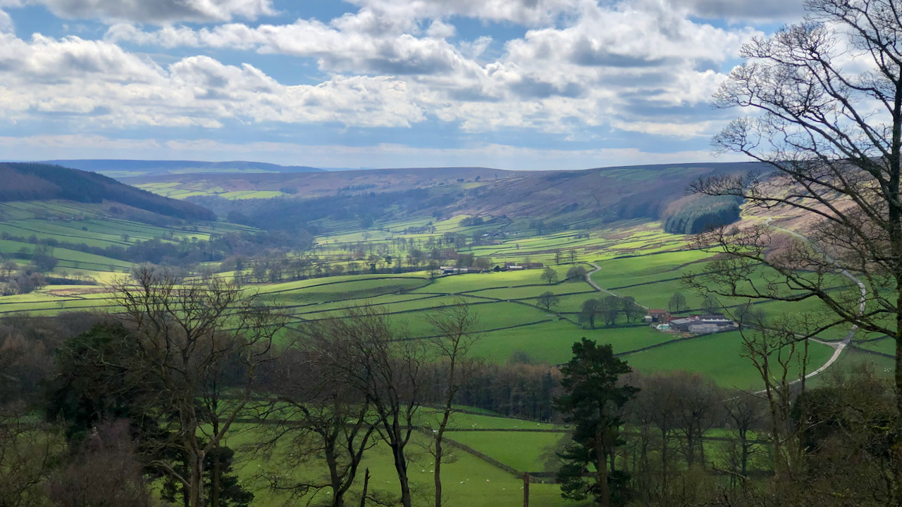
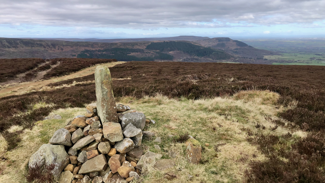
A clearing in the appropriately named High Plantation, elevated above the hamlet of Cockayne, affords a magnificent view of the western side of Bransdale. Bransdale is drained by the Hodge Beck, which, in medieval times, formed a significant boundary. To the west lay lands granted to Rievaulx Abbey, while to the east, they belonged to…
-
Percy Cross Rigg’s Hut Circles
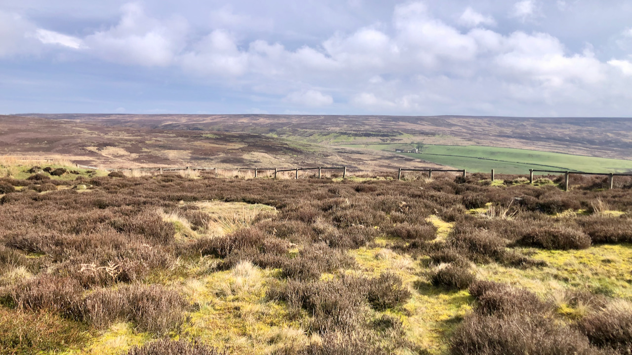
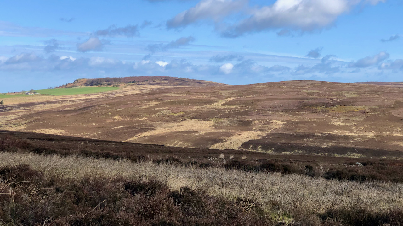
I thought I would take a re-look at the Percy Rigg Iron Age hut circles. It has been quite some time. Alas, the perimeter fence lies in disrepair, casting a pall of melancholy over the entire site. Located on the Percy Cross Rigg, just 460 metres down from the remains of the medieval cross, this…
-
Seave Green, a hamlet in Bilsdale
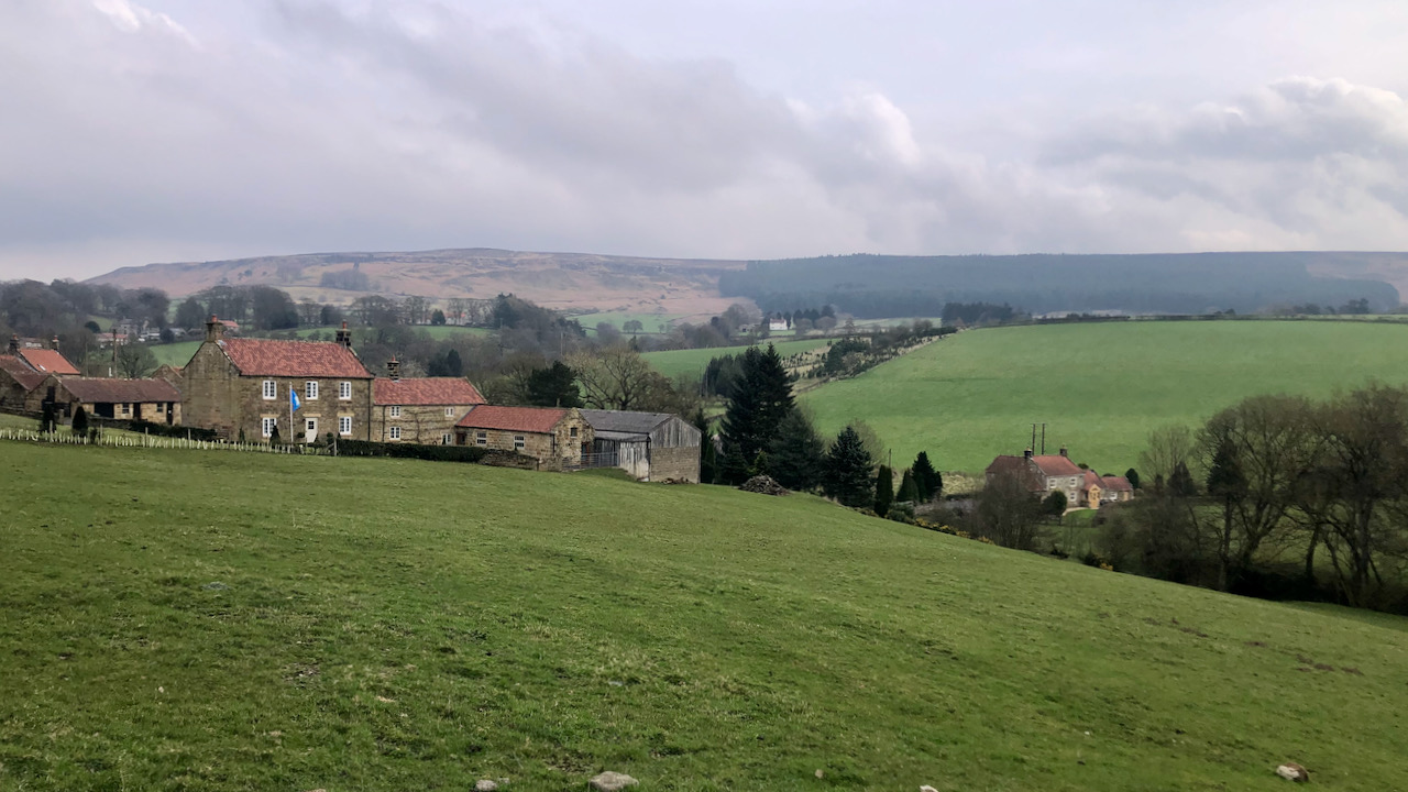
One might reckon Seave Green a hamlet nowadays, though through the ages, it’s been nothing but a scattering of farms, stretching southward to Chop Gate. Further up on Bilsdale’s far eastern slope, a chapel and manor once stood, though ‘Town Green’ hints there might’ve been a medieval village. The buildings of Seave Green, mostly built…
-
A Path up Little Roseberry, Everything has a History
On the hills and moors lie many landscape features, their origins lost in the mists of time. Contemplating their history evokes me with a sense of curiosity. Take, for instance, the path ascending towards the deep notch in the Little Roseberry spur—it stands as a prime example. The erosion scored into the slope suggests either…
-
Burton Howe — A Bronze Age round barrow
Just adjacent to the Cleveland Way, as it slogs its way along the landrover track on Greenhow Bank, lies Burton Howe, topped with its medieval parish boundary marker stone. Perched at an elevation of 433 metres (1,419 feet), it affords a splendid view of the Cleveland Plain, stretching westward along the line of the Cleveland…
-
Codhill Heights — Celtic origins in Yorkshire’s landscape
I read once that place-names split neatly into two groups: habitative names, describing the kind of settlement in question, and topographic names, painting a picture of the lay of the land — rivers, rocks, marshes, and hills. Among the ancient Celtic place-names that have trickled down to us, habitative names are not easy to find;…
-
A View from Wath Hill and Echoes of Life at Clough House
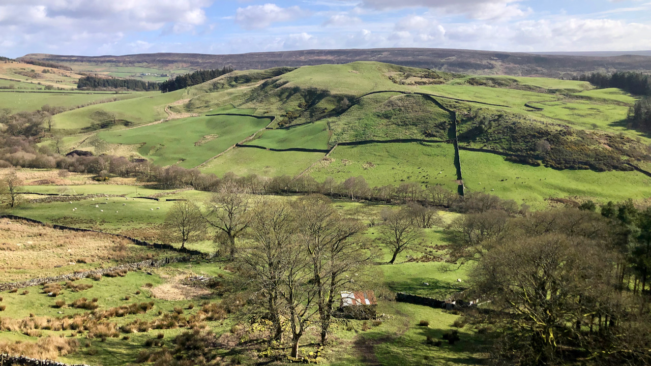
A view of Wath Hill from above the remains of the old farmstead of Clough. Just a handful of moss-covered stones indicate where Clough House farm used to stand. It’s simple to overlook its past as a bustling farm, a family home. A solitary out-building still stands, its roof clad in corrugated sheeting. The rest…
-
The Smiddy, Bransdale Mill
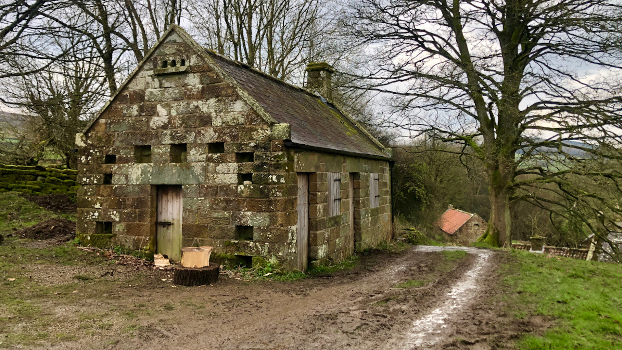
Doing some work at Bransdale Mill, specifically in the old smithy, known as ‘smiddy’ in the local Cleveland dialect, which is being repurposed into a wood store. This structure, formerly a dilapidated two-room, single-story building, had its fortunes revived in the recent past by the National Trust, which rendered it weatherproof with a fresh blue…
-
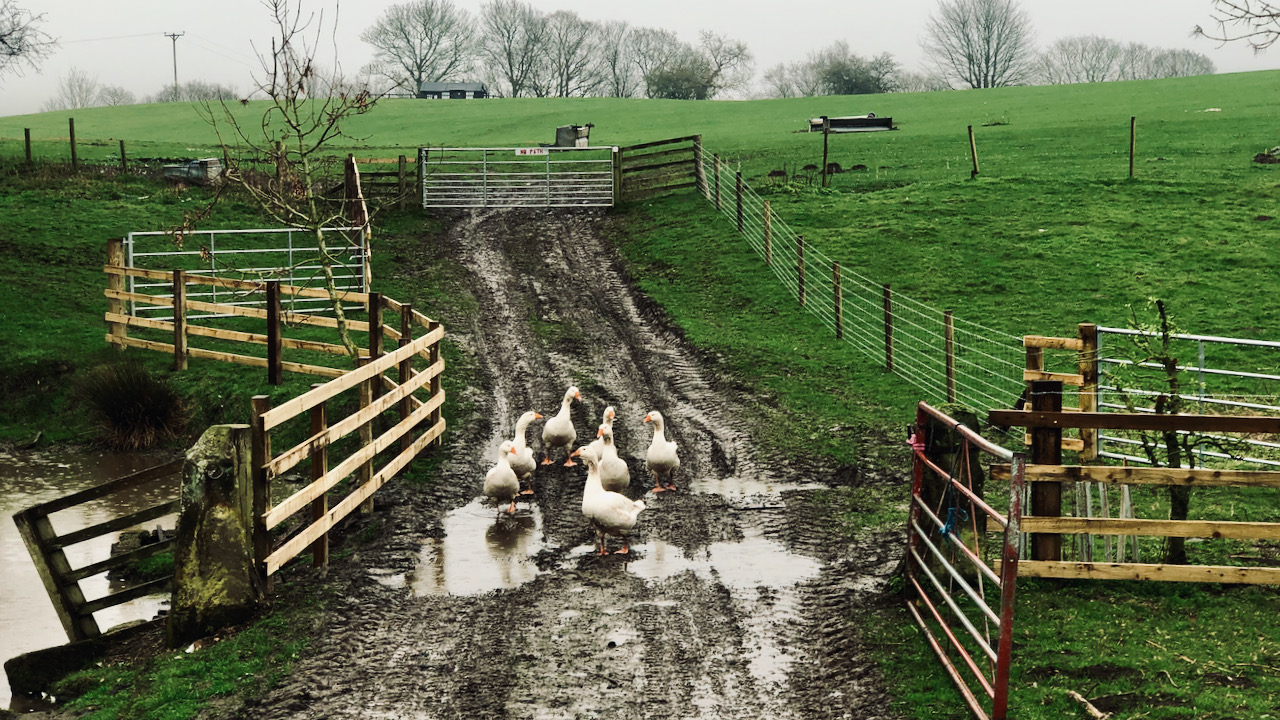
Guardians of Aireyholme Farm
A gaggle of geese attempt at walking single file down a muddy track. Their military precision was disrupted by the temptation of murky puddles to wallow in. The track leads to a gate into a green field. It’s soggy and well-used, with tyre marks alongside the geese’s footprints. At the top of the field there…
-
A dark cloud threatens Middlesbrough
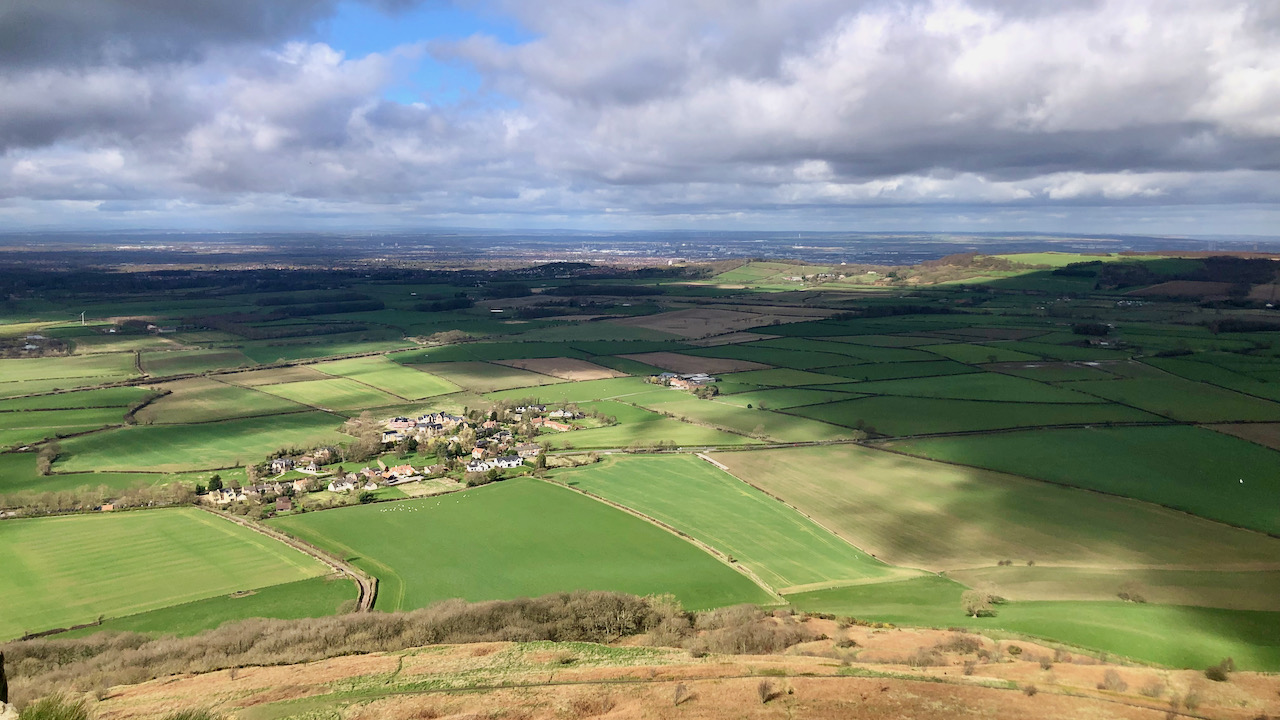
Whilst the sun beams down on Newton-under-Roseberry, Middlesbrough in the distance finds itself threatened by an ominous cloud approaching from the south. In what can only be described as a breathtakingly audacious move, Michael Gove, a shining beacon of the Tory elite, appears to be leading his party on a merry dance towards even greater…
Care to comment?