-
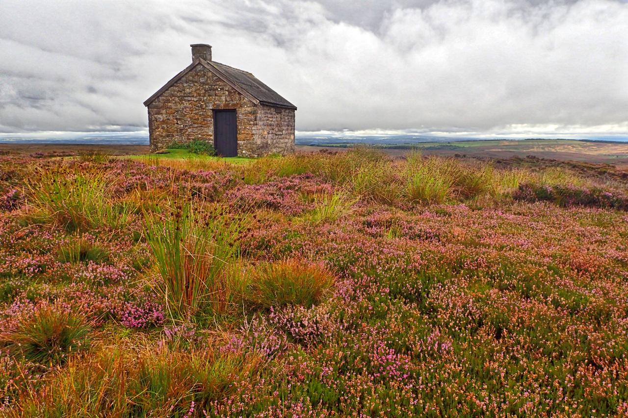
Let’s Learn Moor with the BASC
When the Police seize property as a result of criminal investigations or a court orders the confiscation of property, it is auctioned off (assuming, of course, it cannot be returned to its rightful owner) and the money placed in the Police Property Fund. Grants are then awarded from the fund to local community and voluntary…
-
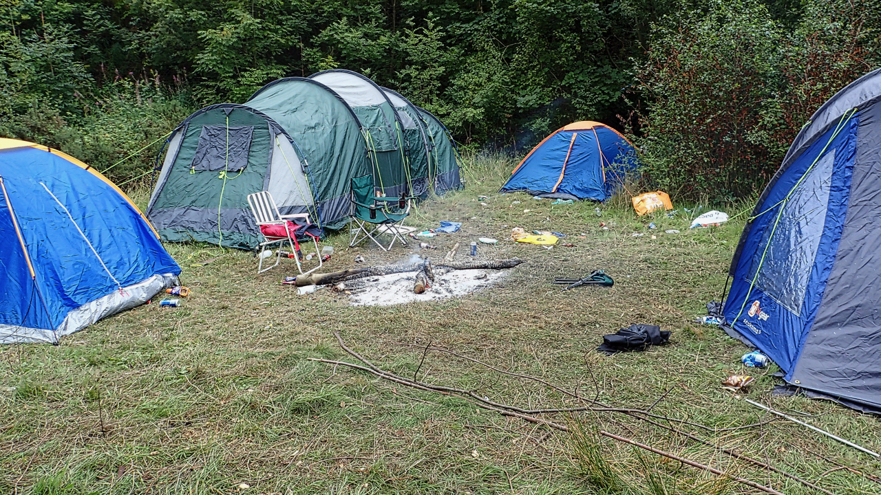
Wakey, wakey, campers
Out and about in Cliff Rigg Wood early on a lovely fresh morning, the start of the weekend, but then I smelt smoke, and then a red mist covered my eyes. But maybe the tents won’t be torched, easier than packing, the brown stuff on the baby wipes on the path is only just chocolate,…
-
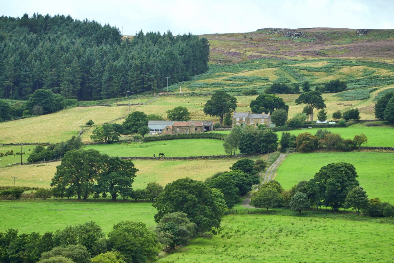
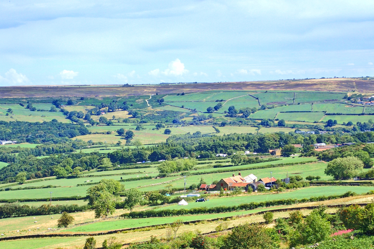
High Crosslets Farm, Raisdale
A dull overcast morning with the occasional spray of fine drizzle foretelling rain but I managed to stay dry. Halfway up Raisdale, on the climb from Chop Gate, the lowest point on the western ridge marks a geological fault in the Jurassic rocks and an ancient route over from Scugdale. Just below the pass, High…
-
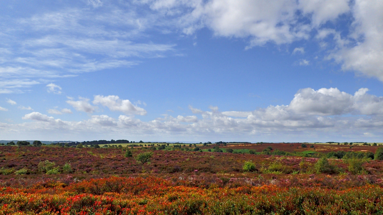
Bridestones Moor
Big skies and white clouds over Bridestones Moor, a unique area of heather moor. Unique in that it has not been intensively managed for the red grouse. Neither burnt nor grazed by voracious sheep. Mature ling dominates but in wetter patches, cross-leaved heath heather and, hare’s-tail and common cottongrasses thrive. On drier parts, bilberry, cowberry…
-
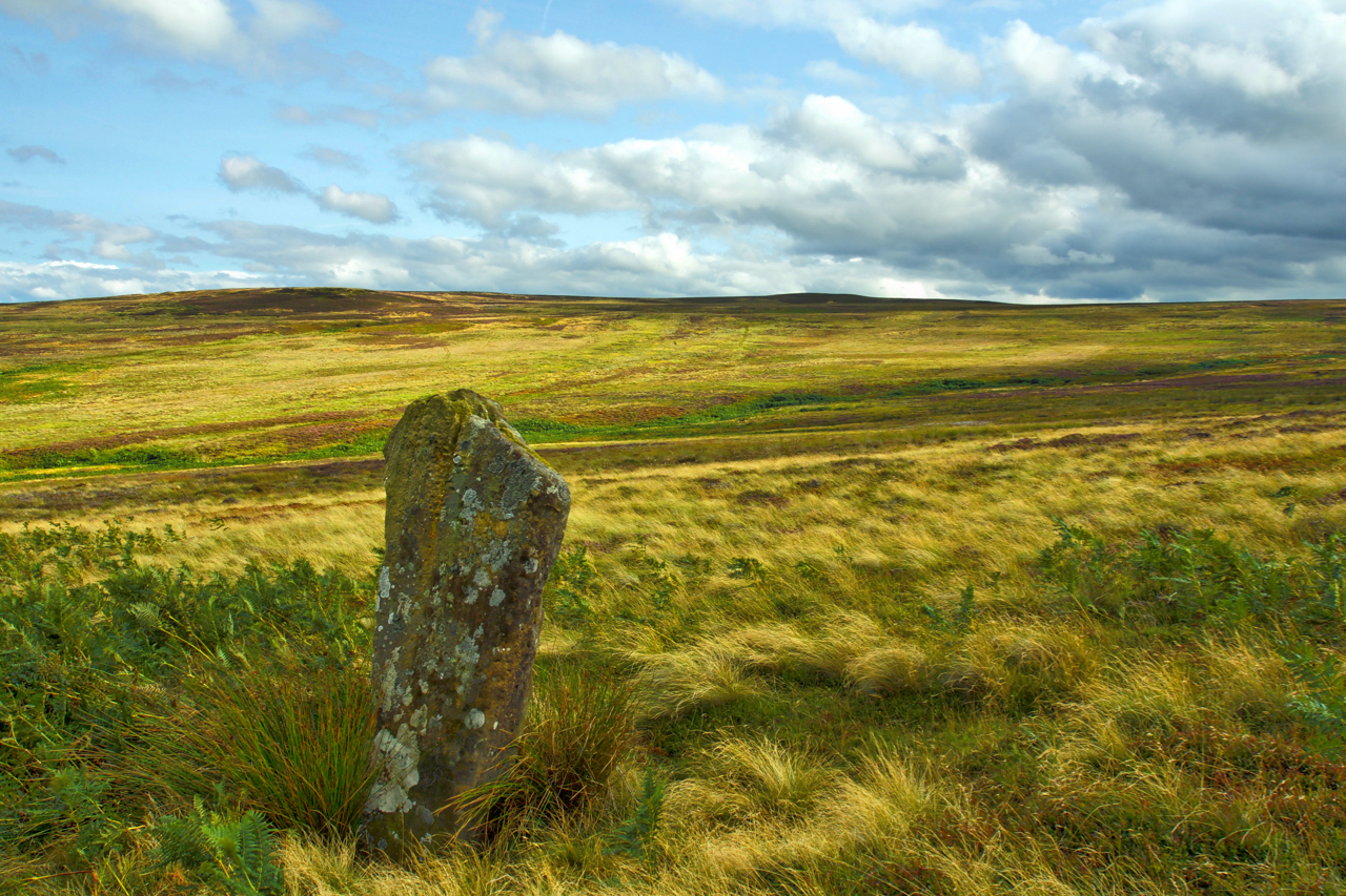
Standing Stone, Glaisdale Swang
Glaisdale Moor is scattered with standing stones. Most mark parish boundaries and tracks and are of dressed stone indicating a probable 17th-century date. In Glaisdale Swang, a boggy hollow draining north into Busco Beck, stands an isolated menhir which looks much older but has been largely ignored by antiquarians. Open Space Web-Map builder Code
-

New Marske
A rare visit to Beacon Moor, the high point above Errington Wood giving fine views over New Marske to the left and Redcar in the distance. Many believe the name, New Marske, derives from the housing built in the 1960s/70s to cater for the expanding industries of Teesside, but the name actually dates from the…
-
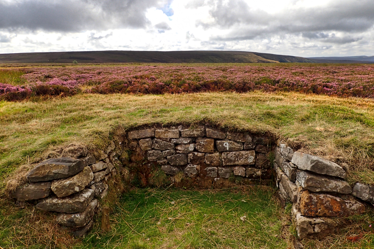
First day of the grouse shooting season
The first day of the grouse shooting season so I took in a circuit via Urra and Greenhow Moors in the hope I might come across a shoot. It is not the “Glorious 12th”, of course, that was yesterday but being a Sunday the start is postponed for a day unless you are in Scotland…
-
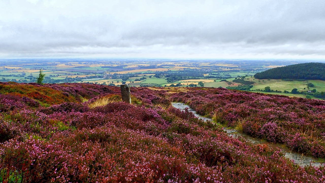
On Faceby Bank
There’s only a week or two of the purple haze so I have to make the most of the heather, providing some colour on a wet morning when the horizon is lost to the mist. The view is down to Swainby with wooded Whorl Hill on the right. Open Space Web-Map builder Code
-
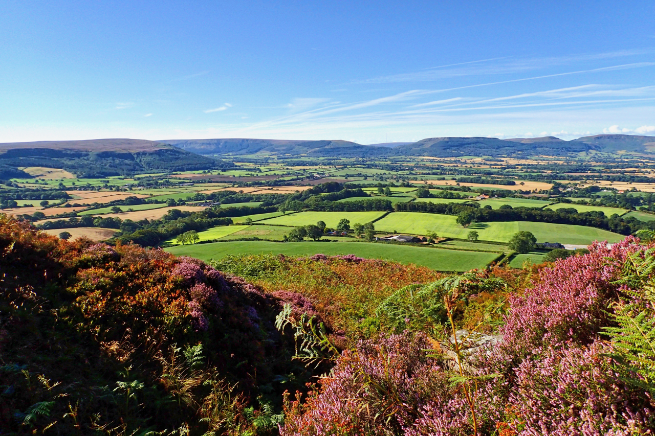
Vale of Cleveland
I haven’t been up to Capt. Cook’s Monument for a while. Blue skies with the bracken heavy from overnight rain. This view across the flat, fertile Vale of Cleveland is from an abandoned sandstone quarry on Easby Moor. In the distance are the Cleveland Hills; Turkey Nab is on the left. Open Space Web-Map builder…
-
The Children of Eskdale
Barry Cockcroft is perhaps best known for his highly acclaimed film “Too Long a Winter” about Hannah Hauxwell, who lived alone on a remote farm without electricity or running water in Baldersdale in the Pennines. He later made a film about five children growing up in the early 70s on a Great Fryup Dale farm.…
Care to comment?