Category: Scotland
-
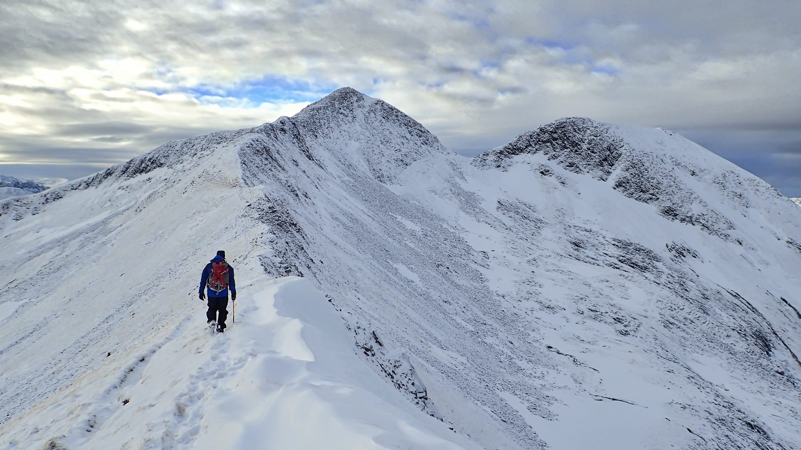
An ascent of Na Gruagaichean
Na Gruagaichean, a Monro of the Mamores, translates as The Maidens (or The Damsels or the Virgins). There is an interesting folktale associated with the hill about two maidens, each represented by the twin tops of the summit. It was originally in Gaelic so I’ll cut and paste the translation directly from Wikipedia: “There once…
-
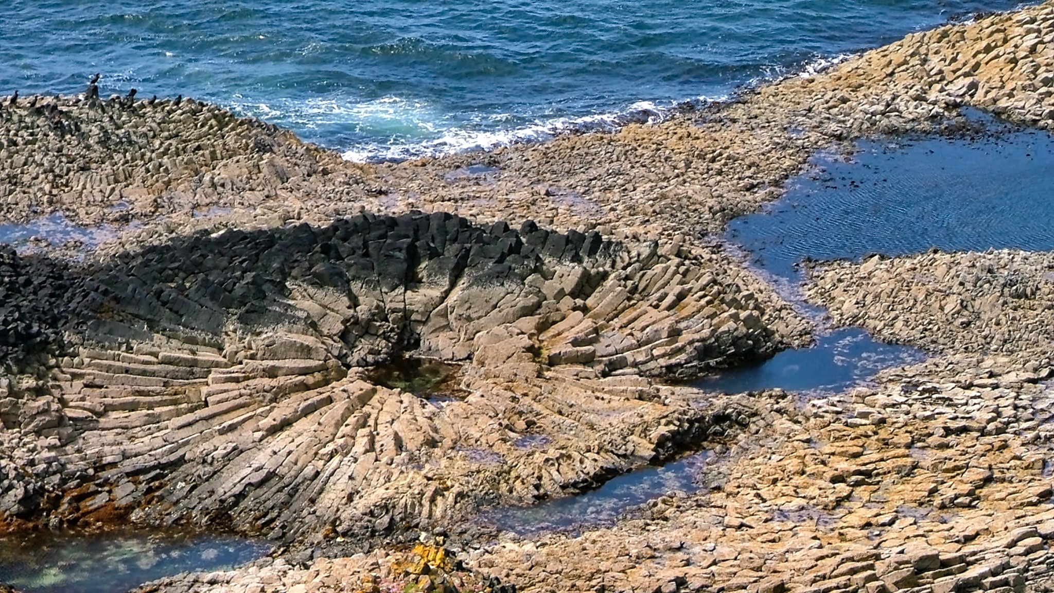
Fossilised Tree
MacCulloch’s Fossil Tree is a fairly popular tourist destination on the Isle of Mull although the trek in is not an easy stroll, certainly not for the faint-hearted. It is located at the western tip of the Ardmeanach peninsula. Parking is at Tioran and in our case a 6km cycle to the township of Burgh…
-
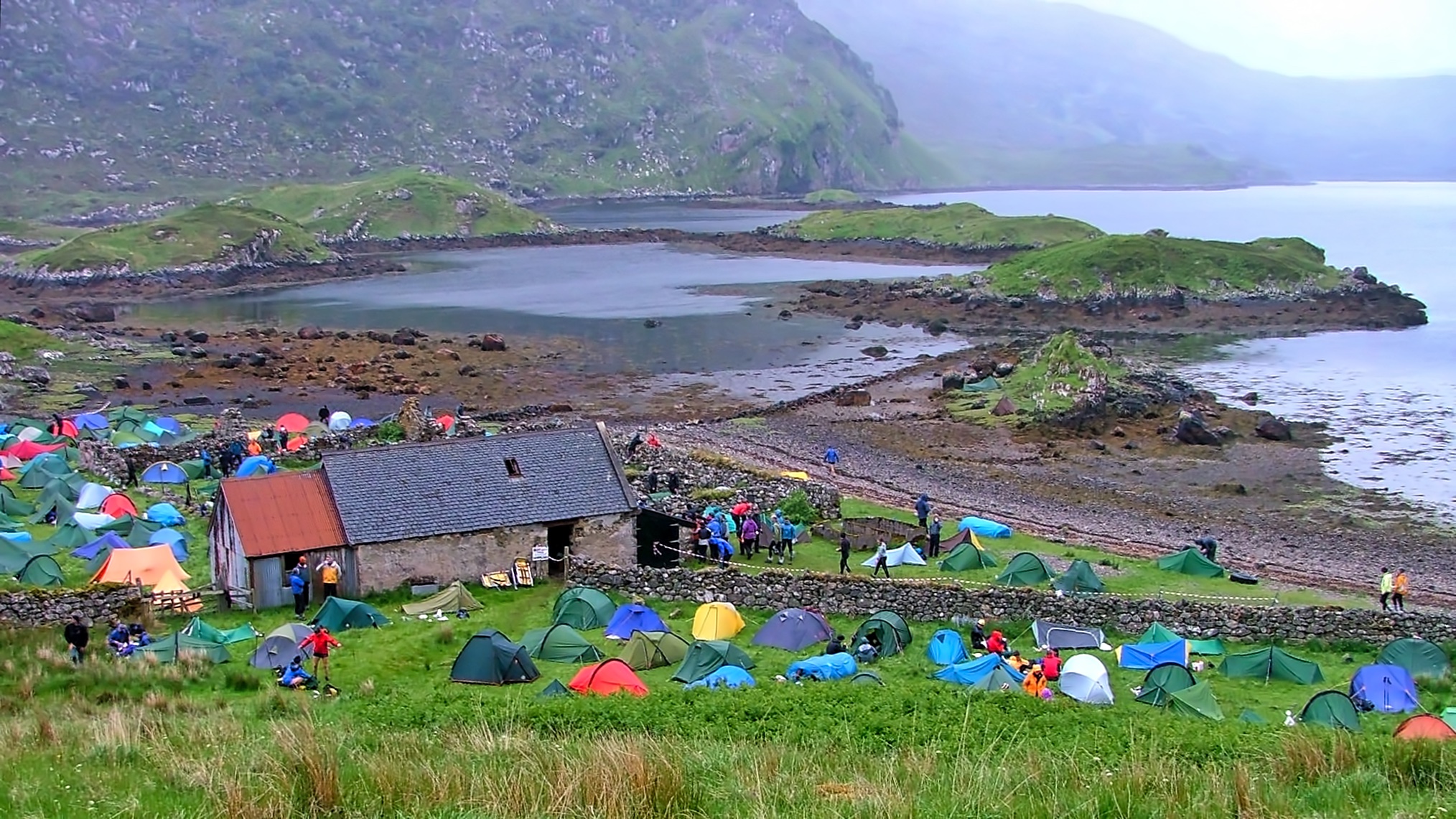
Overnight camp, LAMM 2006
Today I take a trip back to June 2006 and early finishers on Day 1 of the Lowe Alpine Mountain Marathon are arriving at the overnight camp at Glencoul, a remote bothy at the head of the sea loch of the same name. The photo belies the thick, low cloud with rain and drizzle that…
-

Loch na Leitreach
Perfect reflections on a summer morning. One thing I love about Scottish place names is their meaning. Leitreach means slope, so Loch na Leitreach is slope loch. A strange meaning until I imagine the inhabitants of Carnach at its head naming their loch from this view. Dominating the scene is Carnan Cruithneachd, a mere Graham…
-
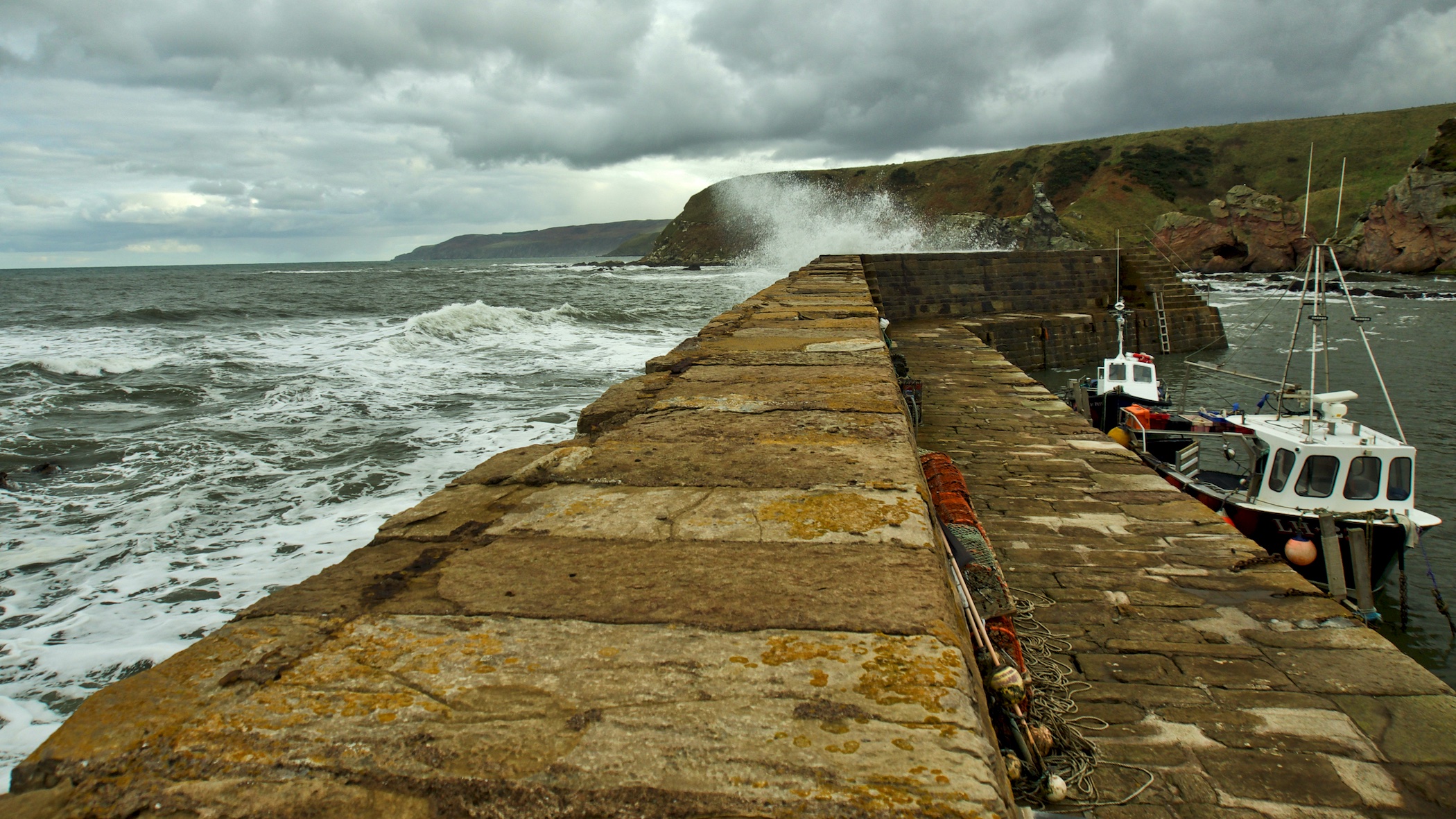
Cove Harbour
I guess I am incredibly lucky. Stopped off at Cove, a picturesque little harbour, just east of Dunbar. Nearing high tide the crashing waves were very tempting. I was leaning my elbows on the harbour wall when I took this. It was the last photo I took with my little Olympus camera. Just a small…
-
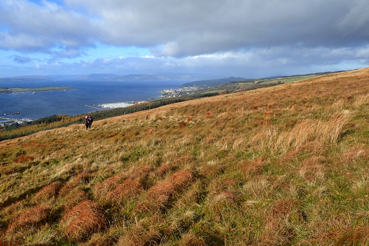
Largs and the Fairlie Roads
Another photo from the OMM weekend in Scotland. This is the final descent to the finish in Largs (or An Leargaidh Ghallda in Gaelic) with super views across the Firth of Clyde and the island of Great Cumbrae. The sound between Largs and Great Cumbrae is known as the Fairlie Roads. The only history I…
-
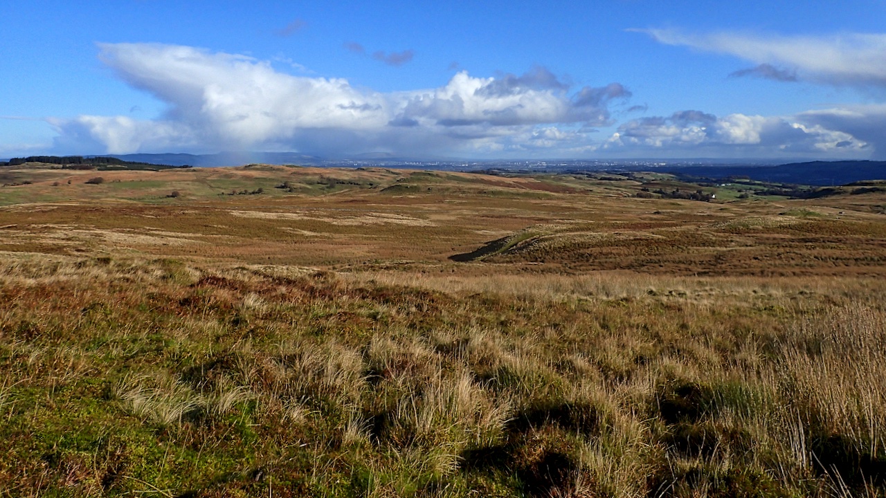
Muirshiel Country Park
The term ‘country park’ brings up an image of a Capability Brown inspired landscape, broad swathes of close-cropped grass pasture grazed by herds of deer with a scattering of veteran trees, sweeping down to a lake. Muirshiel Country Park, west of Glasgow is 110 square miles of blanket bog with knee-high tussocks and soul-destroying heather.…
-
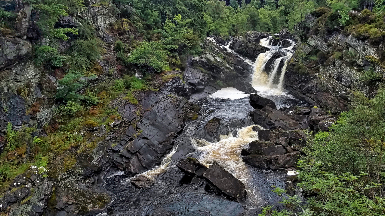
Rogie Falls
Needed some exercise on the journey south so parked up at Torrachilty Forest just north of Inverness. Came across the popular tourist attraction of Rogie Falls. Quite impressive, on the river Black Water or Alltan Dubh. Eas Rothagaidh is the Gaelic name for the waterfall with the ‘th‘ and ‘dh‘ silent so I guess the…
-
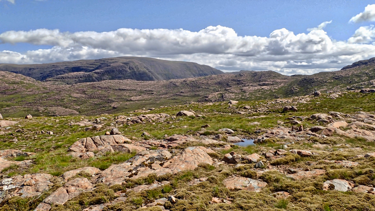
Coire nan Cuileag
A view north-east across the Coire nan Cuileag from near the top of the notorious Bealach na Bà, a 626m high mountain pass. It is reputed to be the steepest road in the UK but I think that accolade is actually on the eastern ascent. I cycled up from the west, still the same height…
-
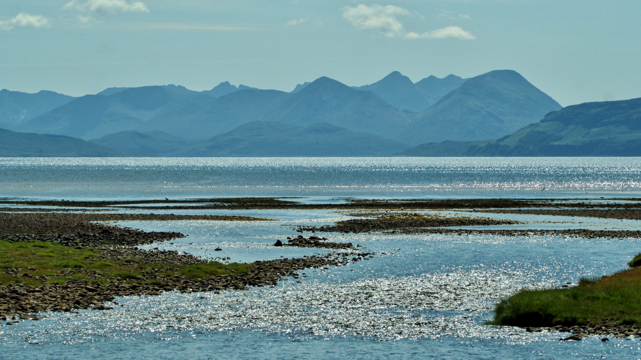
The Cuillin Hills from Applecross
For another trip. This view is across the Inner Sound and through Caol Mòr, the sound between the Isle of Raasay and Scalpay. I can identify Glamaig, the 775m peak to the right, with some confidence, but not, I have to say, any of the others. Well not sure enough to put in print. Open…