Tag: hill
-
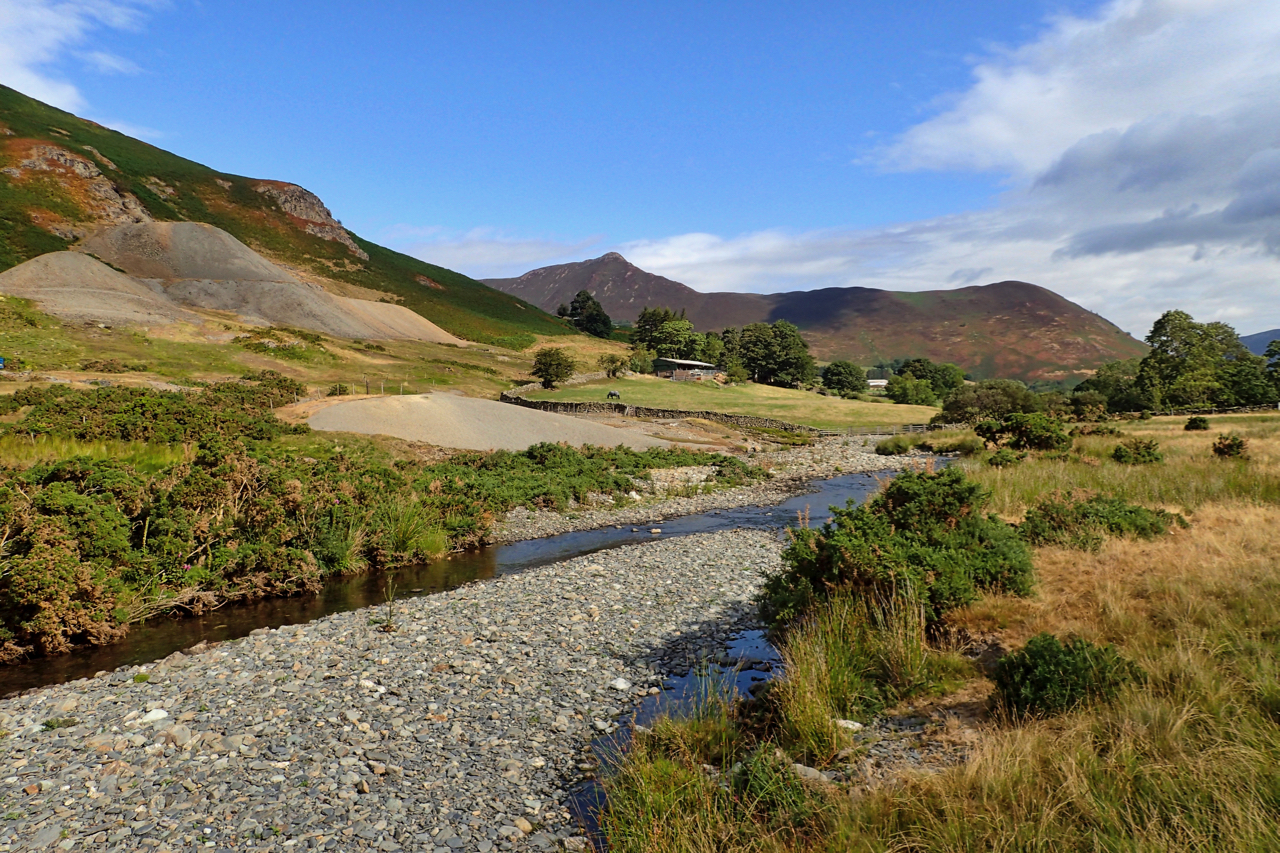
Newlands Valley
Newlands Beck meandering down the dale from its head below the appropriately named 753m high summit Dale Head. In the distance the prominent Causey Pike, a tortuous climb from this direction. The spoil heaps far left are from Goldscope Mine, one of the earliest mines in the area documented back to 1564, the year Shakespeare…
-
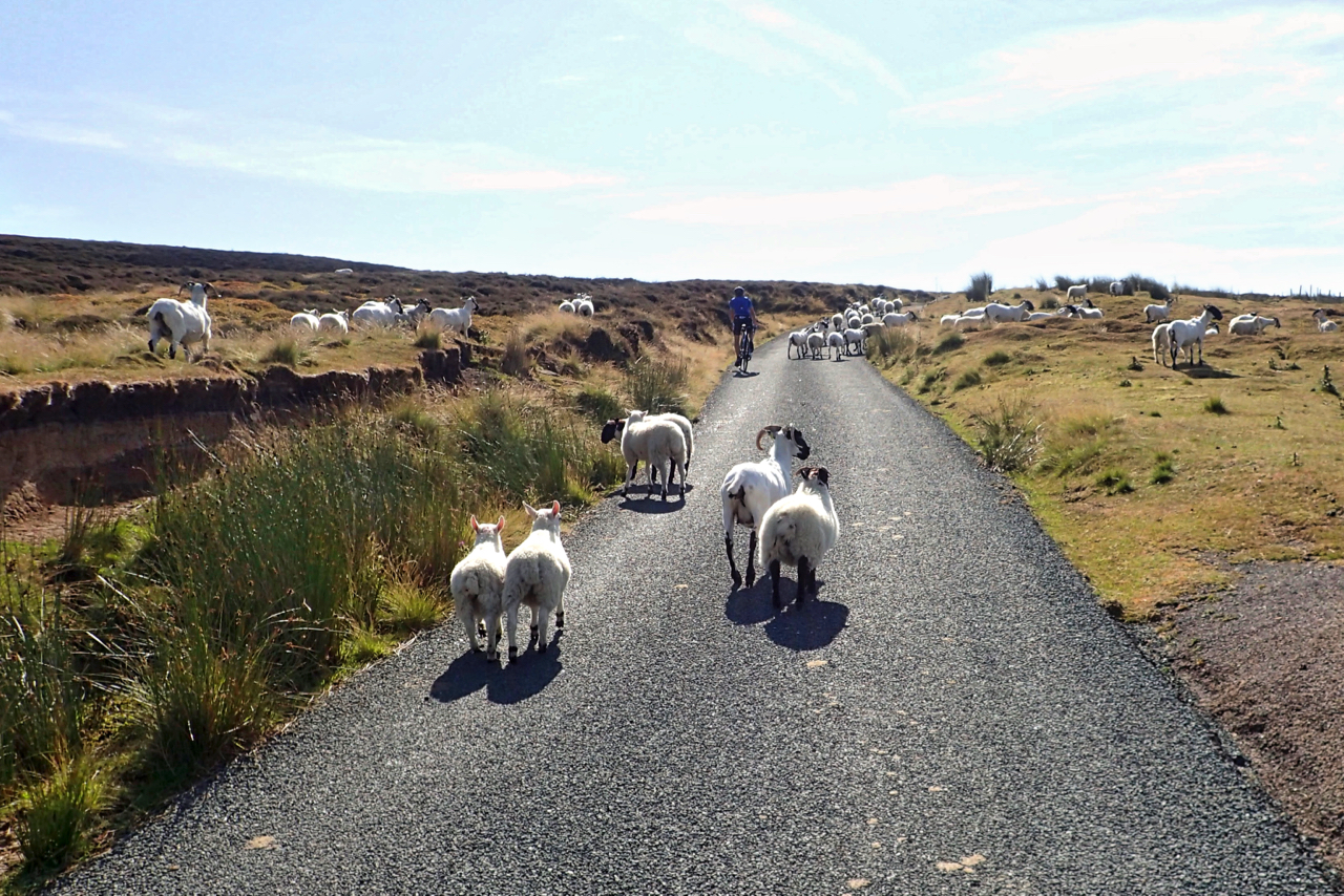
Lamb Jam on the Baysdale Road
Gathering the sheep. We had just overtaken the farmer working his dog. Not sure why though. The ewes were already shorn. Open Space Web-Map builder Code
-
Green Bank and Busby Moor
Here comes the rain. It’s looking ominous. Finally some relief. Looking along the Cleveland Hills from the Raisdale Road. Roseberry is somewhere on the horizon. Open Space Web-Map builder Code
-
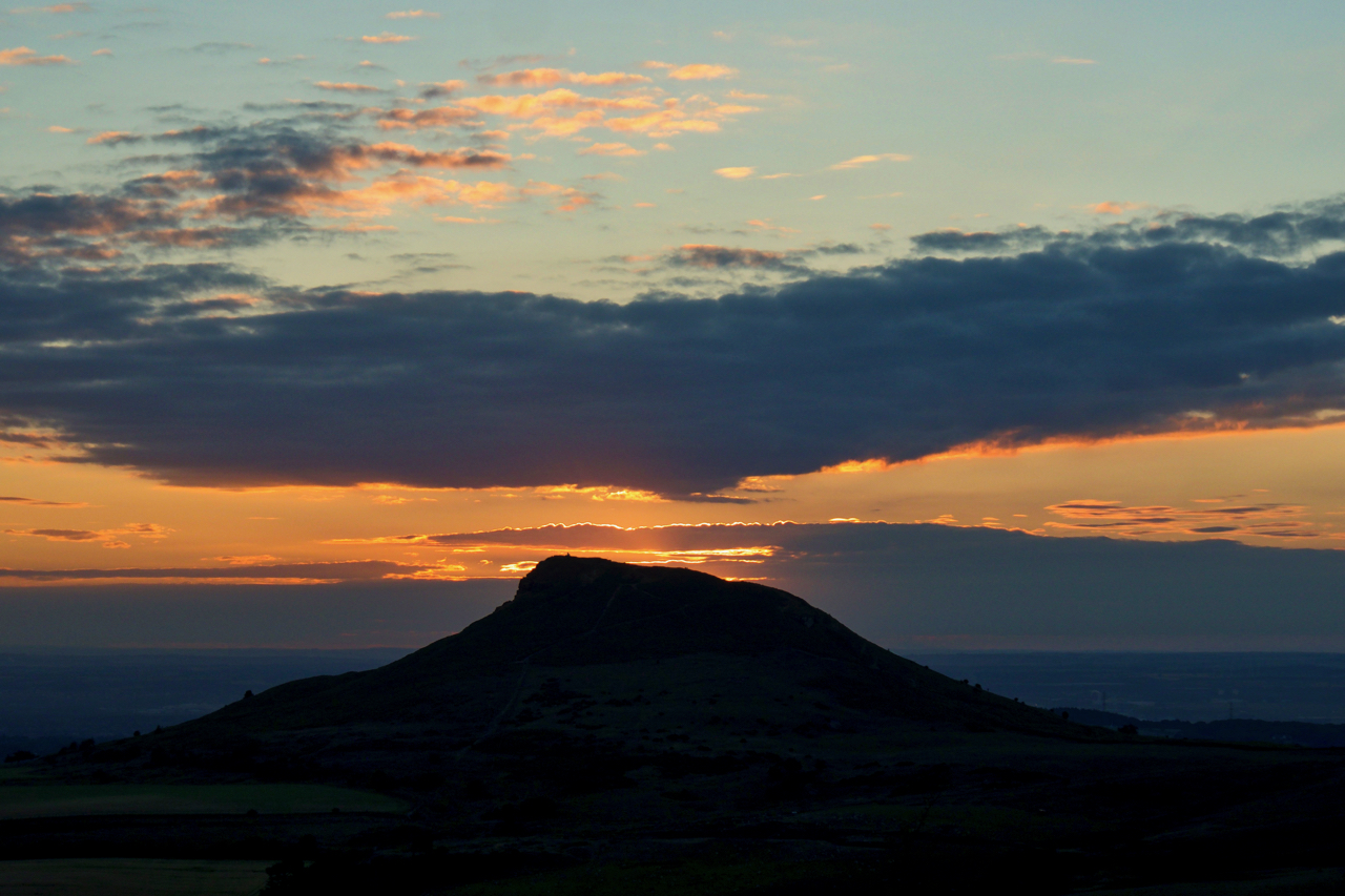
In the cool of the evening …
… a wander on Great Ayton Moor to watch the sunset. The midges were lively though. Open Space Web-Map builder Code
-
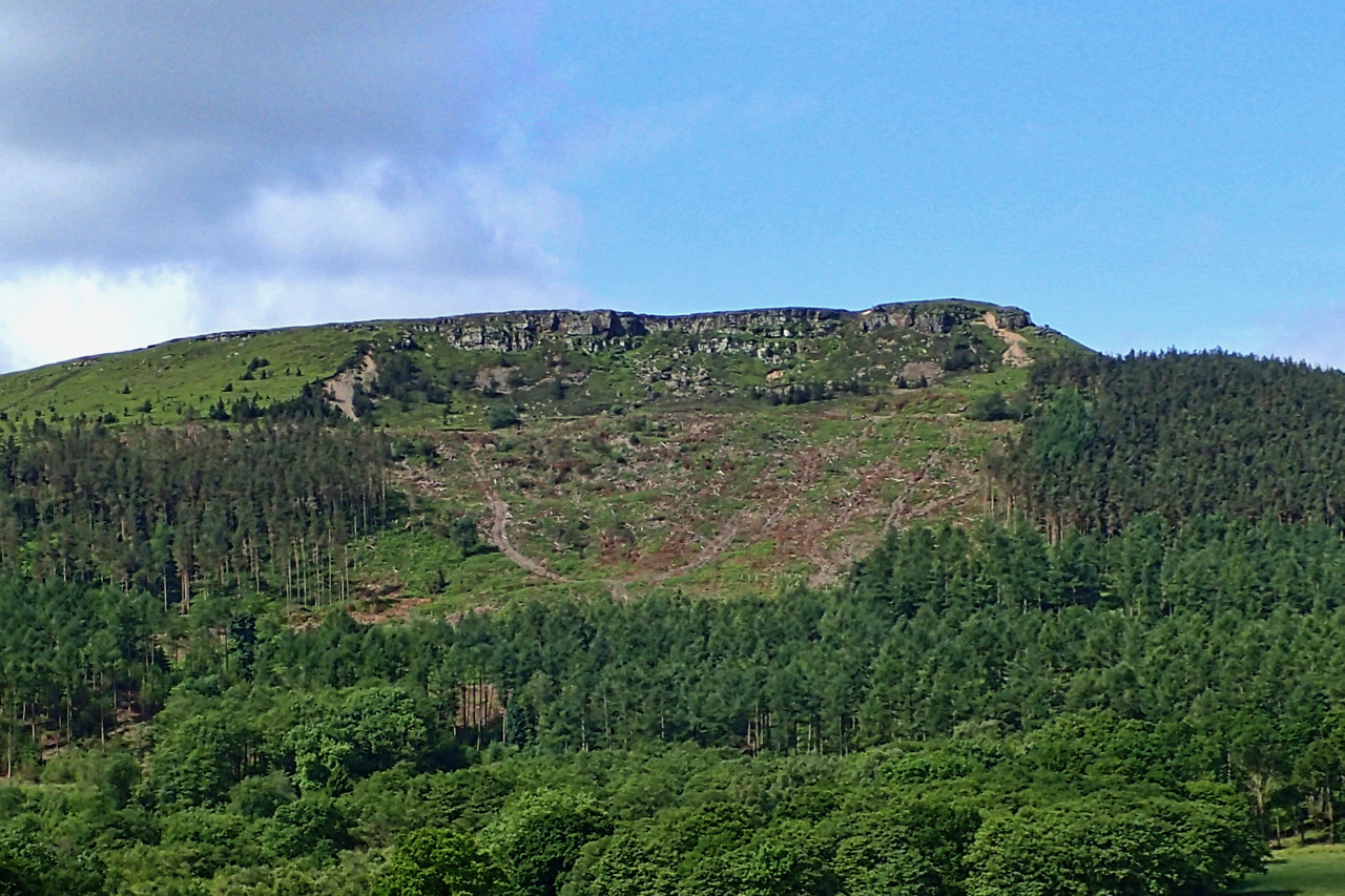
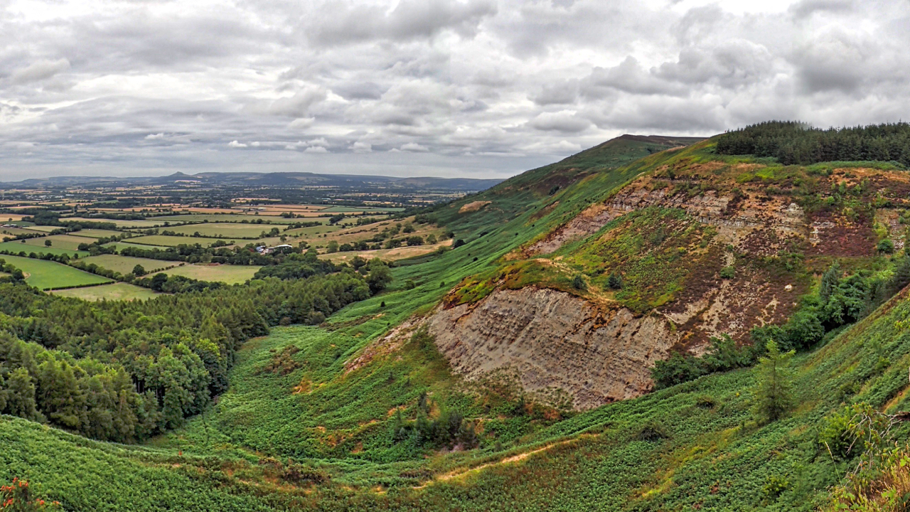
White Hill
A large swathe of clear felling on White Hill. It may be a coincidence but the clearance is almost exactly on the disturbed ground of the 1872 landslip when the Stokesley to Helmsley road was covered to a depth of up to 24 feet with rocks, shale and soil. The argument about who should repair…
-
Roseberry from Newton Moor
A cracking morning. Out and back before the crowds make the pilgrimage to the summit. Open Space Web-Map builder Code
-
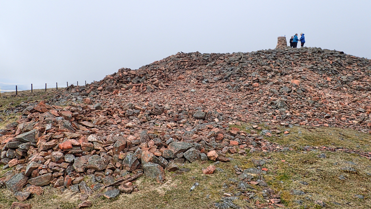
Hill of Fire
Tinto, perhaps the most prominent hill in the Clyde valley. At 707m above sea level it is not particularly high but still a very popular climb. The name means the hill of fire, a reference to the druidic practice of lighting fires on the summit to their sun god. A Bronze Age burial cairn, the…
-
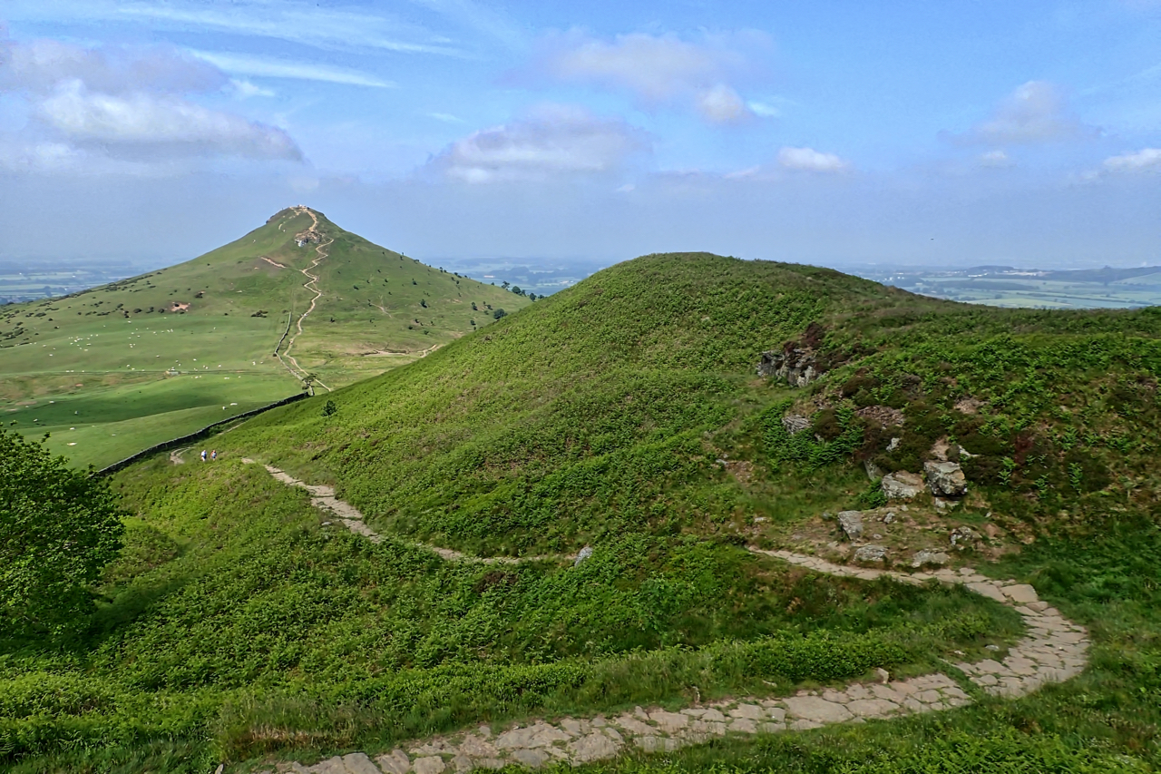
Angle Tarn Pikes
From Deepdale. The valley of Patterdale and the busy A592 hidden. Open Space Web-Map builder Code
-
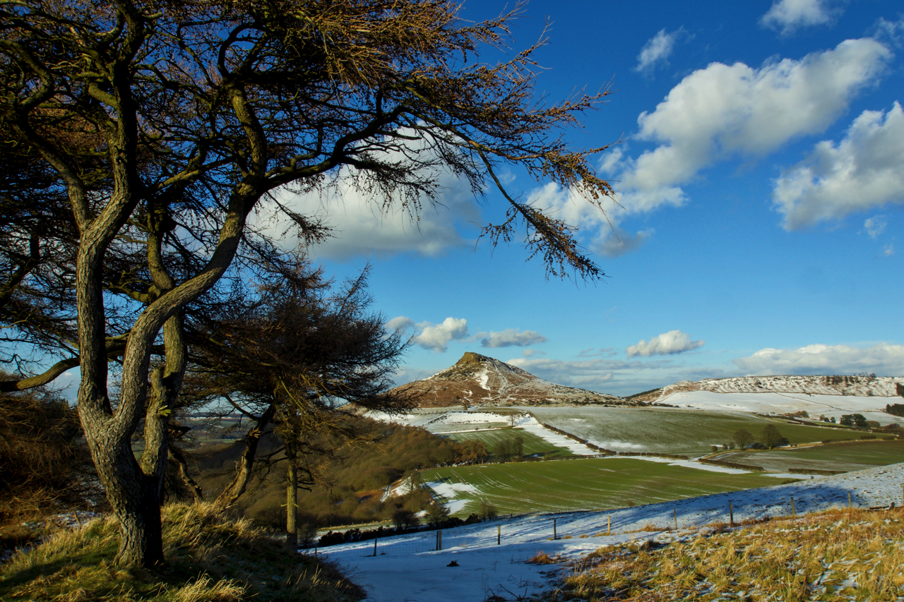
Roseberry Topping
Woke up this morning to a hard frost, overcast but bright skies in the distant out over the North Sea. By nine o’clock, a whiteout. Utter chaos, all roads south at a standstill. By tea time, blue skies, roads clear, and, with Roseberry as a backdrop, warm enough for a moment’s reflection. Open Space Web-Map…
-
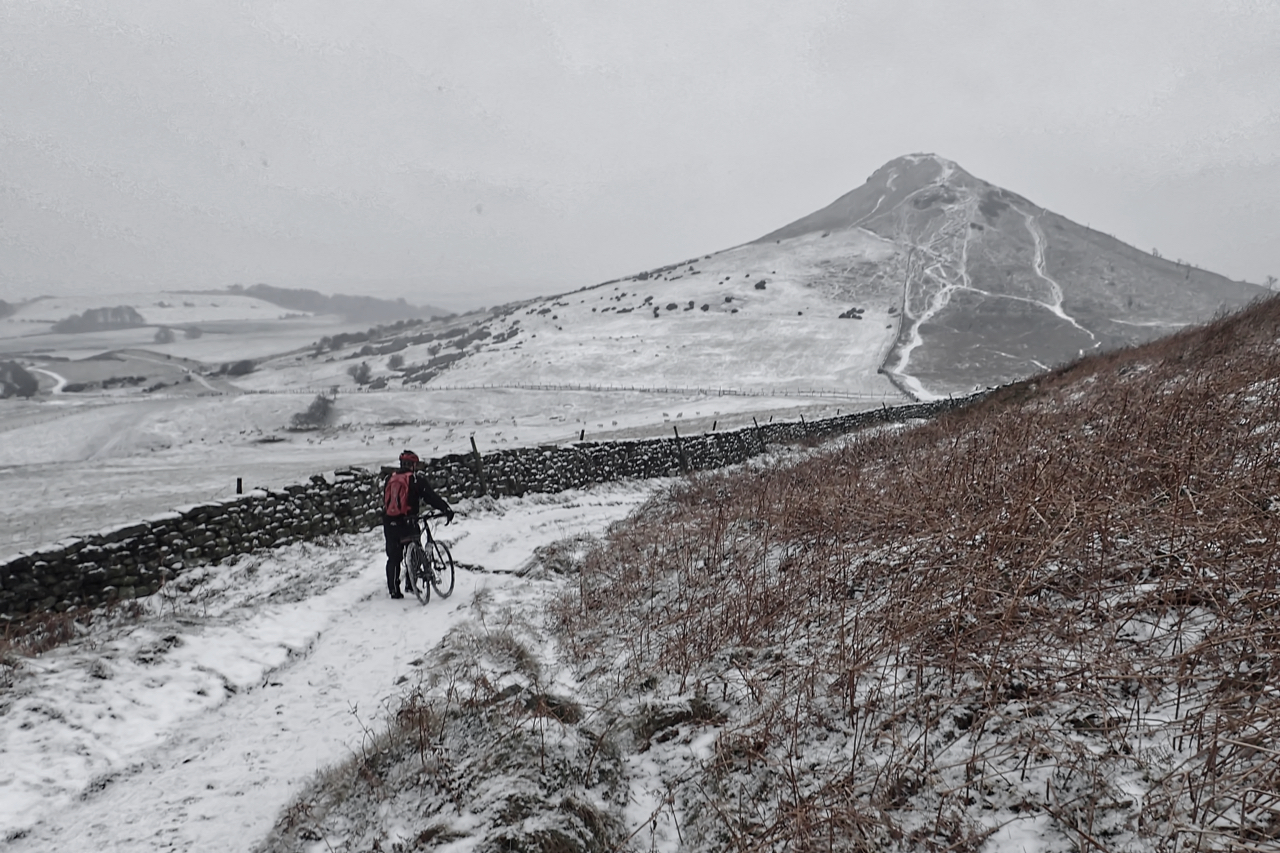
Britain’s 23rd Favourite Walk
A disappointing snowfall. Threatening but just a flindrikin. Roseberry Topping wasn’t so much wearing a cap but a grey veil. Didn’t see a soul except for this lone cyclist pushing his bike down the hill. Why? And a gravel bike at that. Roseberry, recently placed 23rd in a ITV list of Britain’s favourite walks. Part…