Tag: hill
-
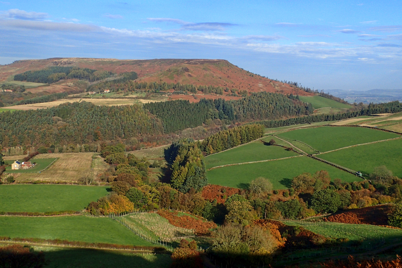
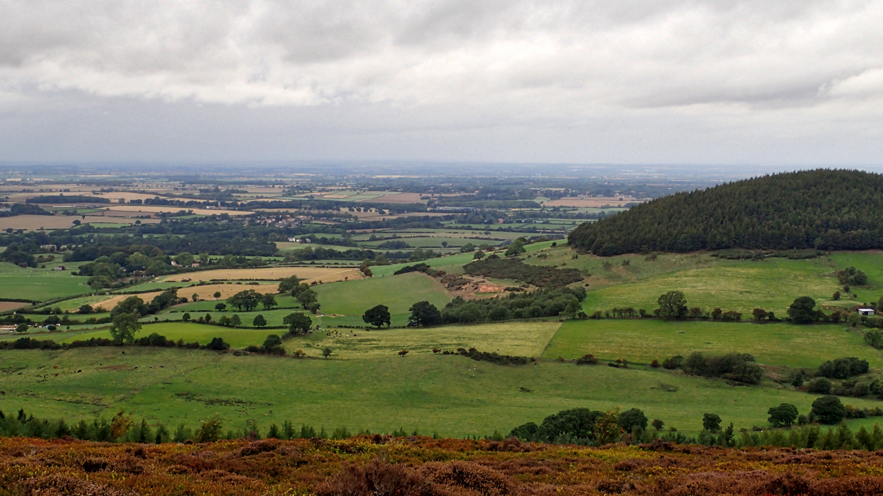
Rotten Scar
Last Sunday I posted a little question where was I when I took the photo. I thought the hill would be a giveaway but for once no one came close. Further back and a little bit higher on the edge of Urra Moor and Hasty Bank becomes more obvious. The valley is the top end…
-
When Roseberrye Toppinge weares a cappe …
Towards the weste there stands a highe hill called Roseberry Toppinge, which is a marke to the seamen, and an almanacke to the vale, for they have this ould ryme common, “When Roseberrye Toppinge weares a cappe Let Cleveland then beware a clappe.” For indeede yt seldome hath a cloude on yt that some yll…
-
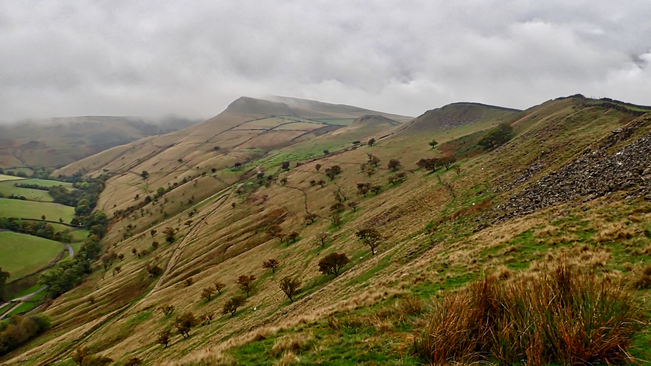
Mount Famine ridge
A pre-breakfast run with the dog. And overnight someone had opened a massive parasol of cloud. The blue skies of yesterday had gone along with any view of Kinder Scout. Mount Famine was familiar to me only as a race in the fell runners calendar. Too short to justify the journey south and too close…
-
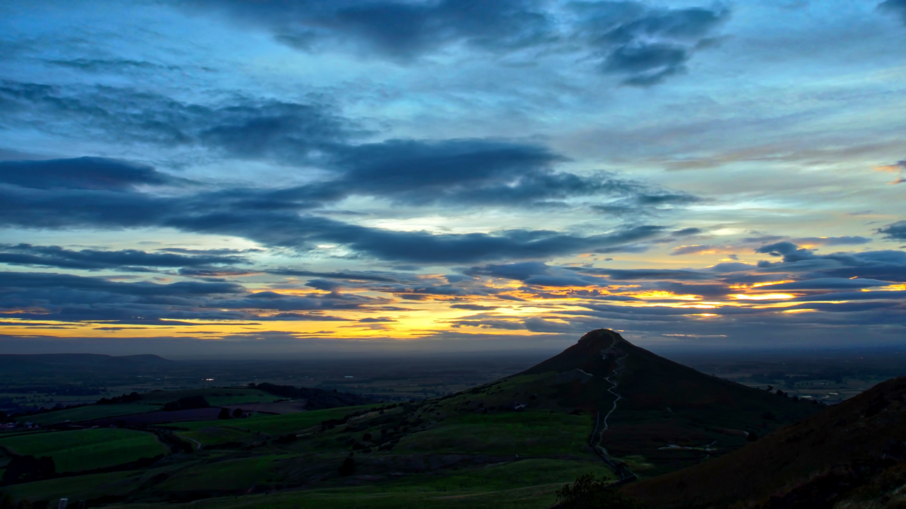
Roseberry Sunset
Such a cracking sunset last night that I had another evening stroll. An online ephemeris tells me the sun will set at 269.4°, pretty close to due west. Not surprising when you think about it, just two days after the Autumn equinox. And it just so happens that Roseberry Topping is a smidgen off due…
-
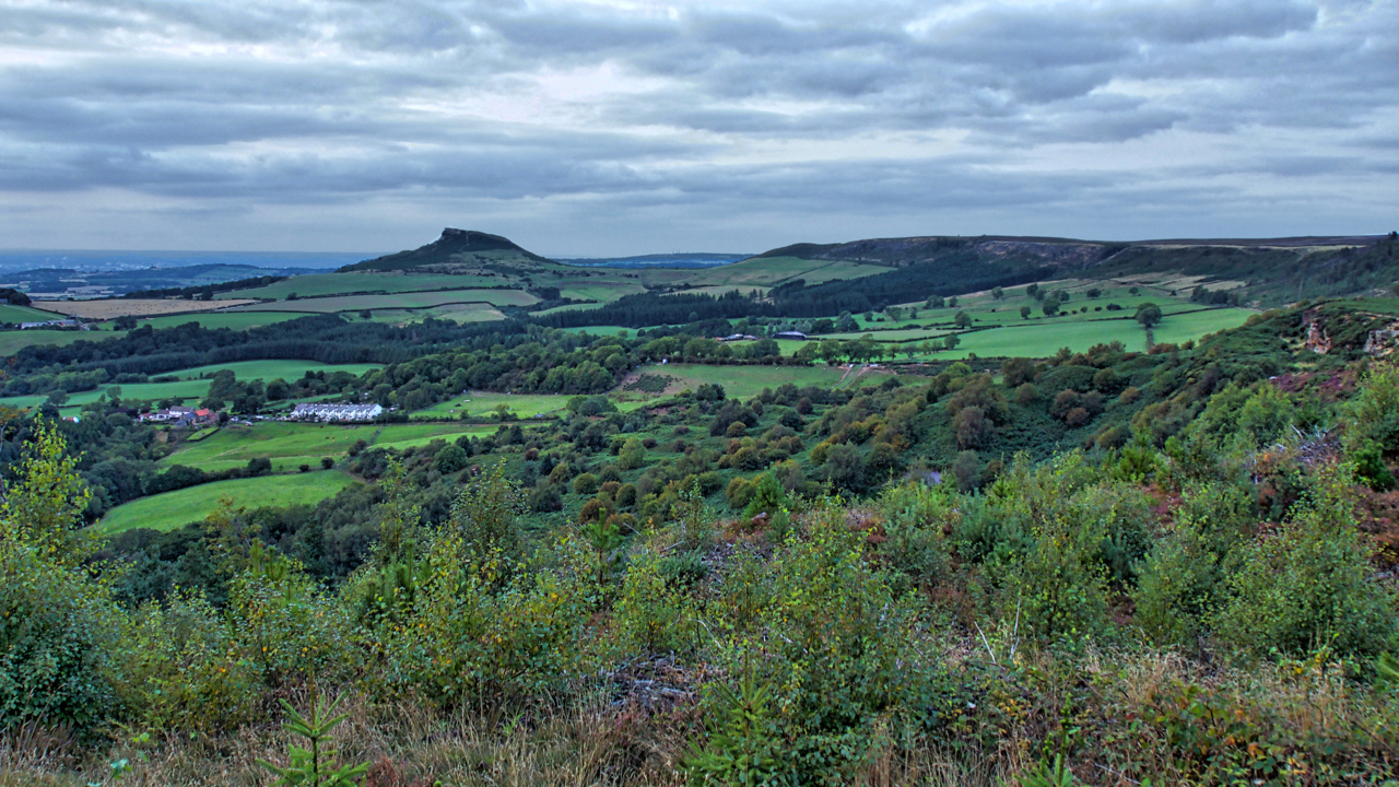
Whorl Hill, Whorlton Castle and Toft Hill
This view, from Live Moor, is interesting. On the right is Whorl Hill and to its left 1km away is Whorlton Castle. You might be able to just make it out, the extreme left of the photo. I was at the National Civil War Museum in Newark the other week and in an interactive display…
-
Gribdale Terrace
An evening stroll up Capt.Cook’s Monument hoping to catch a spectacular sunset. Instead, a diffuse grey blanket gradually smothered the sun. The white cottages of Gribdale Terrace, built for whinstone miners, on the far left overlooked by Roseberry Topping. Open Space Web-Map builder Code
-
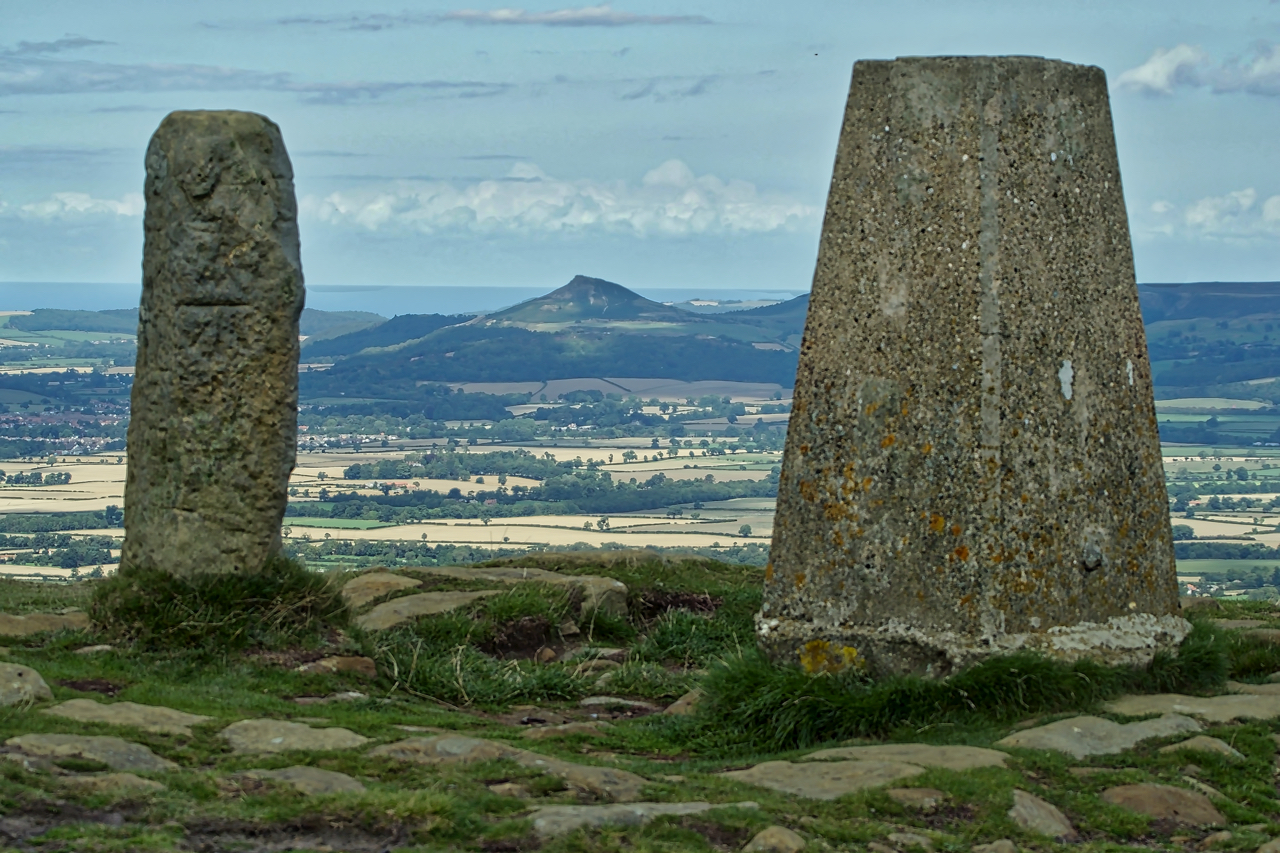
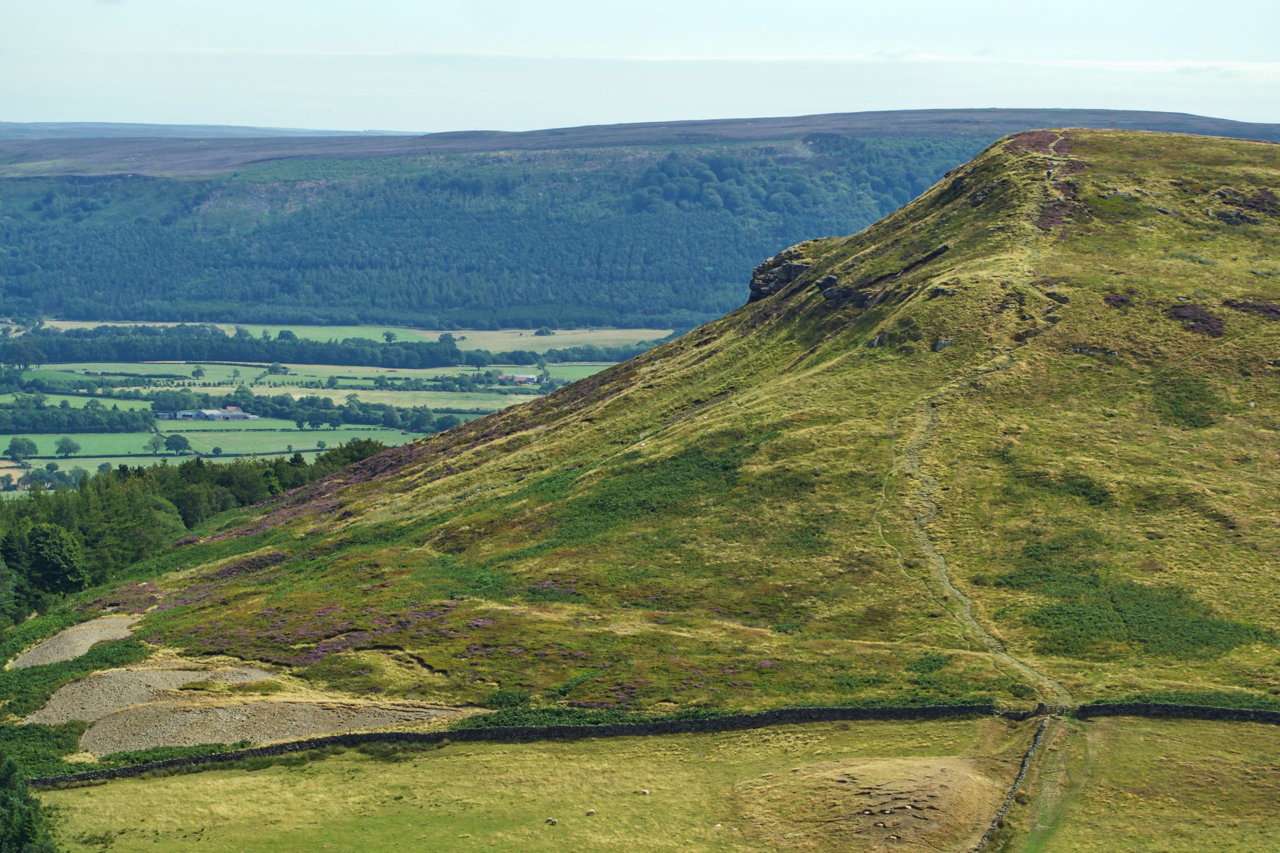
Carlton Bank Trig Point
A view of Odin’s hill, Roseberry Topping, sandwiched between the trig point and old parish boundary stone on the highest point of Carlton Bank. The summit, at 408m above sea level is the third highest point on the North York Moors. Today it is generally known as Carlton Moor but has also been mapped at…
-
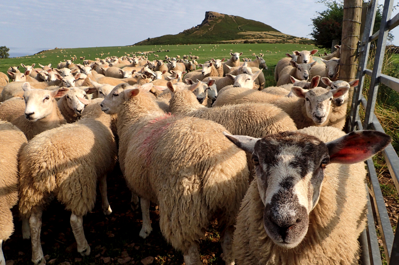
V-ewes of Roseberry
We’re art, a drove of sheep without a shepherd, and I am a wolf in sheep’s clothing. So where are you being driven? Nowhere! Then you must be a flock. And what big teeth you don’t have, for a wolf. No, we’re a hurtle or a trip making eyes at you, baa none. Why that’s…
-
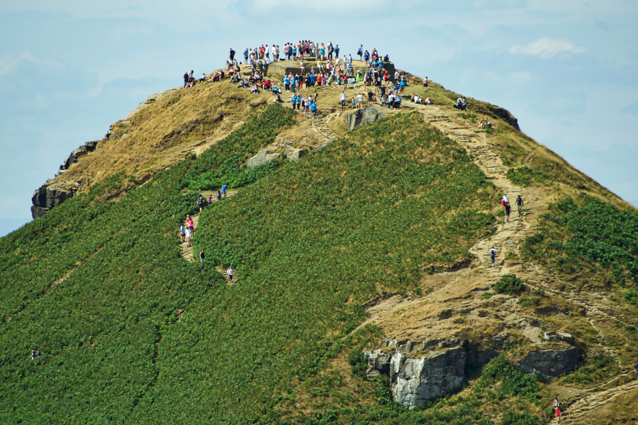
Tea on the Topping
It’s that time of the year again. The annual National Trust’s “Tea on the Topping”, tea and a delicious selection of homemade cakes on offer on Cleveland’s Matterhorn. The bright sunny day attracting hundred’s of climbers. How many people can you get on Roseberry? Open Space Web-Map builder Code
-
Cold Moor
A view from Cringle Moor across to Cold Moor, one of the four bumps so obvious from the Cleveland plain. The footpath followed by the Cleveland Way and Coast to Coast long distance paths can be seen climbing to the 401m summit. The spoil heaps bottom left are 19th-century jet workings, the miners seeking the…