After yesterday’s lapsus calami when I misidentified a whole mountain ridge (see Mark’s comment), I thought I had better be extra attentive.
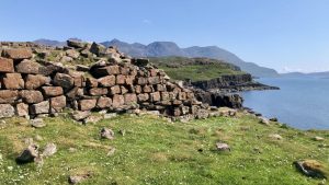
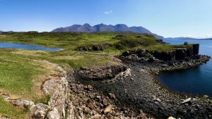
The Rubh’ An Dunain is a remote headland located approximately 6km south of Glen Brittle. It is renowned for its notable feature, the “Viking Canal,” which connects Loch na h-Aide with the Soay sound. Accessible only via a solitary track that gradually narrows into a sheeptrod, this area encompasses a complex landscape comprising both prehistoric and historic remnants. Among its highlights are a chambered cairn, a galleried dun, hut circles, and two deserted townships with their corresponding field systems1‘Skye, Rubh’ an Dunain | Canmore’. 2023. Canmore.org.uk <https://canmore.org.uk/site/11021/skye-rubh-an-dunain> [accessed 3 June 2023]. This peninsula had been inhabited for thousands of years, potentially without interruption, until the 1860s when it was ultimately abandoned2‘Skye, Dunan | Canmore’. 2023. Canmore.org.uk <https://canmore.org.uk/site/11224/skye-dunan> [accessed 3 June 2023].

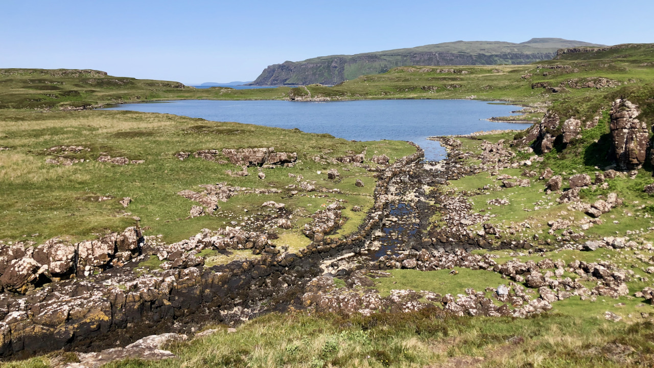
In the past, the outlet of Loch na h-Airde consisted of a small stream that flowed from the freshwater loch to the open sea. Below the galleried dun, there was a naturally protected cove where this stream met the sea. However, at some point around the 12th century or earlier, the stream was modified into a canal to enable seafaring vessels to enter the loch more easily with the help of the rising tide.
The canal, measuring approximately 120m in length, 3.5m in width, and about 500mm deep at high water, featured two docks and boathouses with stone linings in its lower section. These facilities allowed ships to be pulled out of the water. The upper section of the canal, which had well-maintained stone revetments, became blocked by a collection of large boulders. This obstruction essentially rendered the canal useless, although it’s possible that it had already fallen out of use long before that3‘Skye, Rubh’ an Dunain, “Viking Canal” | Canmore’. 2023. Canmore.org.uk <https://canmore.org.uk/site/11028/skye-rubh-an-dunain-viking-canal> [accessed 3 June 2023].
Against the majestic backdrop of the Cuillin ridge, this region appears utterly remote, yet our perception is influenced by our reliance on contemporary transportation systems. These ‘Viking’ inhabitants of this area, however, must have thrived displaying remarkable mastery over the western seaways.
- 1‘Skye, Rubh’ an Dunain | Canmore’. 2023. Canmore.org.uk <https://canmore.org.uk/site/11021/skye-rubh-an-dunain> [accessed 3 June 2023]
- 2‘Skye, Dunan | Canmore’. 2023. Canmore.org.uk <https://canmore.org.uk/site/11224/skye-dunan> [accessed 3 June 2023]
- 3‘Skye, Rubh’ an Dunain, “Viking Canal” | Canmore’. 2023. Canmore.org.uk <https://canmore.org.uk/site/11028/skye-rubh-an-dunain-viking-canal> [accessed 3 June 2023]
Leave a Reply