I had a faint recollection of crossing Newton Mulgrave Moor before and indeed I had. It’s still a bit of a haze though.
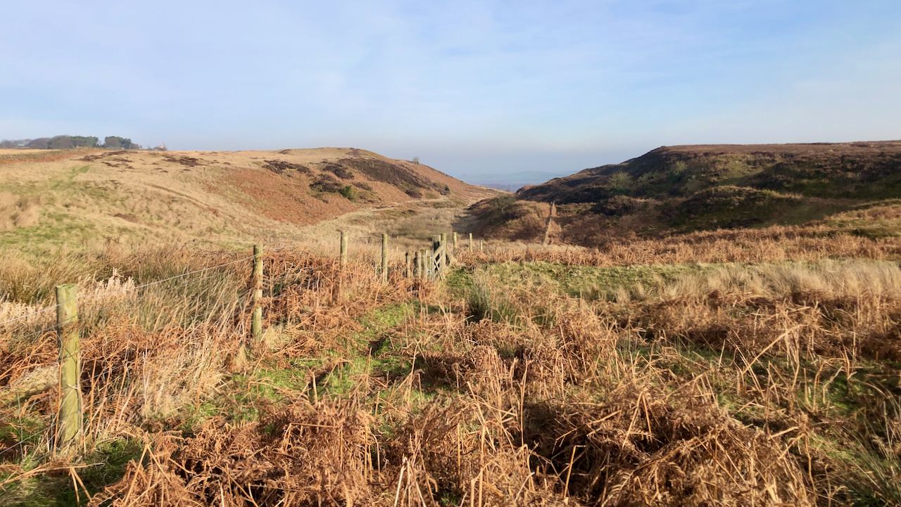
Lying north of the A174, it’s an unfrequented area. Very flat, and exposed to winds from all directions.
But a relatively deep valley provides a welcome incision — Birchdale or Birk Dale as named on the 1856 O.S. map.
The interests were a Neolithic long barrow on Newton Mulgrave Moor and a pre-historic settlement and field system on Borrowby Moor but they were other pre-historic features to explore another day.
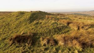
Long barrows are the burial places of our early farmers, and there are actually very few to be found in the North York Moors1North York Moors Historic Environment Record (HER) No: 4621<https://ancientmonuments.uk/114782-long-barrow-on-newton-mulgrave-moor-250m-east-of-birchdale-house-newton-mulgrave#.Y-PiMOzP3UI> [accessed 8 February 2023].
It is one of only a few monuments dating to the Neolithic period to be found in the North York Moors surviving as an earthwork.
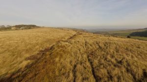
Across Birchdale, the field system on Borrowby Moor — or ‘Soldier’s Garth’ as named on the North York Moors Historic Environment Records — comprised well defined humps and bumps suggesting a a closely-packed group of enclosures with a distinct holloway bisecting the site2North York Moors Historic Environment Record (HER) Nos: 4628/4635 <https://ancientmonuments.uk/115166-late-prehistoric-enclosed-settlement-and-field-system-on-borrowby-moor-360m-south-of-moor-house-farm-roxby#.Y-PibOzP3UI> [accessed 8 February 2023].
Dating pre-historic sites is difficult without supporting finds evidence, and as far as I can learn no archaeological excavation has been carried out on Borrowby Moor. 200m west though, on Roxby Low Moor, an Iron Age settlement site was excavated in the 1960s/70s3North York Moors NMP 2. Aerial Survey Mapping Summary Report. National Mapping Programme. Historic Environment Enabling Programme: Project Number 6445. NRHE Parent Collection: EHC01/222 NRHE Event: 1547939. April 2013. Page 24..
Both these sites occupy an easily defined territory. To the west is Roxby Beck, to the east Birchdale, and on the south and south-east Hardale and Tranmire Slacks. I read that two gaps in these boundaries are marked by standing stones4‘Prehistoric and Roman Archaeology of North-East Yorkshire’. Edited by D A Spratt. Council for British Archaeology. North York Moors National Park. Page 149. Available online at http://archaeologydataservice.ac.uk/archiveDS/archiveDownload?t=arch-281-1/dissemination/pdf/cba_rr_087.pdf. I must investigate this further.
One thing I am confused about. This name of ‘Soldier’s Garth‘. In a 1909 article in the Yorkshire Archaeological Journal, a field adjacent to Rockcliff Beacon, 10km NNW of Borrowby Moor, is referred to by that same name5Hornsby, William and John D. Laverick. ‘Yorkshire Archaeological Journal Vol. 25. Page 48. ‘BRITISH BARROWS ROUND BOULBY.’ 1920. Available online at the Internet Archive<https://archive.org/details/YAJ0251920/page/48/mode/2up?view=theater> [accessed 8 February 2023]. It seems a strange coincidence.
- 1North York Moors Historic Environment Record (HER) No: 4621<https://ancientmonuments.uk/114782-long-barrow-on-newton-mulgrave-moor-250m-east-of-birchdale-house-newton-mulgrave#.Y-PiMOzP3UI> [accessed 8 February 2023]
- 2North York Moors Historic Environment Record (HER) Nos: 4628/4635 <https://ancientmonuments.uk/115166-late-prehistoric-enclosed-settlement-and-field-system-on-borrowby-moor-360m-south-of-moor-house-farm-roxby#.Y-PibOzP3UI> [accessed 8 February 2023]
- 3North York Moors NMP 2. Aerial Survey Mapping Summary Report. National Mapping Programme. Historic Environment Enabling Programme: Project Number 6445. NRHE Parent Collection: EHC01/222 NRHE Event: 1547939. April 2013. Page 24.
- 4‘Prehistoric and Roman Archaeology of North-East Yorkshire’. Edited by D A Spratt. Council for British Archaeology. North York Moors National Park. Page 149. Available online at http://archaeologydataservice.ac.uk/archiveDS/archiveDownload?t=arch-281-1/dissemination/pdf/cba_rr_087.pdf
- 5Hornsby, William and John D. Laverick. ‘Yorkshire Archaeological Journal Vol. 25. Page 48. ‘BRITISH BARROWS ROUND BOULBY.’ 1920. Available online at the Internet Archive<https://archive.org/details/YAJ0251920/page/48/mode/2up?view=theater> [accessed 8 February 2023]
Leave a Reply