There are many named features of the old Ordnance Survey maps which names no longer appear on the modern versions. I feel they must have been significant for the local farmers, gamekeepers and land agents to mention them when those early surveyors came knocking.
I decided to check out three wells today on Scarth Wood Moor and Near Moor, within the catchment of Crabdale Beck.
First up, Oliver’s Well![]() on Scarth Wood Moor1Ordnance Survey Six-inch England and Wales, 1842-1952. Yorkshire 42 (includes: Bilsdale Midcable; Carlton; Faceby; Little Busby; Whorlt…[online] Available at: https://maps.nls.uk/view/102344290#zoom=7&lat=702&lon=2053&layers=BT [Accessed 6 Apr. 2022].:
on Scarth Wood Moor1Ordnance Survey Six-inch England and Wales, 1842-1952. Yorkshire 42 (includes: Bilsdale Midcable; Carlton; Faceby; Little Busby; Whorlt…[online] Available at: https://maps.nls.uk/view/102344290#zoom=7&lat=702&lon=2053&layers=BT [Accessed 6 Apr. 2022].:
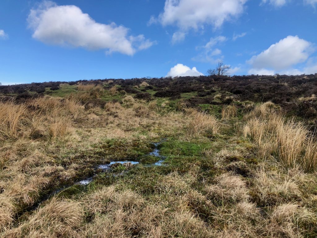
I must admit, I’d half hoped to discover some evidence of a hitherto unknown pre-historic ritual spring. But it was just a flush, the spring water seeping out of the ground and not confined to a definite channel. The bog might have been deep — I didn’t test it — a silted up relic of a pond. Very few stones around.
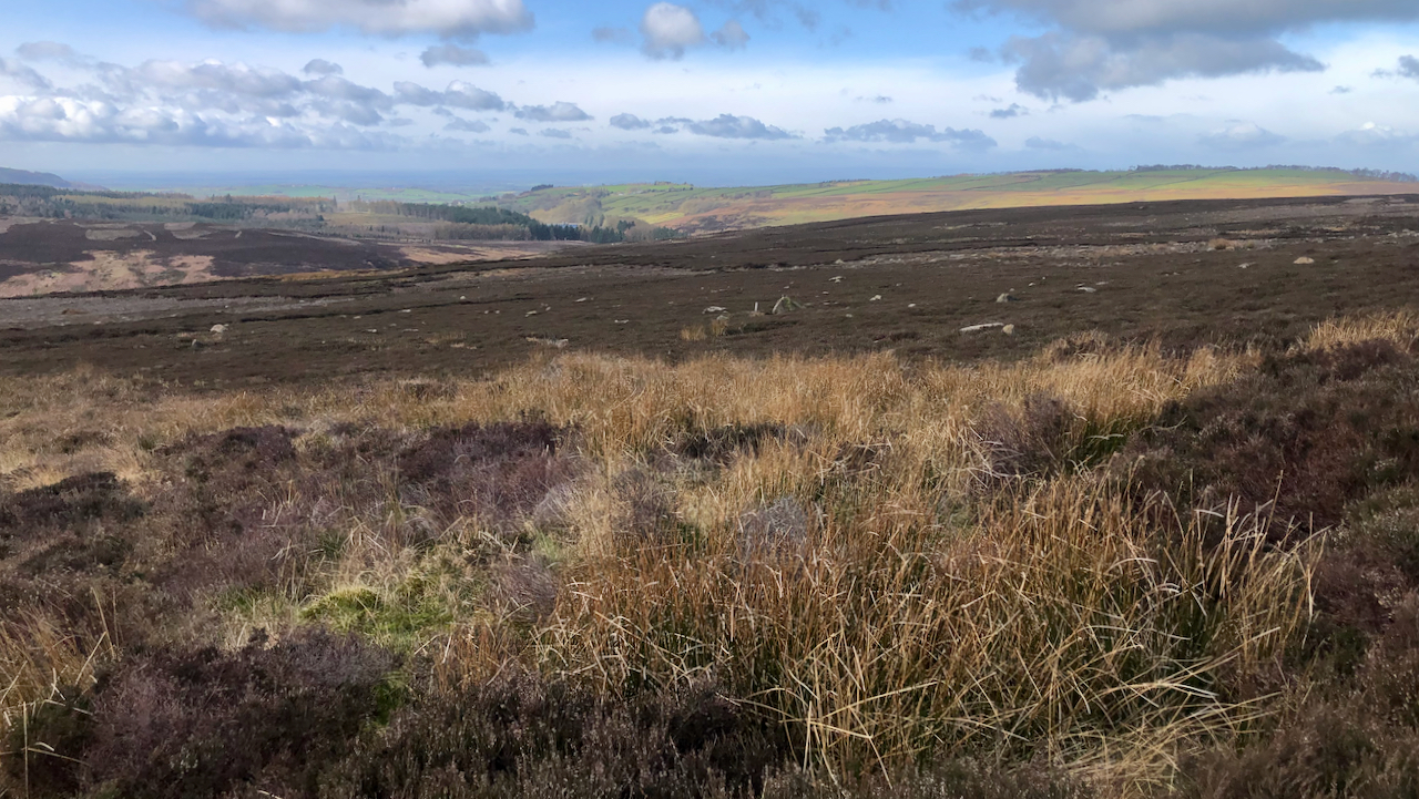
Next up, Raindrip Well![]() , across the road on Near Moor — see featured image above2Ordnance Survey Six-inch England and Wales, 1842-1952. Yorkshire 42 (includes: Bilsdale Midcable; Carlton; Faceby; Little Busby; Whorlt…[online] Available at: https://maps.nls.uk/view/102344290#zoom=7&lat=1067&lon=3885&layers=BT [Accessed 6 Apr. 2022]..
, across the road on Near Moor — see featured image above2Ordnance Survey Six-inch England and Wales, 1842-1952. Yorkshire 42 (includes: Bilsdale Midcable; Carlton; Faceby; Little Busby; Whorlt…[online] Available at: https://maps.nls.uk/view/102344290#zoom=7&lat=1067&lon=3885&layers=BT [Accessed 6 Apr. 2022]..
Only clumps of soft rushes defined the ‘wet’ ground, the linear marsh drifting down the hillside.
And so to Holy Well![]() :
:
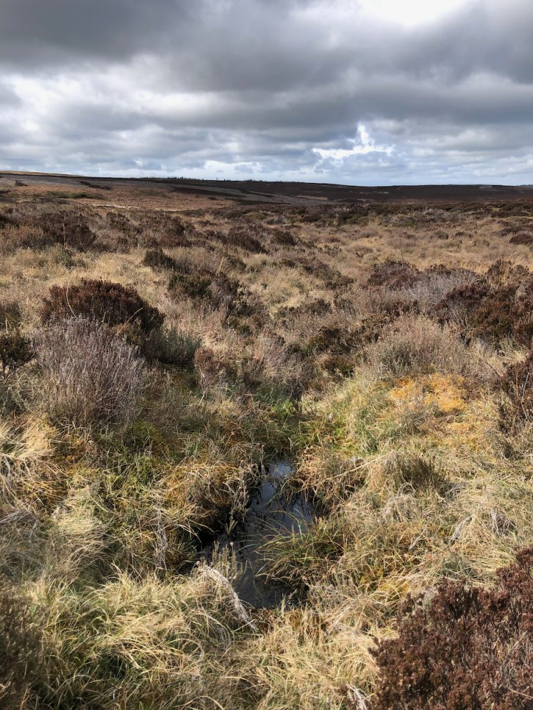
There are many ‘Holy Wells’. Every parish has one, probably ensuing from pagan origins. It’s a name that has been retained on the modern map3Ordnance Survey Six-inch England and Wales, 1842-1952. Yorkshire LVII.NW (includes: Osmotherley; Snilesworth; Whorlton.) [online] Available at: https://maps.nls.uk/view/100942847#zoom=5&lat=4924&lon=4762&layers=BT [Accessed 6 Apr. 2022]..
Holy Well lies just off the main channel of Holy Well Gill, a deep glacial overflow from Lake Scugdale. So the distinctive gulley must take its name after the well. Again there is not much to see. Standing water with a noticeable film of surfactants on its surface, resulting from the natural decay of plant material.
So all in all, a disappointment perhaps. But I remain convinced that in some age past these named ‘wells’ must have been of significant importance either ritually or topographically, or as a water source where stock could be corralled or wildlife hunted.
- 1Ordnance Survey Six-inch England and Wales, 1842-1952. Yorkshire 42 (includes: Bilsdale Midcable; Carlton; Faceby; Little Busby; Whorlt…[online] Available at: https://maps.nls.uk/view/102344290#zoom=7&lat=702&lon=2053&layers=BT [Accessed 6 Apr. 2022].
- 2Ordnance Survey Six-inch England and Wales, 1842-1952. Yorkshire 42 (includes: Bilsdale Midcable; Carlton; Faceby; Little Busby; Whorlt…[online] Available at: https://maps.nls.uk/view/102344290#zoom=7&lat=1067&lon=3885&layers=BT [Accessed 6 Apr. 2022].
- 3Ordnance Survey Six-inch England and Wales, 1842-1952. Yorkshire LVII.NW (includes: Osmotherley; Snilesworth; Whorlton.) [online] Available at: https://maps.nls.uk/view/100942847#zoom=5&lat=4924&lon=4762&layers=BT [Accessed 6 Apr. 2022].
Leave a Reply to Fhithich Cancel reply