Out & About …

… on the North York Moors, or wherever I happen to be.

Help me out here!

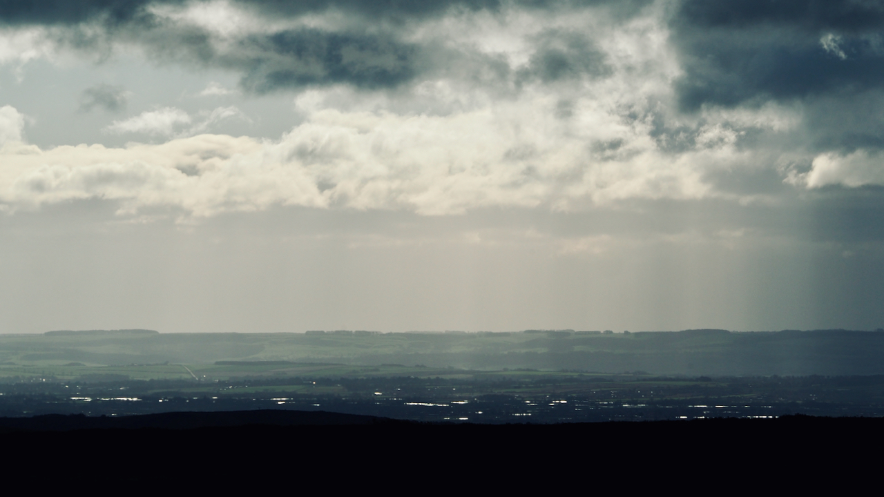
I was making my way along the sandy track over Urra Moor when I noticed the catoptric morning sun on a myriad of small bogs and pools far, far in the distance.

I took a photo expecting to be able to identify the location but …

At first I thought it might be Jewel Mere on Rosedale West Moor (SE 705 952).

Not convinced — the Jewel Mere complex of pools is at most 300 metres wide and at least 12km away.

And the fields and woods don’t add up; there is a distinctive road climbing a ridge to the left.

Technical clues: I was at about NZ 599 015, around the 440 metre contour, time 10:30 am.  View direction approximately south-east. The immediate high ground will be Cockayne Ridge.


Posted

in

,

by

Tags:

Comments

3 responses to “Help me out here!”

  1. si jackson avatar
    si jackson

    The road is Haygate bank out of Rosedale with Russel’s Wood to the right. That does put you on an alignment with Thorgill Head and Jewel Mere. Could it be patches of snow you were seeing? Its hard to tell with that photo. there are also lots of old peat cuts between Rudland Rook and the old shooting house that fill with water after sustained rainfall. Thats my best guess

  2. John avatar
    John

    The pools of water you can see are flooding in the Vale of Pickering in the Salton/Brawby/Great Barugh/Amotherby area.
    I’m fairly sure the road you mention is Langton Road heading south out of Malton, the hedge lines to the east certainly fit, particularly one on the extreme left which has spaced out trees (around SE808695). The area on the horizon beyond the road is the North Grimston/Wharram le Street/Wharram Percy area.
    I used the ‘visibilty cloak’ feature on HeyWhatsThat.com, didn’t pan out at first because I had you at the head of Badger Gill but once I used the grid ref (presume you were near the Face Stone) the extra 10 metres altitude made a considerable difference.

  3. Fhithich avatar
    Fhithich

    Robin replied on FaceBook, more or less agreeing with John:

    “I reckon your super dooper, fancy pants camera lens has given us a serious foreshortening effect. I suggest that the distinctive wood on the LHS of the horizon is on the earthwork at Leavening Brow, south of Malton ~27 miles / 44 km away. I think the road climbing the intermediate ridge is the minor road climbing south from Amotherby to Easthope Hall, beyond which is Castle Howard. The bogs and pools are simply flooded fields around the River Rye. I have been surprised this last week or so how much standing water there has been on local fields, given my recollection of this winter has been more towards wind than rain.”

    John provided a link to a very fascinating website http://www.heywhatsthat.com from which I’ve created a ‘panorama’:
    https://www.heywhatsthat.com/?view=MIWI6JWN

    This suggests I was looking in a direction 157° approx. SSE, looking straight down Bransdale, past Kirkdale, and on to the Wolds at Barton-le-Street, and Easthorpe. The limit of visibility is Garrowby, 32 miles away.

    Incredible.

Leave a Reply

Your email address will not be published. Required fields are marked *