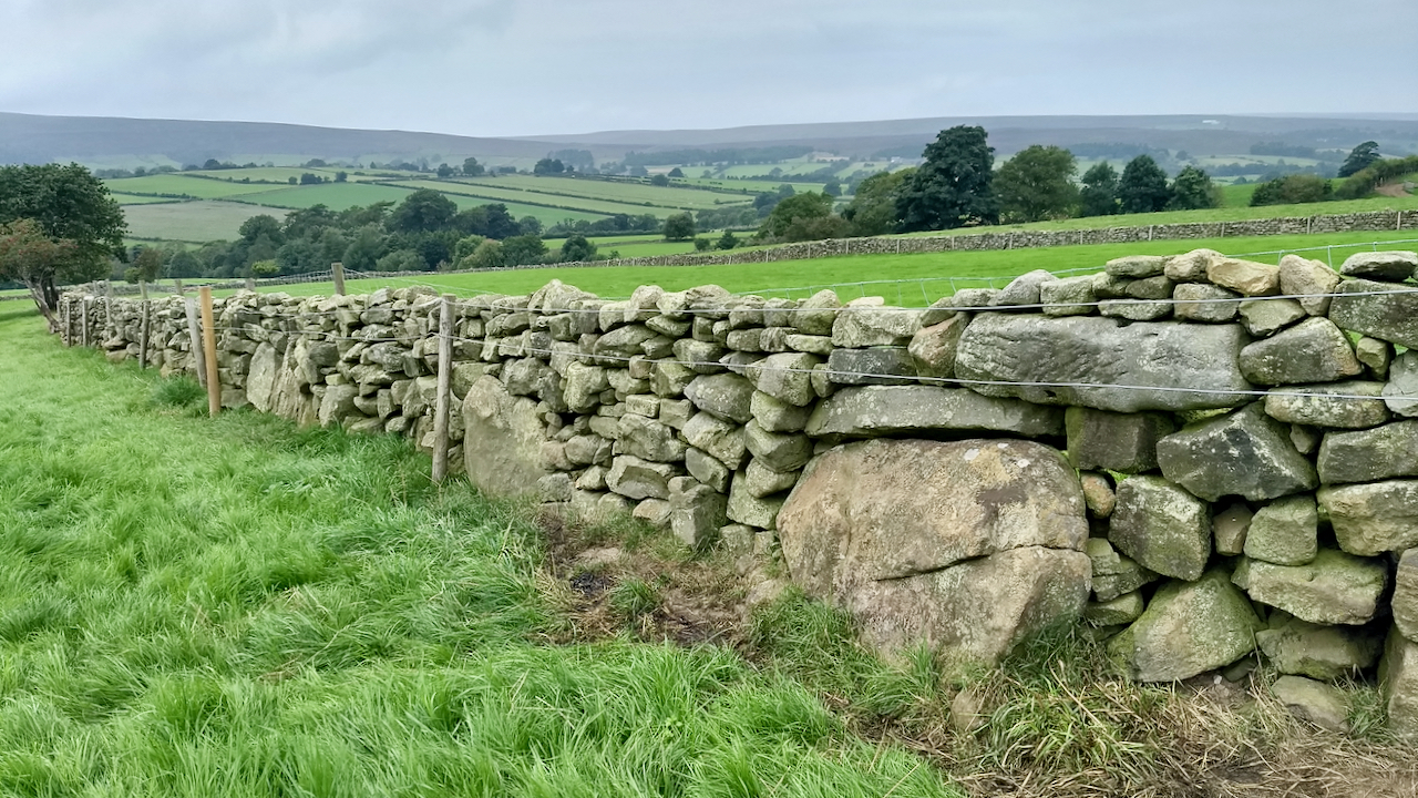
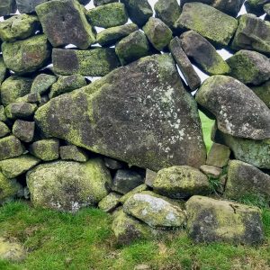
An orthostat, in the true sense of the word, is a large upright stone, think of a standing stone or menhir, but one that has been built into a structure or wall. There’s a few in Stonehenge. However, the term has been applied vernacularly to any huge stones that are built into walls such as this one in Westerdale.
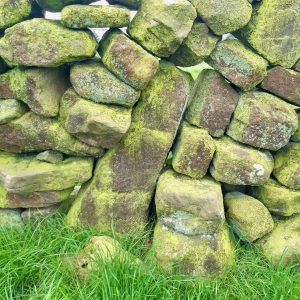
The general opinion is that a wall constructed in this way is of considerable age, possibly even among the first to be built when the early farmers were settling in the dales1“The North York Moors Landscape Heritage”. Edited by D.A.Spratt and B.J.D.Harrison. Pp 129/130. David & Charles. 1989. ISBN 0 7153 934722Cowley, Bill. “Snilesworth”. P 39. Turker Books 1993. When deciding a stock boundary, it seems logical that the largest stones, too big to move or too earth fast would be left in place. Other large stones dragged alongside with smaller stones built on top as the field was cleared.
Of course this is all conjecture, dating evidence is extremely hard to find. Historical surveys and maps suggest that after the 17th-century enclosures all new walls were of the more familiar rough dressed stone and tended to follow straighter lines.
This particular wall is alongside the Public Footpath that goes from Brown Hill House down to Tower Beck continuing up the other side of the dale to the Broad Gate Road. The footpath follows a holloway named as Gill Bridge Road, the depth indicating long useage3North York Moors National Park. (2012). HER Map: North York Moors National Park. HER No: 12632. [online] Available at: https://www.northyorkmoors.org.uk/discover/archaeology/her-map [Accessed 4 Sep. 2021].. Brown Hill House Farm itself is attested in a document dated 1539 as ‘one messuage and 2 bovates‘ (a dwelling with around 40 acres)4Wilson, Carol M. “Westerdale: the origins and development of a medieval settlement”. pp 59. ISBN 978-0-9565779-2-4 2013. The following decade, this whole side of the dale, which is now known as Westerdaleside, was referred in another document as ‘Barwykerowe‘. It was listed as “an area of wood and underwood”, but the name indicates a ‘berwick‘ or ‘barley wick‘, land belonging to the manor but separate to it, where grain was grown or stored. The ‘rowe‘ element indicates a hamlet of a row of dwellings5Wilson, Carol M. “Westerdale: the origins and development of a medieval settlement”. pp 37/61/67. ISBN 978-0-9565779-2-4 20136North York Moors National Park. (2012). HER Map: North York Moors National Park. HER No: 18795. [online] Available at: https://www.northyorkmoors.org.uk/discover/archaeology/her-map [Accessed 4 Sep. 2021]..
- 1“The North York Moors Landscape Heritage”. Edited by D.A.Spratt and B.J.D.Harrison. Pp 129/130. David & Charles. 1989. ISBN 0 7153 93472
- 2Cowley, Bill. “Snilesworth”. P 39. Turker Books 1993
- 3North York Moors National Park. (2012). HER Map: North York Moors National Park. HER No: 12632. [online] Available at: https://www.northyorkmoors.org.uk/discover/archaeology/her-map [Accessed 4 Sep. 2021].
- 4Wilson, Carol M. “Westerdale: the origins and development of a medieval settlement”. pp 59. ISBN 978-0-9565779-2-4 2013
- 5Wilson, Carol M. “Westerdale: the origins and development of a medieval settlement”. pp 37/61/67. ISBN 978-0-9565779-2-4 2013
- 6North York Moors National Park. (2012). HER Map: North York Moors National Park. HER No: 18795. [online] Available at: https://www.northyorkmoors.org.uk/discover/archaeology/her-map [Accessed 4 Sep. 2021].
Leave a Reply