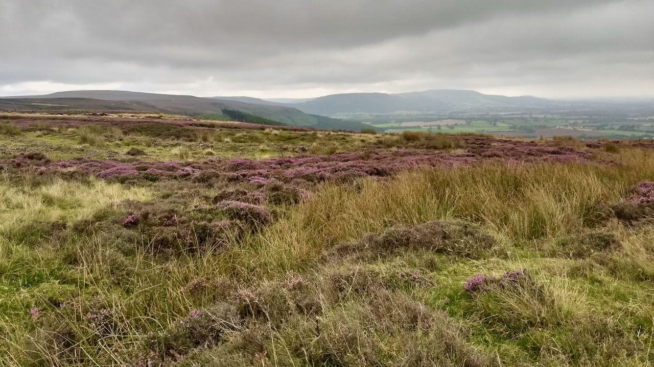
A view south along the Cleveland Hills on the meteorological first day of Autumn. Corrugated skies of grey. The heather is just about to change, not many more days when there is a hint of the purple.
This moorland was once part of a medieval deer park of the Percys of Kildale1North York Moors National Park. (2012). HER Map: North York Moors National Park. HER No: 2487. [online] Available at: https://www.northyorkmoors.org.uk/discover/archaeology/her-map [Accessed 1 Sep. 2021].. Just out of shot to the left is Juniper Gate on the Baysdale Road with John o’Man’s Cross, a Bronze Age round barrow and standing stone which The North York Moors Historic Environment Record says is prehistoric (up to AD 43)2North York Moors National Park. (2012). HER Map: North York Moors National Park. HER No: 2500. [online] Available at: https://www.northyorkmoors.org.uk/discover/archaeology/her-map [Accessed 1 Sep. 2021].. I have tried to find this stone which I think is lying prone so there is no much to see.
The cross/barrow lies on the boundary of the parishes of Kildale and Battersby. One theory is that our Bronze Age ancestors built their round barrows at significant points on their tribal boundaries. And that the ghosts of these tribal boundaries may continue to this day.
Or did later generations use the existing barrows as their territorial markers? It a chicken and egg question.
- 1North York Moors National Park. (2012). HER Map: North York Moors National Park. HER No: 2487. [online] Available at: https://www.northyorkmoors.org.uk/discover/archaeology/her-map [Accessed 1 Sep. 2021].
- 2North York Moors National Park. (2012). HER Map: North York Moors National Park. HER No: 2500. [online] Available at: https://www.northyorkmoors.org.uk/discover/archaeology/her-map [Accessed 1 Sep. 2021].
Leave a Reply