Out & About …

… on the North York Moors, or wherever I happen to be.

Ash Bank

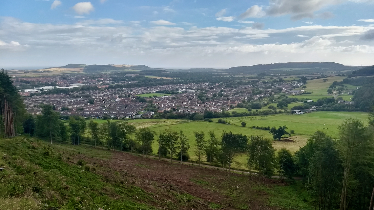
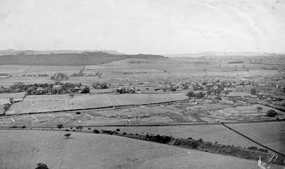
The last time I used this track up to Highcliff Nab, was several winters ago, in the dark. It was then, as I’ve always remembered it, a quagmire, enclosed by tall forestry conifers.

So it was quite surprising to find the bank clear-felled revealing a surprising view of Guisborough. And removed from the perpetual shade, the track was nice and dry.

The curving hedge line that forms the limit of the Hunter’s Hill housing estate follows the course of the branch railway to the Belmont Ironstone Mine. It is also the Boundary of the National Park.

The development of the housing south of Guisborough began in the late 1950s with the building of 400 houses for Guisborough Urban District Council of which 100 were to be allocated to employees of I.C.I (Imperial Chemical Industries) at Wilton in return for an offer of financial assistance to the council.

New Housing Estate from ICI magazine August 1957
A view of Guisborough 63 years ago
From the ICI magazine August 1957
I think this view is more north and taken from the top of Green Bank


Open Space Web-Map builder Code


Posted

in

,

by

Tags:

Comments

2 responses to “Ash Bank”

  1. Paul Jardine avatar
    Paul Jardine

    I’ve always tried to establish why they called it ash bank. Two theories are that before ww1 it had ash trees planted there that were cut down to help the war effort. The second theory was that it was used as ash deposit site from boundary and mining.

    1. Fhithich avatar
      Fhithich

      Paul, it was called Ash Bank on the 1853 O.S. map https://maps.nls.uk/view/102344206#zoom=5&lat=3378&lon=9318&layers=BT

      which continued all the way on a path to Hutton Lane.

      1853 would have predated the Belmont mine.

      Fascinating.

Leave a Reply

Your email address will not be published. Required fields are marked *