The southwestern corner of the North Yorkshire Moors. 900 feet above sea level. To the north, the Hambleton Hills extend to the summit of Black Hambleton, at an altitude of 1289 feet. To the east, the moorlands stretch to Rydale at Helmsley, moorlands that are now predominately cultivated or forested.
Due west, across the Devil’s Leap, is the glacial outlier Hood Hill, and somewhere below at the foot of the limestone cliffs of Roulston Scar is the cave known as the Devil’s Parlour where the Devil is supposed to appear at midnight.
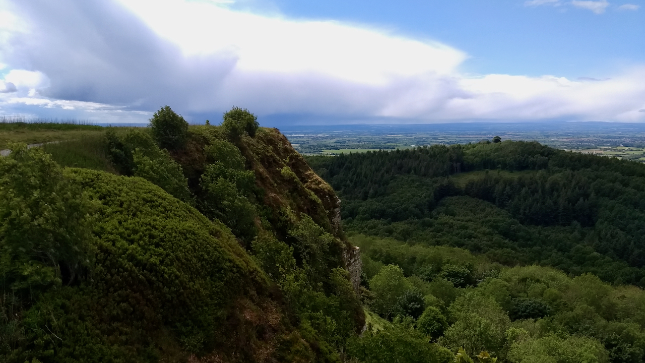
Roulston Scar is today occupied by the Yorkshire Gliding Club which uses the uplift provided by the cliffs to quickly gain height, but in the Iron Age, roughly 2,500 years ago, the promontory was the site of a hillfort commanding extensive views over the Vale of York.
The hillfort at Roulston Scar is the largest Iron Age fort in the north of England, enclosing a huge area of 24.5ha which I think is about 34 football pitches. An imposing earth bank, timber palisades and deep ditches defended the neck of the promontory with the steep-sided Boar’s Gill in the east. Within the fortified area, there would likely have been round houses of stone and timber, shelters and enclosures for livestock and storage areas for food and weaponry. The true scale of the fort wasn’t appreciated until 2000.
Leave a Reply