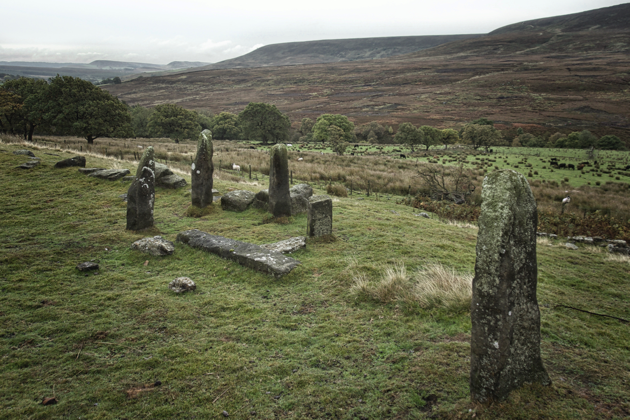
A wet stroll. A very wet stroll. First proper rain I’ve been caught out in for months. Headed over to Square Corner and into upper Ryedale. I had in mind to revisit a peculiar arrangement of standing stones at the old farmstead of High Cote. There are seven in this cluster including the prone one, another at the end of the wall of huge orthostats going off to the left and another four further down the slope in the next field. The obvious question is why. Bill Cowley, the local historian, could think of no agricultural use and find no dating evidence as to their age. They all seem to be randomly positioned.
The farmstead is named as “Stephen Thwaite” on the 1857 OS 6″ map, which is derived from Stebynthwayte and is mentioned as a tenement of Byland Abbey in its dissolution document dated 1537. Stebynthwayte is a Norse name probably meaning a clearing from which tree stumps had to be stubbed out and so must pre-date the establishment of the monastery around 1150. Highcote is also mentioned in the 1537 document but as a separate tenement located near to the current entrance to Snilesworth Lodge, about a kilometre away. Cowley surmised that when the lodge was built the farm would have been relocated to the Stephen Thwaite site from when it began to be known as High Cote. He referred to Stebynthwayte as the Snilesworth Callanish.
The last tenants at Stephen Thwaite/High Cote were the Fosters in about 1918. Sometime after that stone from the buildings was salvaged and used for improvements to Snilesworth Lodge.
Leave a Reply