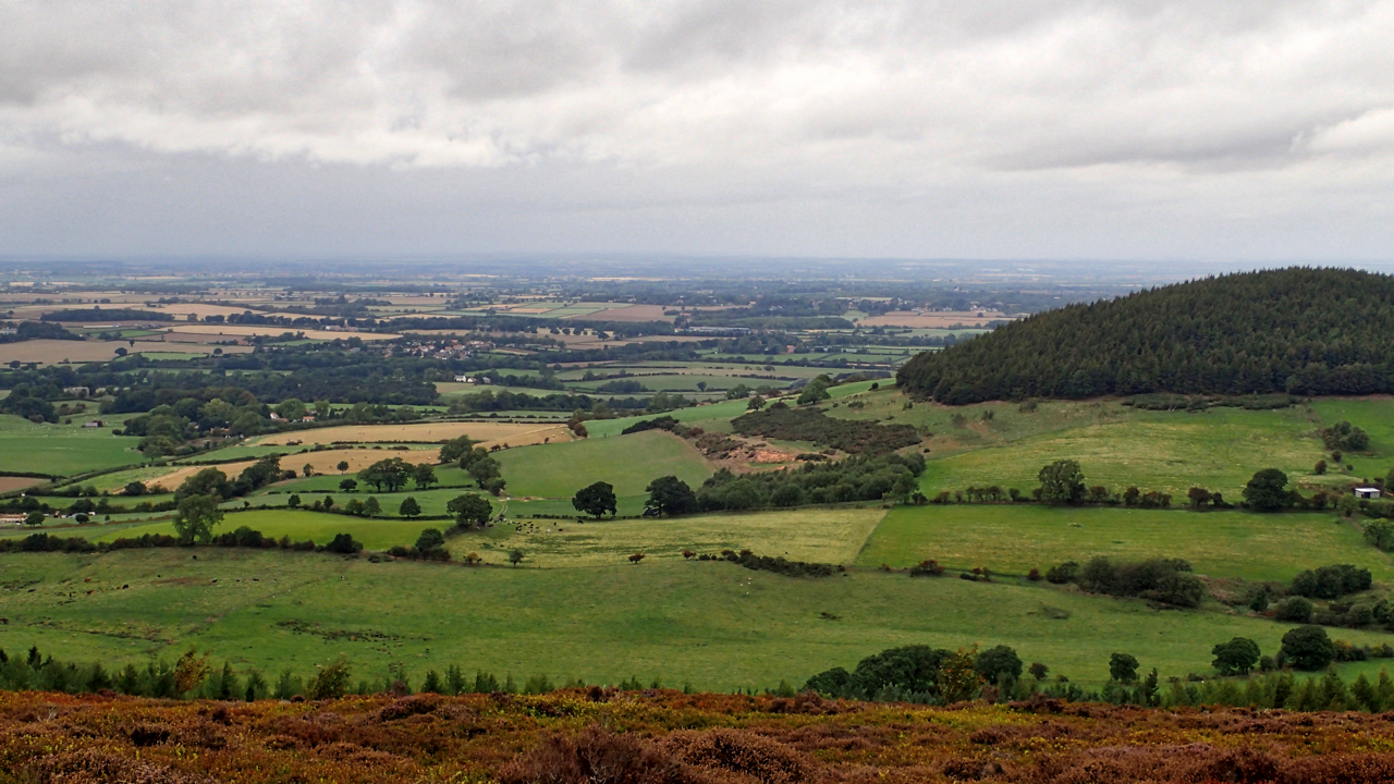
This view, from Live Moor, is interesting. On the right is Whorl Hill and to its left 1km away is Whorlton Castle. You might be able to just make it out, the extreme left of the photo. I was at the National Civil War Museum in Newark the other week and in an interactive display there it said that “Whorlton Castle was the home to the Bruce family, who held it for the King. Parliamentary soldiers who sought to take the castle decided to bombard the garrison into submission. They mounted artillery on Whorl Hill but soon realised they were overshooting and missing their target. The attackers moved to Toft Hill where they were able to fire far more accurately, destroying much of the castle and eventually taking it for Parliament.”
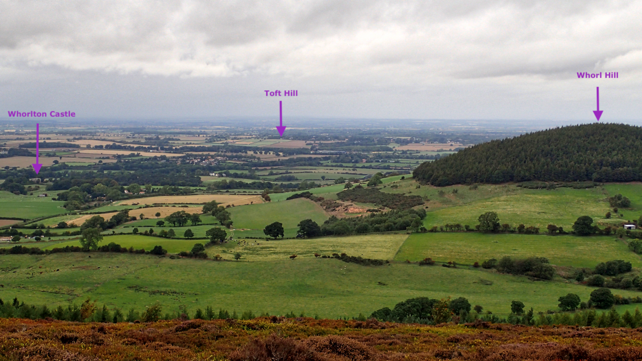 After a lot of perusing maps, I noticed a Toft Hill Farm a mile south-east of Hutton Rudby and nearby in a field off Belbrough Lane a spot height of 89m, the elusive Toft Hill. Unfortunately, the hill is on farmland with no Public Right of Way across it. It doesn’t look exactly photogenic anyway.
There is a line of trees centre in the photo. That is Belbrough Lane. Toft Hill is in the fields nearer. A slight elevation can just be made out. Honestly, it’s not wishful thinking.
Leave a Reply