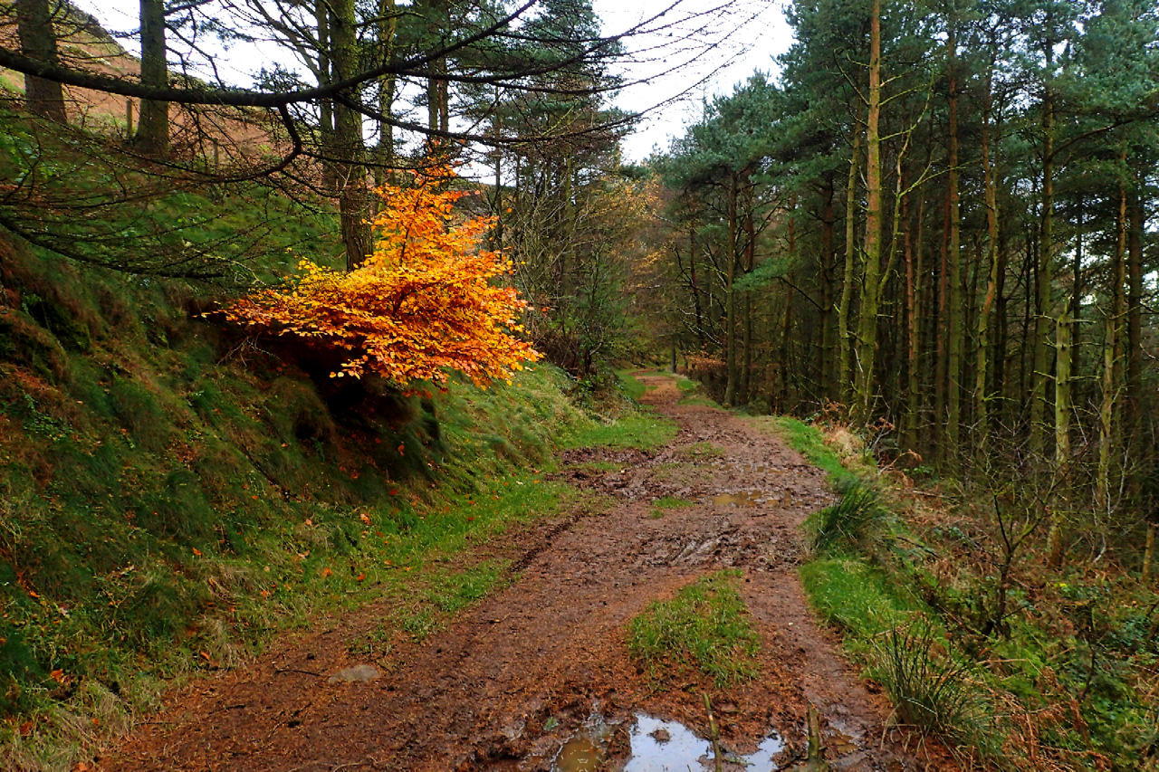
A dull day, in sharp contrast to yesterday afternoon’s blue sky, with flat muted colours of spruce and dead bracken. Along the muddy track that contours through the forestry plantation below Raven’s Scar, a beech sapling, sheltered from the wind and frost, still retains its vibrant autumnal leaves. The track is an extension of the Miners’ Track, jet miners they would be, although the oldest Ordnance Survey map available shows no track at this point. However, the map does indicate the boundary between the parishes of Broughton and Bilsdale and it seems reasonable to assume that a path exists alongside. Indeed a few hundred metres further along the track, below the Wainstones, a large rock is inscribed with a date of 1772. On dry summer’s day, the track is perhaps better known as an alternative route for Cleveland Wayers and Lyke Wake runners opting to avoid the climb up and over White Hill (perhaps better known as Hasty Bank).
Leave a Reply