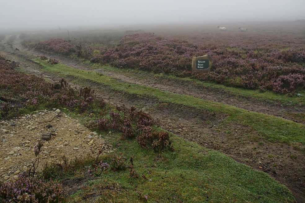
With low cloud shrouding the North York Moors I had to dig into my bank of “bad weather” ideas. Earlier this year I recalled seeing a large new sandstone “PRIVATE NO ACCESS” sign which I thought a bit over the top. So I headed for Kempswithen, the site of a 18th-century agricultural experiment but now under intensive management for grouse shooting. But the stone had disappeared, or had my navigation let me down. A hardcore base suggests it could have been here. Instead, there was a new small sign:
“NO FOOTPATH
NO BIKES
NO DOGS”
Now, no bikes I can understand, no dogs too but no footpath! Technically it’s probably correct but this is Open Access Land over which we have the freedom to roam. Clearly, it is intended to intimidate walkers into keeping away.
On the way back I took in Percy Rigg over Kildale Moor and came across the missing sandstone “PRIVATE NO ACCESS” sign. Or its twin. Maybe I’m not going doolally after all. I just had to take a photo in case it moves again. Way over the top. The siting of this stone is actually on the boundary of Open Access Land which is to the right in the photo below. To its left is a small area of heather moorland which somehow escaped Open Access designation. An anomaly. Either way, the intention is clearly to discourage walkers from enjoying their freedom to roam. They’re a red rag to a bull to me.


Leave a Reply