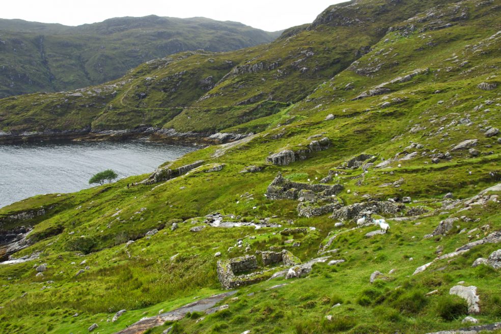
Compared to west coast the east coast of Harris is rugged and harsh, lacking the fertile machair found on the western coast of the islands. Even today with no white sandy beaches few tourists make the 6 mile detour along the windy hilly single track road. Gearraidh Lotalgear was an outying settlement of Rhenigidale, today a community of a handful of cottages. Prior to the clearances there were just a couple of shepherding families at Rhenigidale reached by a 3½ mile mountainous walk from Tarbet. The track can be seen snaking around the hillside. When the landowners cleared the western lands for more sheep some of the evicted settled in communities like Rhenigidale swelling its population to over a 100 by the 1880s. Others went further afield, emigrating to Nova Scotia. Those left supplemented what meagre produce the land could provide with by fishing for the herring.
A century later the population had shrunk to 10 and Rhenigidale was on the verge of total abandonment. There was still no road to the rest of the island. It was not until 1989 that a road was constructed, and Rhenigidale became the last community in Scotland to be connected to the road network. The population is now at around 20. Gearraidh is a Gaelic word meaning the outer pastures. Its handful of stone ruins and lazy beds, now home to sheep, provide an evocative glimpse into past lives.
Leave a Reply